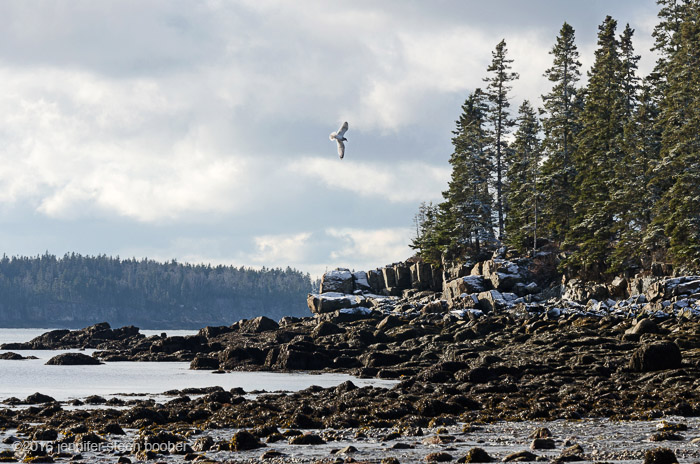
Dec. 6, 2016: 8:50-10am. 28ºF (-2ºC), sunny with scattered cumulus clouds and a sharp wind off Little Long Pond. Flock of 17 Buffleheads (Bucephala albeola), 6 much larger ducks (probably Black Ducks, Anas rubripes, since they had yellow bills), 2 crows, 2 Herring Gulls.

It was pretty cold out, and the wind off the pond elevated that to Damn Cold Out. The first real snow of the season had fallen overnight, just a dusting, but enough to pretty up the landscape.
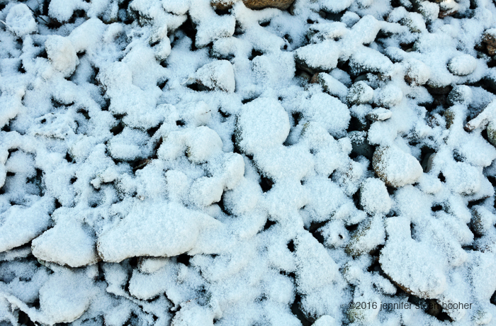
One of the cool things about winter is how clearly you can see the high tide line. The ocean practically draws a topographic map in the snow:

A couple of things have been puzzling me more and more as I travel: cobble beaches and natural seawalls. I thought that as I looked more closely at the island I’d understand better why certain things formed where they did, and for some things that’s true. I now understand, for example, why there is sand at Seal Harbor Beach and not at Hunters Beach. I’m still struggling with cobble beaches and seawalls, though. I can’t find any “reason” why they form where they do.
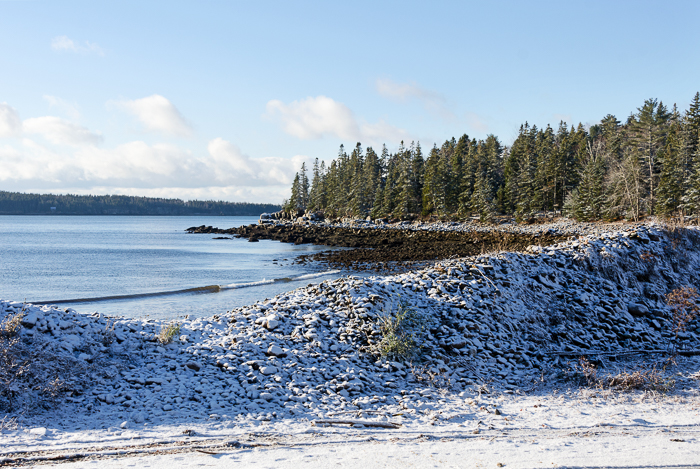
I’ve been combing through the newest book on MDI geology, Duane and Ruth Braun’s Guide to the Geology of Mount Desert Island, which is awesome and has answered a lot of my other questions (e.g. sand at Seal Harbor), but haven’t found anything. Maybe something to do with wind direction? I mean, why is there a cobble seawall here in Bracy Cove, and not at the Seal Harbor Beach? The shorelines look pretty similar. The bedrock looks the same. They’re maybe half a mile apart. And yet the stones at Seal Harbor are more angular, and the sand dominates over there. There’s a little sand in Bracy Cove, too, but here the stones are rounded, and they are piled 8 or 10′ high. Anyway.
Let’s walk!
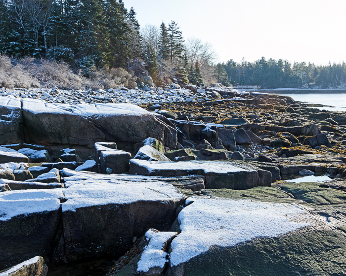
A small flock of Buffleheads was hanging out in the cove, and I watched them for a long time. My attempts at note-taking and observation were frequently interrupted by snorts of laughter. They would bob their heads up and down rapidly four times, dunk their heads under water, and then rear up flapping their wings like this: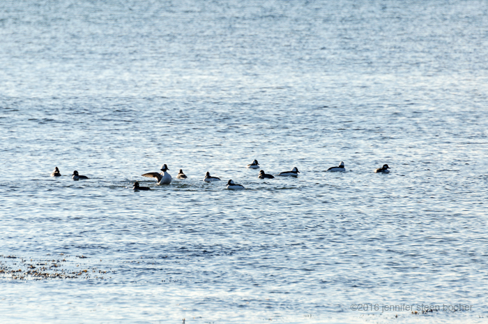
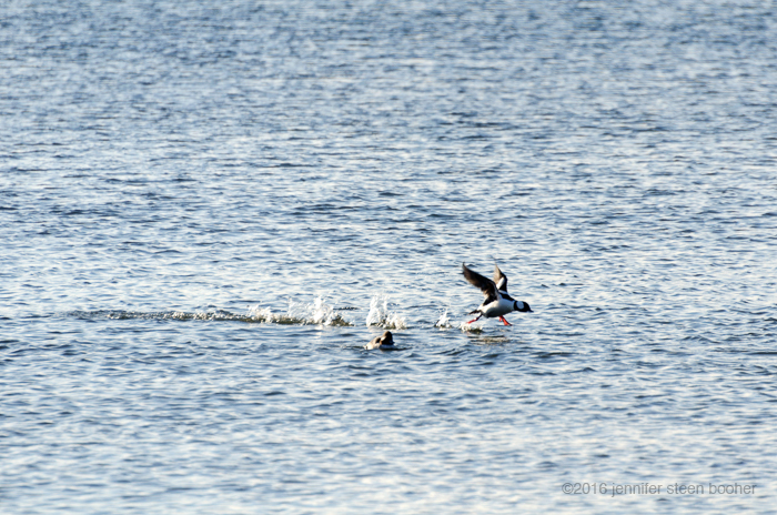
No idea what that was all about, but it was very funny to watch. When I started researching them to figure out what they were doing, I discovered that they nest in old woodpecker holes. If I ever am lucky enough to see a duck emerge from a hole halfway up a tree I am going to fall over laughing. There’s just something so terminally awkward about ducks. I mean, very little is funnier than watching a duck get a running start for flight – it just looks so implausible, and they always seem to be on the edge of tripping over their own feet:
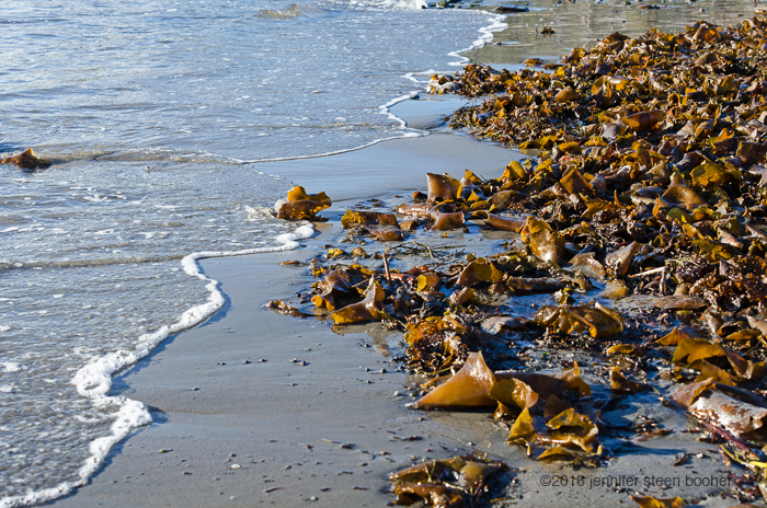
Also hilarious (or maybe I’m just easily amused), seaweed hairstyles:
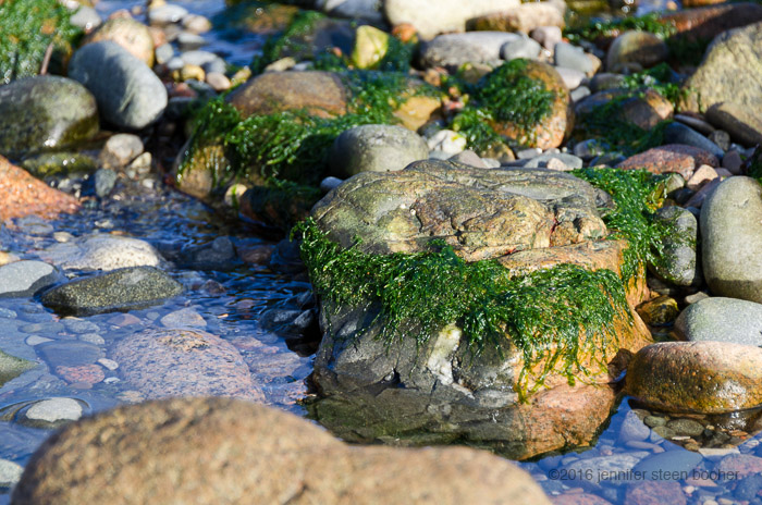
Another cool winter phenomenon – frost that melts off seaweed as soon as the sun touches it, so the remaining frost traces the edges of shadows:

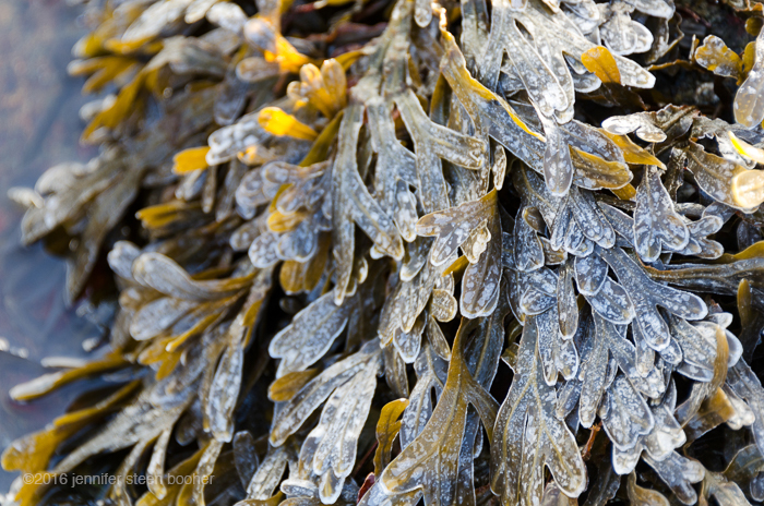
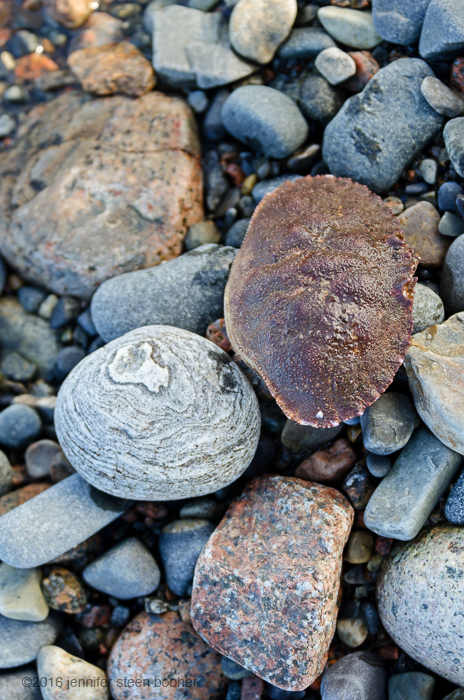
The stream running out of the pond was moving surprisingly fast and deep. I suppose I could have gone back to the road to cross it, but I was feeling lazy and since I wasn’t planning a long walk I just waded through. It went right over the tops of my boots – brrr!!

Then I got distracted watching this situation develop:
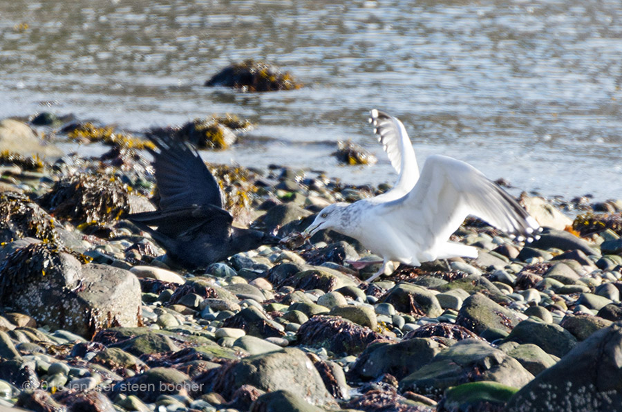
That’s a (doomed) crab they’re playing tug-of-war with. The herring gull won. But the battle gave me a chance to compare crow and gull footprints (crow on left, gull on right):

Ok, how about some history?
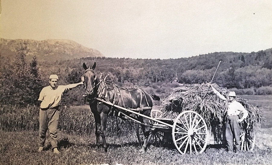
“Harvesting Fresh Water Marsh Hay at Little Long Pond, Seal Harbor.” Image courtesy of Raymond Strout via the MDI Historical Society (003.17.1, Archival Box 58)
Other than the Clement houses near the Seal Harbor beach, most of the early settlement was around Little Long Pond and Bracy Cove. (I’m talking European settlement here: I haven’t been able to find any references to Wabanaki camps in the area, although there is speculation that it may have been part of a canoe portage route. See the bibliography for more info on that.)
Until the 1860s the town was known as Long Pond. There were a store, the blacksmith’s house, and a school. The Bracy, Smallidge, and Dodge houses were on Dodge Point (now Crowninshield Point), and 2 Clement houses were near the Seal Harbor beach (we met the Clements in CW 14). [Revisiting Seal Harbor] Although the map below dates from 1887, many of those landmarks are visible on it (and I put red arrows next to a few.)
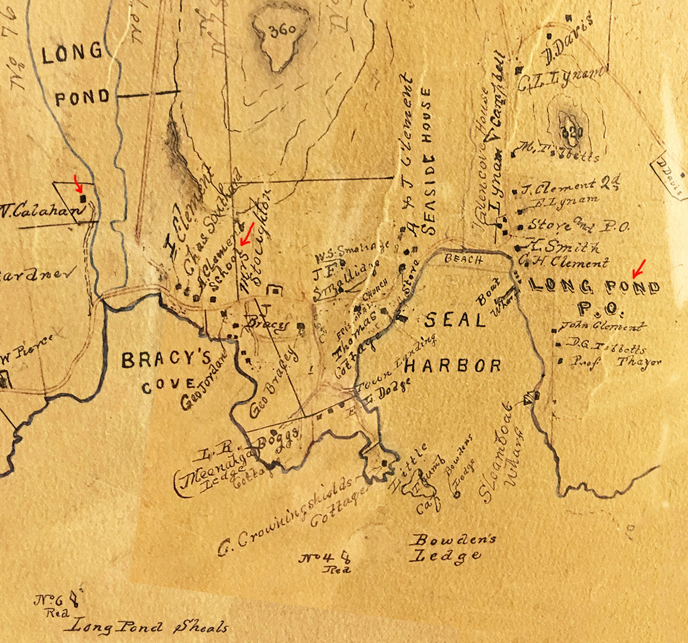
Hand-drawn “Map of Mount Desert Island,” Colby & Stuart, 1887. Image courtesy of the Northeast Harbor Library Archives
The post office moved from Long Pond to Seal Harbor in 1886 (and as you can see, was still called the Long Pond Post Office) “with Charles Henry Clement, the postmaster, at first conducting business from his own house. By 1903 it was settled at the location it still holds. With some intervals, Clements were in charge of this postoffice [sic] until as late as 1935.” [Heckscher, p.5]
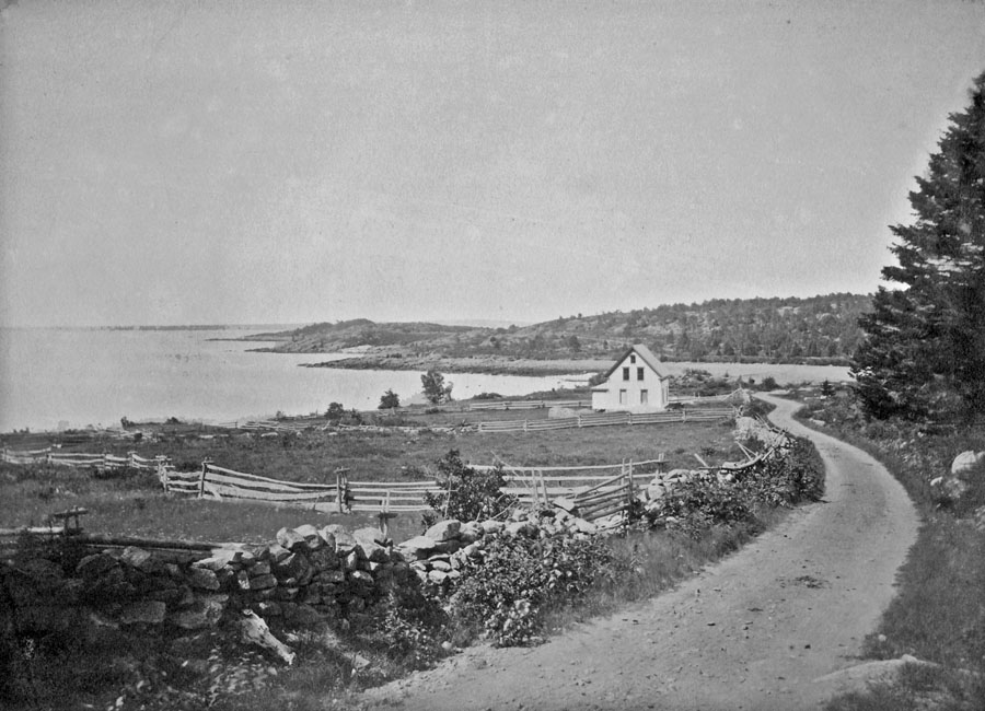
“Jordan Homestead, road to NEH at Bracy’s Cove.” Photo courtesy of the Seal Harbor Library. (The Jordan house is visible on the 1887 map above.)
The schoolhouse was constructed on a road that now forms part of a private driveway – it was called Knowledge Hill. [Heckscher] “In the fall of 1931, the Seal Harbor schoolhouse was moved to … Lower Dunbar Road in Seal Harbor. Named St. Jude’s Chapel Guild House, [it] was used as a winter church and fellowship space. … The Guild House was … secularized and sold in 2001. ” [from St Mary’s-by-the-Sea website]
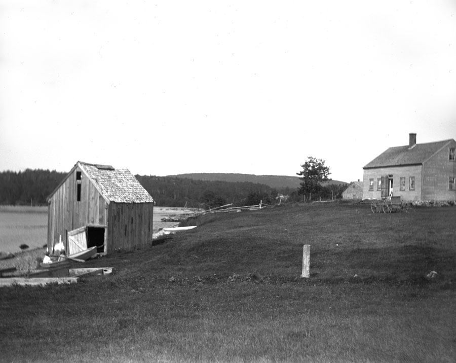
“Old house and fish house, Bracy’s Cove.” Photo courtesy of the Seal Harbor Library. (No.132 on website)
By 1882, when Cox’s general store opened in Seal Harbor, the business center had moved from Long Pond to the harbor area. [Revisiting Seal Harbor]
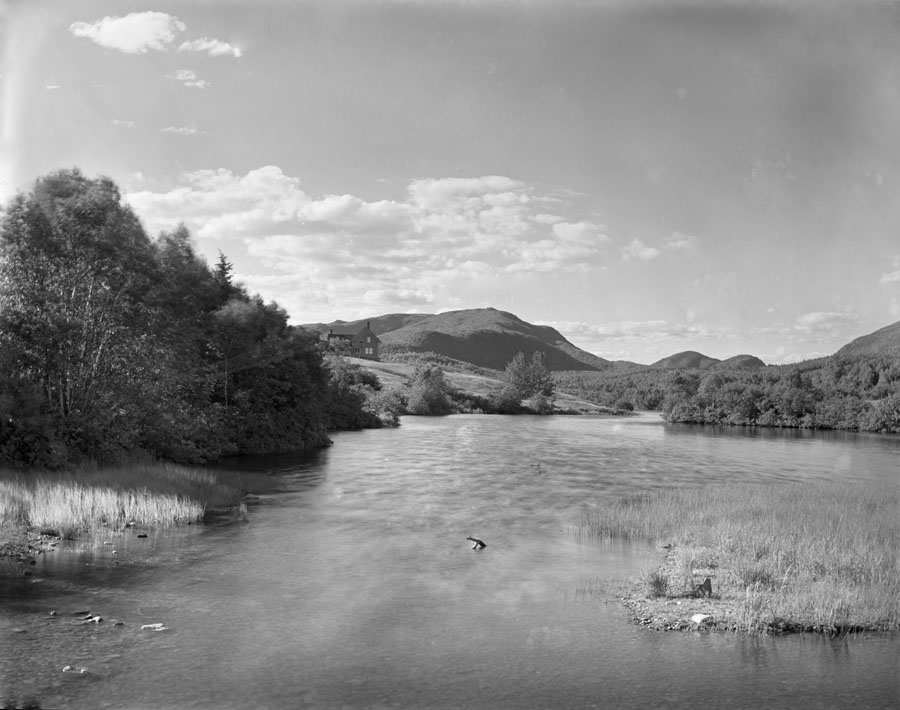
“Old Callahan House, Long Pond.” Photo courtesy of the Seal Harbor Library. (Marked on the 1887 map with a red arrow.) The house was torn down when the Rockefellers bought the property.
As near as I could get to the same view today:

You can just barely make out the boathouse near the center of the photo.
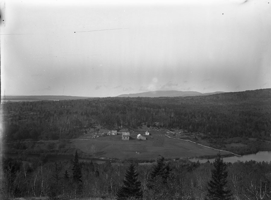
“Long Pond and farm, from Barr Hill.” Photo courtesy of the Seal Harbor Library. (Another view of the Callahan house.)
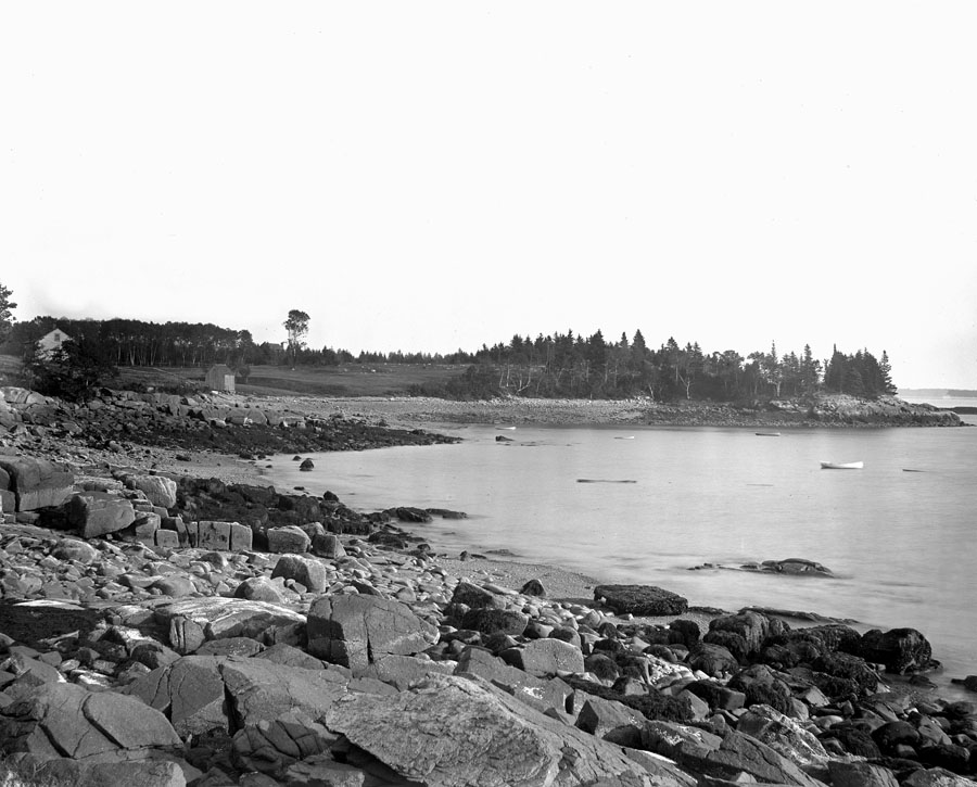
“Golf links, Meenaga Ledge, from Bracy’s Cove.” Photo courtesy of the Seal Harbor Library. I think the house and fish house are the same ones in the photo farther back in this post.
The road seems to have been in a similar spot, although the outlet from the pond has changed a lot:
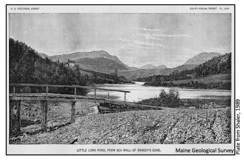
from The Geology of the Island of Mount Desert by Nathaniel Southgate Shaler, 1889, as reproduced in Tom Weddle, The Landscape of Mount Desert Island Past and Present, Maine Geological Survey, November 2011. Shaler’s book was the first published detailed study of the island’s geology.
A couple points of interest in this view east along the beach: there’s a car at the bottom left that gives scale to the size of the seawall, and the Rockefeller estate, known as the Eyrie, dominates the top of Barr Hill. Also note that the telephone or electric poles are set right into the seawall.

“Sea wall thrown up in Bracy Cove,” photo courtesy of Acadia National Park Archives, Box 44 ACAD29539
The seawall appears to be about the same height as the present one, although you can see how modern maintenance standards have pushed the stones away from the road so the landward slope is much steeper.

Not a black-and-white photo, just taken in a snowstorm.
Since we’re going to talk about remnants of the Rockefeller estate around Long Pond, let’s take a quick look at the Eyrie:
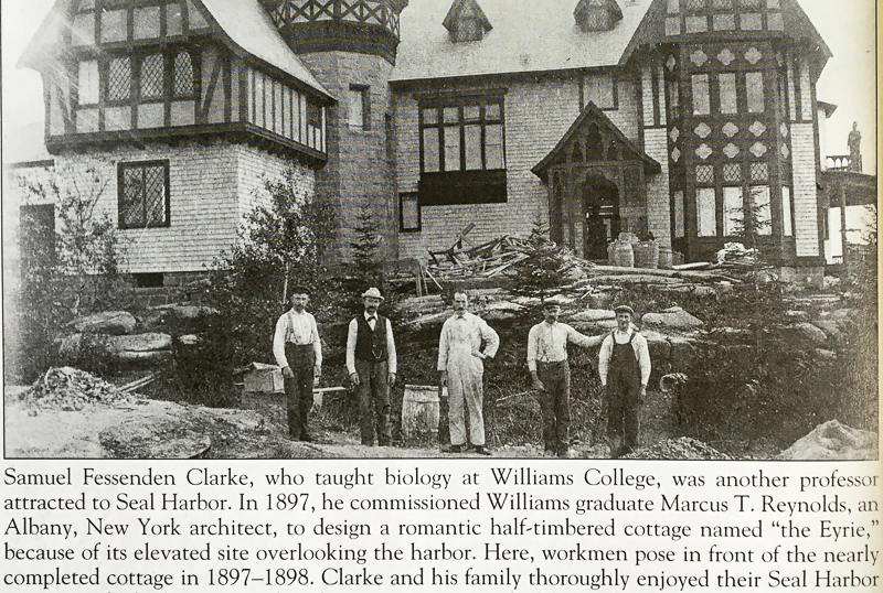
Photo from Vandenbergh and Shettleworth, Revisiting Seal Harbor.
The original house was built in 1898; the Rockefellers bought it in 1910 and expanded it in 1915. It was torn down in 1963 after John D. Rockefeller, Jr.’s death. With 99 rooms, the property taxes must have been insane. All that’s left of the house is a broad brick terrace and the Abby Aldrich Rockefeller Garden. Beatrix Farrand designed the garden with Mrs. Rockefeller, and I understand that she also worked on the landscape around the pond, although I haven’t yet found specifics about her design for the area. You might also enjoy reading an interview with David Rockefeller, Sr. (who was six months old when the Eyrie was expanded) in the 2011 Chebacco that includes his memories of summers in Seal Harbor.
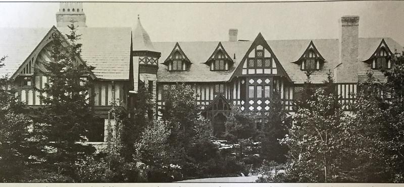
Photo from Vandenbergh and Shettleworth, Revisiting Seal Harbor.
The architect for the expansion was Duncan Candler. His sister, Edith, married George Stebbins, who, you may remember, was George Cooksey’s business partner and took over management of their real estate development firm after Cooksey became ill. Through Stebbins, Candler began designing cottages on Ox Hill – his remaining work in Seal Harbor includes Skylands, East Point, and the boathouse at Little Long Pond.
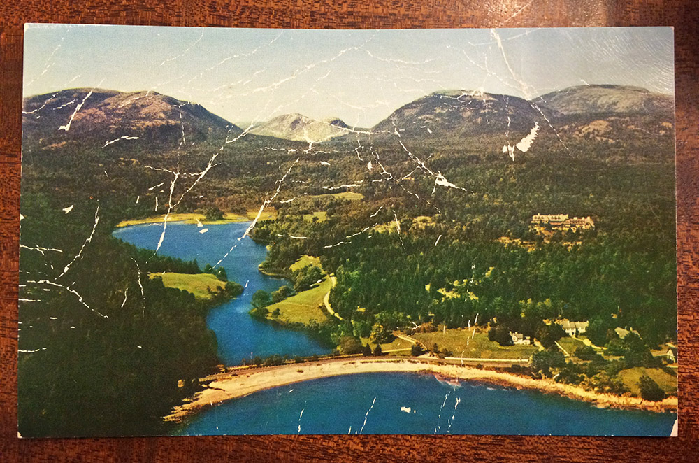
Photo courtesy of the Jesup Memorial Library. (JML PC 24010)
[Interesting digression – several sources described Candler as having married “Edith Stebbins,” while others referred to her as his sister. While I can’t find any biographies of Duncan Candler or Edith Stebbins, it appears Edith and George’s son, George Ledyard Stebbins, became a biologist and geneticist of enough importance to rate his own Wikipedia page, which lists “George Ledyard Stebbins, a wealthy real estate financier who developed Seal Harbor, Maine … and Edith Alden Candler Stebbins” as his parents, so I’m going with sister, not wife. I find it mind-boggling that Candler doesn’t have a Wikipedia page of his own, but that’s fame in the new millennium for you. Also a good argument for using multiple sources.]
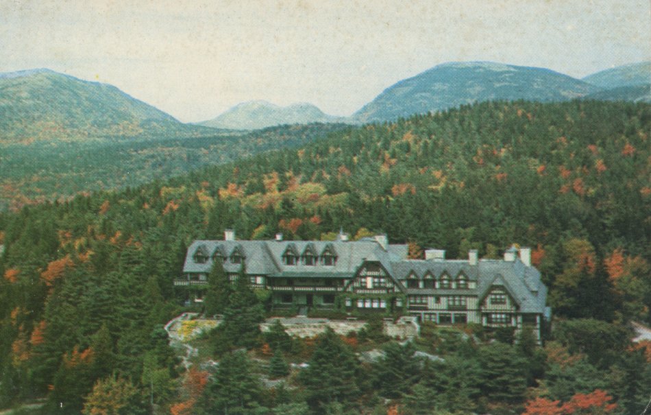
Image courtesy of the MDI Historical Society. (002-47-50-2476)
Last summer, David Rockefeller, Sr. gave the Long Pond area to the Land and Garden Trust of Mount Desert Island, ensuring that it will remain open to the public. As a member of the public, “Thank you!”
January 6, 2017: 25ºF (-4ºC), snowing hard.
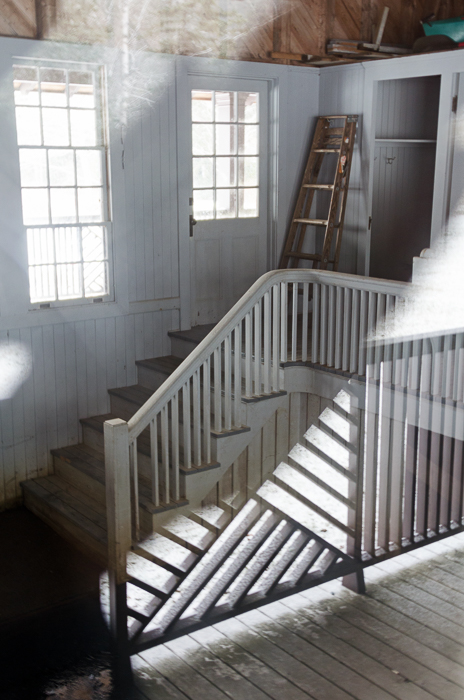
I went back to get a better look at the boathouse. It snowed.
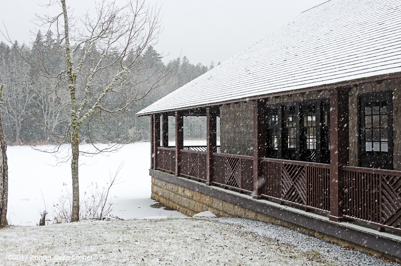
Last time I walked up this way, I had my infant son in a backpack (he’s a college freshman now).

_________________________________
ADDENDA Oct 2, 2017

Samuel Eliot and John Rivers have just published a new book called Little Long Pond: A Field Guide to Four Seasons. There are chapters on the ecology of the pond, the history of the area, and the pond’s future. With hundreds of photos by John Rivers and other local photographers, it’s really a beautiful book!
Copies are available at McGraths in Northeast Harbor and from the authors, 276-3665.
___________________________________
WORKS CITED
Braun, Duane and Braun, Ruth. Guide to the Geology of Mount Desert Island and Acadia National Park. North Atlantic Books, 2016.
Eliot, Samuel A. and Rivers, John R. Little Long Pond: A Field Guide to Four Seasons. Blurb Inc., 2016.
Heckscher, August. The Harbor Club, A History. J.S.McCarthy Co., 1995.
Miller, Kathleen and Rockerfeller, David, Sr. “An Afternoon with David Rockefeller,” Chebacco, Volume XII, 2011. (available as a pdf at the link)
Prins, Harald and McBride, Bunny. Asticou’s Island Domain: Wabanaki Peoples at Mount Desert Island, 1500-2000, vol.2. Boston, Northeast Region Ethnography Program, National Park Service, 2007. (available as a pdf at the link) There is a discussion on p.574 of possible portage routes from Duck Brook to Bracy Cove (judged unlikely) and from Hulls Cove to either Bracy Cove or Seal Harbor (judged very possible.)
Shaler, Nathaniel Southgate. The Geology of the Island of Mount Desert. Washington, Government Printing Office, 1889.
Vandenbergh, Lydia and Shettleworth, Jr., Earle. Revisiting Seal Harbor and Acadia National Park. Arcadia Publishing, 1997.
Weddle, Tom. The Landscape of Mount Desert Island Past and Present. Maine Geological Survey, November 2011. (available as a pdf at the link)

Thank you for your thoughts and old photos!
I found your post very interesting. My father grew up in Otter Creek. I would love to learn more history of our family, Bracy!
Thank you, Nancy! I’m sorry, I don’t know much about your family history, other than they were some of the earliest settlers in the Bracy Cove area. The place to start looking for more info would be the MDI Historical Society: http://mdihistory.org/
A great place to search is Familysearch.com
It is free and they actually have images of documents. I have found documents as far back as early 1800’s. My grandfather was born here, but lost his mother very early and lived with his brother until he joined the army in WWI, he was born in 1892. He died when I was a baby and since there was such a big age difference between him and my grandmother, she never met any of his family or knew much information. I started it as a project with my students and it has been a cool experience.
I have been doing my ancestry and my grandfather Laforest Robin Bracy was born here in 1892 and I have gone back as far 1761 to my 3rd-time great grandfather John Bracy. I can’t wait to visit and explore Bracy Cove. My boys love to fish and were excited to find out their ancestors were sea and lobster fisherman since as far as time goes back. Thank you for such beautiful pictures.
Hi Cory,
How exciting! Thanks for the tip about the research site, too. I hope you get to bring your boys downeast soon!
Jenn
Your research and photos are all top notch and so appreciated by all your readers. Thank you from all of us!
Wendy L.
Thank you!