The Coast Walk Project

Blog

Coast Walk 3: from Cromwell Harbor to Compass Harbor

web©-_DSC5668-Edit

Notes:

January 12, 8:30am-11:30am, about 32 degrees. Overcast with very light snowfall at start, which got much heavier. Felt relatively warm, no noticeable wind.

January 12: Cromwell Cove to Compass Harbor

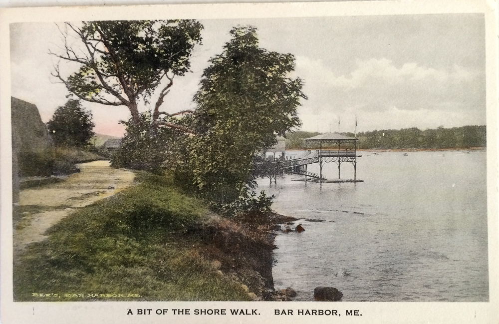
January 12: Cromwell Harbor to Compass Harbor

Walkers:

David Parker, caretaker

Lisa Burton, Reel Pizza

web©-_DSC5615-Edit

Lisa Burton and David Parker

Cromwell Harbor is a quiet little cove looking east toward Bald Porcupine and the Breakwater. Surrounded by summer homes, it has no public access. The cove has a broad, flat, gravelly beach tucked between two dramatic rocky headlands. I had come round the northern one the previous week, and planned to scramble across the southern one on this Walk. My friend Lisa and I met David Parker on the beach there during a gentle snowfall. Lisa has a gift for observation and a cavalier disregard for weather that make her an ideal hiking companion. David has been the caretaker for two houses on the cove since 1978, and we were meeting for the first time.

web©-_DSC5621-Edit

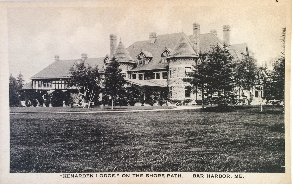
Cromwell Harbor looking north toward Kenarden.

David: Well you picked a nice morning here.

Lisa: It’s better than the last time she [asked] me to come with her, which was like, 5 degrees and blowing 40 knots!  [That was Tuesday of Coast Walk 2.]

As we walked along the beach, stopping now and then to look at a stone or pick up a piece of sea glass, we chatted about the weather, our children, and the project. When I mentioned that I had come around Kenarden’s point last week, where the Shore Path had once run, David said, “You know, this used to be public, at one time. There was a trail that went round the brook. This was years ago, I guess even the 50s. And then they would let the local kids come down and use the beach. Then it got real private after a while.”

web©-_DSC5628-Edit

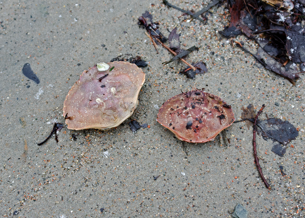
Rock Crab carapaces  (Cancer irroratus)

J: How long have you been a caretaker here?

D: I’ve been over here for the Pulitzer family since 1978. Thirty-seven years.

J: What are your favorite things about the cove?

D: Oh, I don’t know. … For many years I had a boat out here.

J: Sailboat?

D: No, powerboat. Used to pull traps.

J: In the cove?

D: Yeah, set em up off the Breakwater. Very popular spot for the fishermen.

web©-_DSC5614-Edit

Mallard ducks in Cromwell Harbor

J: So did you grow up on the island?

D: Nope. From New York, upstate New York.

J: Really, whereabouts?

D: The Binghamton area. Endwell actually. Endicott, Endwell.

L: Oh yeah, my mom’s from there.

D: Really?

L: Endicott. She lived in Endicott for a while. My grandfather was with the New York electric company. He had a Reddy Kilowatt cardboard stand-up that he put out at Christmas time.

D: My father was an IBMer. IBM originated in Endicott. I did a stint at IBM, and thought, ‘Mm, it’s not for me. And then I headed up this way.

J: What brought you up here?

D: Just hearing about the island, what a great place, and you know… Never left.

L: Young hippie?

D: I don’t know, no, well maybe, a little bit, but it was ’77, so I was starting to settle a little bit by then.

L: It’s a great place to come to and never leave. I did that!

D: Yeah, we came up and then three weeks later we were back here. We went back, came up here for a visit in March of all times.

L: That’s a good time; if you like March then you really like the island…

D: It was mild, I remember, and foggy. We came back in April and I started working at the golf course. Fred McPeters hired me. Worked there a couple of years…

web©-_DSC5637-Edit

That’s the toe of my boot for scale. Anyone know what kind of fish it is?

D: See there’s all kinds of sea glass. Look at the colors!

J: That’s gorgeous

D: And you can make jewelery out of it

J: One of my friends, Lisa Hall, makes beautiful jewelry [from seaglass]. Me, I take photographs.

web©-_DSC5625-EditL: So how high is the highest tide?

D: Oh it’ll get up to the base of the bank there. One storm we had one time, it went over the bank. But that was many years ago.

J: Wow. And are the wooden pilings just reinforcing the bank, or what are those?

web©-_DSC5629-EditD: I wish we could see a picture, but supposedly, there were three sisters that lived here, and I think it was that house, that house, and this house [pointed to Seacove, Beachcroft, and Aldersea]. ‘Cause you see the end over here and supposedly they had some type of a boardwalk across in front of their properties. And that’s the story, but there’s no proof of it, you know, but for some reason they’re still there. They’re still solid some of them. And if you dig down in the mud the boards are like the day they were put in, you know? They’re just preserved down there.

J: Well, I can ask Debbie Dyer, over at the historical society.

D: Yeah, I should get over there sometime, I haven’t been there in seems like forever.

J: I’ll see what she knows about it. She said she used to come down here when she was a kid. They called it Scott’s Beach.

[I did ask Debbie a few days later, but she didn’t remember a boardwalk. Of course, as she pointed out, she was a small child, and small children are not observant of things that don’t interest them. The story about the three sisters she thought was unlikely, as the cottage owners are documented and none seem to have been related. I’ll have to go back and look through old photos of the cove to see if I can find out more … If anybody reading this knows, sing out in the comments!]

Screen Shot 2015-01-16 at 9.51.55 PM

Google thinks it’s called Cromwell Cove. Silly Google.

J: Oh, you know what I meant to ask you, do you call this Cromwell Harbor or Cromwell Cove?

D: It’s known as Cromwell Harbor. Or Scott’s Cove, you know, that was a popular name before; it was Scott’s Cove, because of the Scott family that owned the property, I guess.

J: Well, I wondered because everyone I know calls it Cromwell Harbor, but it’s on the map as Cromwell Cove. And it wouldn’t be the first time the maps were wrong.

D: I’ve got a map at home, I bought it just [because] this was called ‘Rodick Cove’ and I’d never, ever seen it referred to as Rodick Cove. But it’s a Coast Guard map and that’s called ‘Little Round Porcupine’ [pointing to Bald Porcupine.]

J: Wow, I’ve never heard that one. How old’s the map?

D: 1927, so it’s not that old, you know I’m surprised.

J: Well, this was still Lafayette National Park then, too. I’ve got a fantastic map of the States from I think 1922, and it shows Lafayette National Park on it.

J: So you got any other good stories about the cove?

D: No, I don’t know much, well I could tell you one year there was a yacht, I think he was a Dupont cause it was from Delaware, but anyhow it was a night time and he ran smack into that Breakwater there.

J: Oh no!

D: So they towed him in here on the beach. That was the biggest excitement since I’ve been here.

J: When was that?

D: Oh, I’m trying to think, it was back in the 80s.

J: You’d think that they would see the Breakwater on their charts.

D: Well I think that he was down below deck or something. Not paying attention.

J: How long did it take to get the boat patched up?

D: Well they put a temporary patch on it and took it around over to Hinckleys to get it patched up. It was a nice yacht.

web©-_DSC5617-Edit

J: Ok, sorry, but I have to take a picture of that. [disposable razor on the shore] I photograph the weirdest things that I find.

D: You know what I found a lot around here over the years is leather soles to shoes. Strange.

J: Yup. I find those. Flip flops, I find.

D: And every day the beach is different here. Some days more sand, some days less sand. There’s a lot of gravel now over that way, but sometimes there’s sand all over. You never know.

D: One thing that surprised me is going back and reading in the history of the native Americans here in Bar Harbor and on the island, why this, this seems like this would’ve been an ideal place for them, for a camp, with the freshwater stream coming in. But I’ve never heard or read anything about them ever setting up camp down here. Or a reference to it. That’d be something Debbie Dyer might  know about.

J: The other people you could ask are the Abbe

L: [Coming up with another disposable razor] Must have lost a whole package of them. It’s still got the little cover on it.

D: Geez, I could maybe use that.

L: You’re more than welcome to have it! It looks brand new.

D: Started growing my beard cause I ran out of disposable razors last year.

J: Well it’s come in nice.

web©-_DSC5620-Edit

D: Hey, a dog toy!

J: Is that what it is?

D: You know they sell these down at Bark Harbor for probably $9.95.

J: Sheesh. You got a dog?

D: I have three of them! I would have brought them down, but they’d be a pain.

J: Yeah, they’re always like, ‘What are you looking at, give me some!’

D: I got two little ones and a golden retriever.

web©-_DSC5622-EditL: Ooh!

J: What’d you find?

L: I thought at first it was a tongue and teeth, but there’s a foot attached to it, so I’m not really sure.

J: Oh, crazy! Well, that’ll make for an interesting still life. web©-_DSC5644-EditJ: Is this an overboard discharge? [Looking at a large pipe running down the center of the beach.]

D: That one, that’s just stormwater, but the one that runs underneath it is.

J: Oh, it’s just stormwater?

D: Yeah, that’s just draining. Right underneath it, the pipe, you see it, runs straight out? That is the overflow, if the sewer department gets overloaded.

J: That’s good. Usually when I see an overboard discharge it’s like, green where it comes out because of all the nutrients in it.

D: This one here runs out, supposed to go out there past the middle of the cove. I don’t know what the condition is out there now.

J: I find a lot of them broken off. But that one’s a lot bigger.

D: They just repaired this a couple of years ago.

D: It used to be terrific flounder fishing [here.]

J: Really?

D: Yeah, oh, they’d pull them up by the bushel full.

J: But not anymore?

D: No, they put a sewer plant in.

J: Huh?

D: All these houses, the main line sewage went right in the cove up until 64, no 74. 1974.

J: Oh, so the flounder came for the sewage?!

D: Yeah! It was so good for the flounder.

J: You don’t usually think of improving the sewage disposal as bad for the wildlife!

D: Yeah, the flounder went away after they cleaned it up.

J: That’s too bad.

D: Yeah, I hear stories. You could sit there in a boat and just pull them up one after the other.

L: That was one of the fascinating things when our kids went to Swans Island for their 4th grade trip. They, at the little museum there, they had these pictures of these guys just with spears, and they’d just spear them from the boat.

J: So how big were the ones you were catching?

D: Oh, I’ve never caught one, this was before my time, before I came here. Back in the 50s and 60s. No, I never caught anything but a mackerel out here. And a pollock. And lobsters.

web©-_DSC5646-Edit

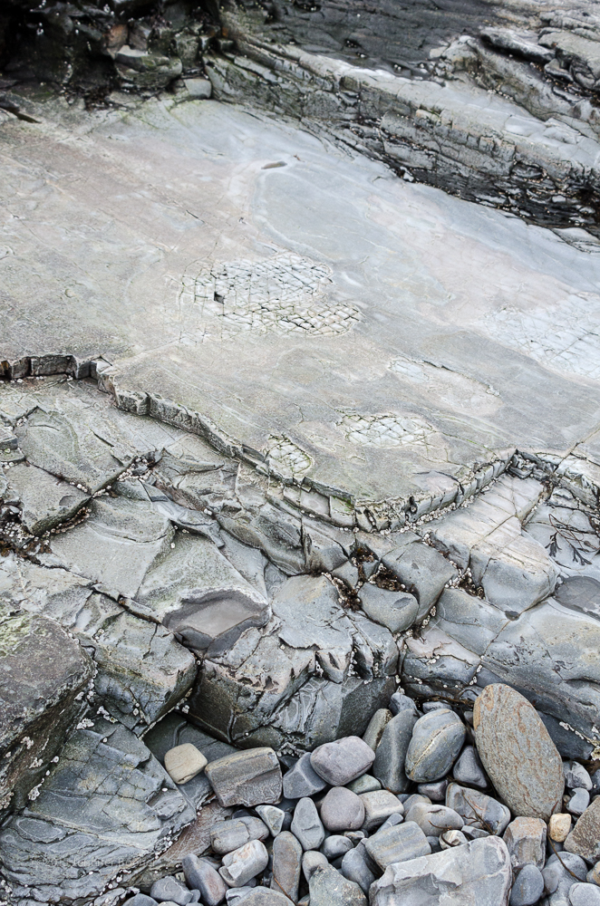
The snow was starting to come down more enthusiastically, so after a little more chat and many thank-yous, Lisa and I headed out around the point. We moved cautiously onto the rocks, and found that the snowy rockweed gave the best footing. Even so, we had to be wary as the light coating of snow disguised the semi-frozen tidepools. I stepped in one myself, misjudging its depth, and was pleased to discover that my Smartwool socks and insulated boots kept my foot as warm as it had been when dry. (If they hadn’t, or if the day had been colder, I would have cut the walk short rather than risk frostbite. There are limits to my stubbornness.)

web2©-_DSC5677-Edit

Lisa in her protective winter coloring.

We spotted two male and two female Buffleheads on our way out of Cromwell Harbor, three or four brown ducks that might have been female Mallards off the point between the harbors, and a juvenile loon who followed us out of Cromwell into Compass Harbor. I say a juvenile loon, but it might have been an adult in winter plumage: my bird knowledge is spotty.

web©-_DSC5666-Edit

web©-_DSC5683-Edit web©-_DSC5691-Edit

web©-_DSC5673-Edit

Looking back into Cromwell Harbor from the point.

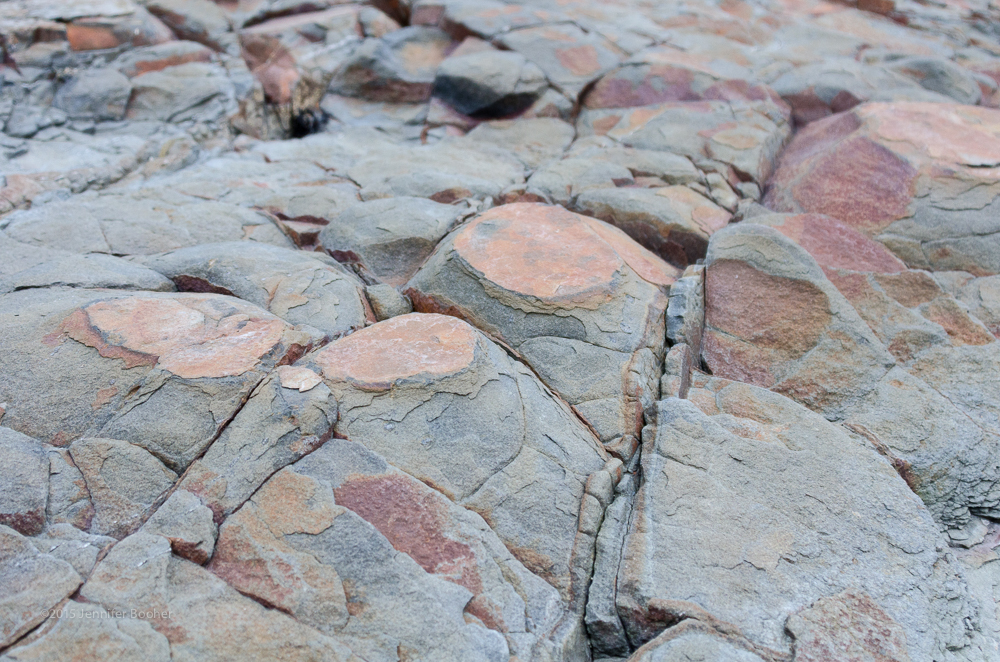
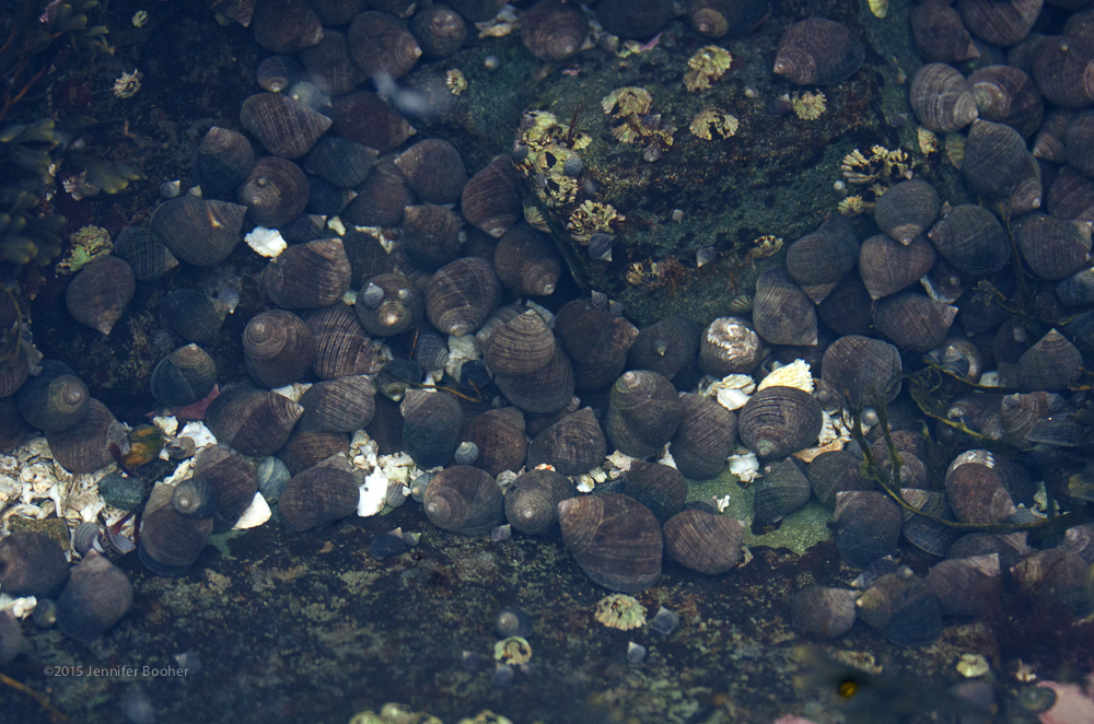
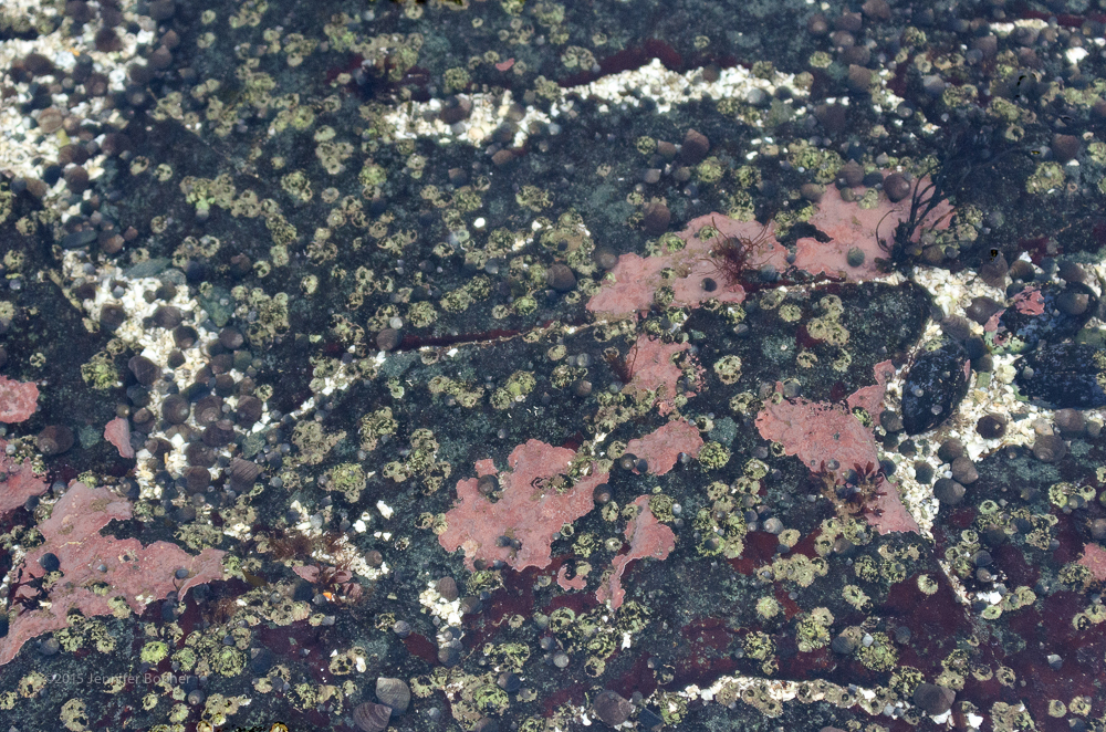
Our attention was pretty focused on keeping our footing, but we couldn’t help stopping to admire the tidepools every so often. The reds and greens just glowed in the grey, snowy daylight.

web2©-_DSC5659-Edit

The tidepools were full of baby periwinkle – see if you can spot them in the photos that follow!

web2©-_DSC5651-Edit

web2©-_DSC5661-Edit

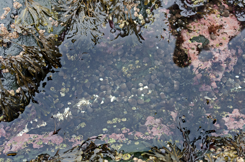
This was the densest colony of periwinkle I’ve seen – if you look closely, tiny baby periwinkle are piled on top of the adults.

web2©-_DSC5663-Edit

web2©-_DSC5656-Edit

web2©-_DSC5690-Edit

Looking across Compass Harbor to Dorr Point, the ‘finish line’ for this Coast Walk.

Eventually we rounded the point into Compass Harbor, which although shaped much like Cromwell Harbor has a much rockier character, with a cobble beach rather than sand and gravel. Half of Compass Harbor is in Acadia National Park, and I’ve been bringing my children here since before they were born. (The trail from Main Street is a nice, level stroll for a pregnant woman, and it’s also a pleasant walk for toddlers.)

web2©-_DSC5685-Edit

web2©-_DSC5680-Edit
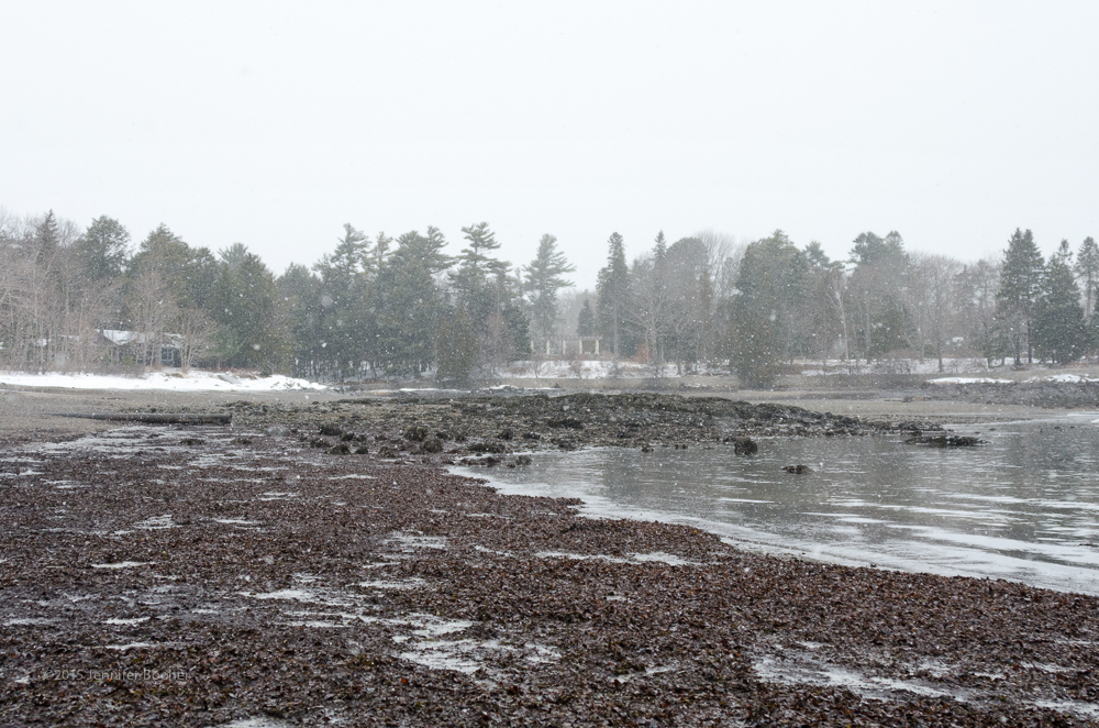
By this point, the snow was coming down much thicker, and we were glad to reach the easier walking of the cobble beach just beyond this seaweed-covered stretch. For those of you who worry about our safety, the first rule of the Coast Walk is “Do not die.” Just above the outcropping at right is a house with a lawn whose owner had given me permission to cross her land. We could have reached it in two minutes. In fact, from the beach where we left David, there were three properties from whom I had permission, so we were never more than a few minutes from civilization.

web2©-_DSC5679-Edit

Looking out toward Bald Porcupine with the Breakwater at left.

We spotted three female buffleheads off Dorr’s Point, and called it a day, trudging gratefully and happily along the path back to Main Street.

Next week’s Coast Walk is still taking shape: I’ll be heading up along Sols Cliff, which should be exciting. About half of the property owners along this segment have given me permission to cross their land (no one has actually refused, I’ve just had a hard time reaching people who live out-of-state in time for the Walk: must remember to start calling and emailing at least three weeks ahead) so I may be zigzagging around a few places to avoid trespassing. It will be an orienteering adventure!


Share

Coast Walk 2: from the Town Beach to Cromwell Harbor, Bar Harbor

web©--9

Walkers:

Debbie Dyer, curator, Bar Harbor Historical Society

Notes:

Tuesday Jan. 6: 3-5pm. Sunset at 4:10pm and low tide at 5:04pm.  Somewhere between 0 and 5ºF, gray overcast sky, light wind from the Northwest. Ice slowed me down so much that darkness fell before I even reached the end of the Shore Path, so I had to finish the walk on Saturday.

Friday, Jan.9: 1-2:45pm. Low tide and sunrise 7:10am. About 35ºF. Snowing hard with strong winds when I began. Gradually stopped snowing, wind died down, and sun came out.

Saturday, Jan.10: 8-11am. Sunrise at 7:07am, low tide at 7:53. About 3ºF at the start, might have been in the 20s by the end. Sunny with very little wind.

The stars were out of alignment for the Coast Walk this week, and I mean that literally: neither the sun nor the moon cooperated. Low tide was before sunrise and after sunset until the very end of the week. The weather was against us, too: below-zero windchills and a vigorous snowstorm meant the shores were covered in ice and/or snow, which slowed my pace a lot. In the end, this week’s walk got fragmented into three separate days, one walking on the Shore Path looking at the houses, and two walking on the shore (because darkness overtook me and I had to complete the walk the second day.)

web©-_DSC4985-2-Edit

The Bar Harbor Town Beach, with the oldest portion of the Bar Harbor Inn (the Reading Room) in the background.

Coast Walk 1 had ended at the Town Beach (above), which is also the start of the Shore Path (below.)

web1-ShorePath

Looking along the Shore Path toward the Bar Harbor Inn (just off to the left) and the Inn’s pier.

web©--2

Looking along the Shore Path from below Grant Park toward Reef Point

Over a hundred years old, the Shore Path is one of the oldest tourist attractions in town. It exists through the grace of generations of shorefront property owners who have allowed it to run across their private property, and is lined with lovely old summer cottages as well as a fair number of more modern homes. Debbie had offered to walk the Shore Path and tell me some of the history behind those cottages and her memories of some of the owners, but it was somewhere between 0º and 5ºF on Tuesday the 6th, and she was (very sensibly) worried about falling on the icy Path, so we met indoors at the Historical Society museum, where she walked me into the past with maps and photos. I’m going to try to superimpose her stories onto my walk (although you’ll see it was more of a scramble, with the occasional slither.)

web©-_DSC5050-2-Edit

I began Walk 2 under the pier in front of the Bar Harbor Inn. The shoreline here alternates loose stones with outcrops of dramatically slanted, layered, and shattered ledges, with the occasional sea stack.  This is Bar Harbor Formation stone, layers of sandstone and siltstone that form the second oldest type of rock in this area. It’s at least 360 million years old. That fringe of white near the base of the sea stack above is ice marking the high tide line.

web©-_DSC5018-2-Edit

The Reading Room portion of the Bar Harbor Inn, with tilted layers of (I think) Bar Harbor Formation in the foreground.

web1-ReadingRoomThe oldest part of the Bar Harbor Inn, shown above, was built by a summer social group known as the Oasis Club. The members had been meeting at 32 Mount Desert Street (now the Secondhand Prose bookstore.) They wanted to build a new meeting place on the shore, but there was already a house at the location they chose: the Veazie Cottage. So, Debbie explained, “The Veazie Cottage was moved down West Street, on rollers, and it is now called the Kedge, on the corner of Bridge and West Street.” A new building, called the Reading Room, was designed by architect William Emerson, and is now the restaurant of the Bar Harbor Inn.

web©-_DSC5033-2-EditAs I rounded the point on which the BH Inn sits, the ledges shrank back from the low tide line, leaving a wide foreshore of loose, weathered stones, exposed around the high tide line and covered with rockweed near the low tide line:

web©-_DSC5070-2-Edit

web©-_DSC5104-2-EditYou can’t see it in this photo, but everything above the high tide line was slick with ice from the sea spray. The seaweed was frozen, too.

web©-_DSC5014-2-EditSomething I found along the way: it looked an awful lot like the salmon roe you get in sushi restaurants. Couldn’t tell if the eggs were attached to the seaweed or just frozen to it.

web©-_DSC5080-2-EditA peculiar stone formation I hadn’t seen before.

_DSC5148-2-web©Just past the far end of the Inn is Grant Park. Debbie continued, “Now, Grant Park was the second oldest summer cottage; they never actually named it, other than ‘the Grant cottage.’ [ed.note: the first cottage was Ulikana, which isn’t quite visible from the shore anymore as it’s hidden by a wing of the Bar Harbor Inn.] It was right down close to the water, and … up in the parking lot area where you can see a depression in the ground, that was the tennis courts for the Grant cottage. It was built in 1869-1870. [Mr. Grant] wanted to give it to [Mrs. Grant] as a wedding gift. She came here and it was all fogged in, it was just absolutely horrible weather, and the day they were to leave, the sun came out, and there they were right on Frenchmans Bay, and she said it was the most beautiful sight she had ever seen … . They were from Tarrytown, New York.  The town purchased that land in 1912. The house was torn down in 1930.”

web©--4

The Balance Rock Inn (formerly Balance Rock cottage.)

web©-

Balance Rock, a glacial erratic, from which the Inn got its name.

On the other side of Grant Park “we’ve got the Balance Rock cottage [which] was built on the Shore Path in 1901 and 1902 by Alexander Maitland. The architects, Andrews, Jacques, and Rantouil, were very famous architects from the Boston area. I quite often go down to the Chamber [of Commerce] and pick up these brochures from the different establishments … because it’s interesting to hear the history of what they put on their brochures. The Balance Rock Cottage, when they first came to town, they put on that ‘the ruins, if you’re standing on the Shore Path, the ruins to the left of our cottage, the pink granite ruins, are the house where Nelson Rockefeller was born.’ Well, that’s not true at all, so I made point of going down and telling them that they should revise their brochure. Because the name of the cottage that was next to the Balance Rock Cottage, [where now] you can see cottages being built … toward Derby Lane, was … called Shore Acres. And it was built in about 1869-70 … by a Dr. Haskett Derby from Boston. He was an oculist, and the house was torn down in 1957. But anyway, Dr. Haskett Derby owned from that strip of the Shore Path all the way up to Main Street. So that’s why you get the name of Derby Lane.”

4birds

Top left: female Bufflehead Top right: Male Bufflehead Bottom left: Merganser Bottom right: Juvenile Loon?

On Friday, I saw about about 25-30 birds between the Bar Harbor Inn and Reef Point, mostly Buffleheads, one Merganser, and one that might have been an immature Loon.  The Buffleheads are just adorable, and when they flock together they’re really striking. It was still snowing a bit, and there wasn’t enough light for good telephoto shots, so after watching the birds for a while I continued along the shore.web©-_DSC5249-2

web©--8

The Reef Point fence

web©--5“So, we’ve gone past the Grant Cottage, we’ve gone past Balance Rock, we’ve gone past Shore Acres, now we’re coming to a very prominent patch of land where you’ll see the fence continues right straight around, which was Beatrix Farrand’s. [Farrand was a well-known landscape designer around the turn of the 20th century.]  … Never declared herself a landscape architect. I have the last piece of [stationery] that she had embossed, and it said ‘landscape gardener.’ Her place was Reef Point, and her parents had it before her. You will never, ever find a picture of her father because Mr. Jones was kind of wiped out of the family many many years ago. Mary Cadwallader Jones [Farrand’s mother] and her daughter lived there, and of course her father’s sister was Edith Wharton, the poet – there’s a bureau scarf of Edith’s over there [pointing to a glass case in the corner]. Beatrix … didn’t get married until into her 40s. She married a man by the name of Max Farrand. That area – now it’s got the Testas, the Hobbes, and that new head of the Lab there, [who] bought Judge Smith’s house, and Chad Smith’s house. So all of that is [built on the former] Reef Point.

web©--7

The late Judge Smith’s house, once the gardener’s cottage for Reef Point, and a flight of terraced stairs: some of the few remaining elements of the Reef Point gardens.

I live on … Hancock Street, [and] she used to open up her [gardens] on Sundays … and I remember as a child, … I couldn’t understand how this woman, who must be very bright, I thought to myself, to have all these pretty gardens, but … why does she have to mark everything? Because as a small child, I’d walk around, all by myself, on Sunday afternoons, and see all of these writings … – she had all of her [plants] labelled. And I couldn’t understand how she [didn’t know] what things were!”

web©--11

Former site of Devilstone / Eaglestone. i think the building on the right is the old projection room.

web1-Devilstone“The Shore Path goes down Hancock Street, so as you walk down [Hancock St.] to the Shore Path, Reef Point would be on your left, and on your right would be a place called Devilstone. Frances Coleman purchased that, and changed the name to Eaglestone, because she didn’t think Devilstone was a very appropriate name. … Her chauffeur would come up on Labor Day, just before we’d start back for school, and he’d come up and take us children down there, and we’d go for tea and cookies on her lawn, and then we’d go into her projection room and watch SPCA films [which were]  films on … making sure you knew how to take care of [cats and dogs] and be kind to them. We looked forward to every Labor Day, because we’d be chauffeured down to Miss Coleman’s place and look at SPCA films, and then we’d be chauffeured back to our homes. Now if you are on the Shore Path and you look up to those houses on the Shore Path, the projection room is still there, it’s on the right hand side. It’s a long type of a house, which is now owned by John Nelson. And the rest of the cottage was torn down.”

web©--10“Next to that is the Breakwater estate, which was built in 1904. A lady and her husband bought it several years ago and changed the name to Atlantique. Now Scott and Laurie West purchased it and changed the name back to the Breakwater. … Five years [ago] this year they bought that. Every September they have a block party and all of us on the street are invited to that.  I went down to Swan Agency the other day, sometimes I pick up their magazines on the shelf there, and one of them had an article about Matilda Dodge Wilson. … I recognized the name because the Wilsons owned the Breakwater estate years and years ago back in the late 50s or 60s … . They had an auction in the 1950s and I went down there. I walked down this long driveway to the Breakwater estate, and in the dining room [there were] all these people walking around … and I’d see the tags hanging from things, you know, for the auction. I walked into the … beautiful dining room, but all I could see were these … stacks of dishes being sold.

Jenn: How old were you at this point?

Debbie: Probably six, seven, eight.  I was just mesmerized by all of those [dishes], and I went into the kitchen and … there was a wooden cat’s dish; it was wooden, it would hold a dish, and it was the shape of a cat. I grabbed that, and I thought, ‘I want that.’ So I went over to George Goodrich at the cashier counter, and I said to George, ‘How much is this?’ And he says, ‘Well how much money [do you have]?’ I didn’t know what I had, I just took [makes gesture of pulling money out of her pocket] and he said, ‘Well you’ve got just the right amount of money.’

J: Aw, that’s so sweet

D: And so I lugged that wooden cat’s dish home. And I don’t know where it is now. I don’t know if it’s still in the house or not, I don’t have a cat now anyway, I’m allergic to them. It’s just fond memories of the Breakwater estate.

Now next to that as you’re walking the Shore Path [was The Briars.] You’ll see the servants’ quarters that sit in the back, but the main house was torn down. … As you walk toward Wayman Lane, … the servants’ quarters are over there, the bowling alley’s down there, the house would’ve sat here. And that’s where Nelson Rockefeller was born. … His mother and father, John D. Rockefeller and Abbie Aldrich Rockefeller, … they’d never been to Mount Desert Island. Abbie Aldrich Rockefeller was pregnant with Nelson. In July. And the pediatrician said ‘If you want me,’ here they were from Tarrytown, New York, and had never been to Maine, ‘If you want me to deliver your child, you’ll have to come to Maine. … I’ll be in Blue Hill.’ Well, fortunately for Mount Desert Island there was no room at the inn in Blue Hill. So they … rented a place called the Briars. Evalyn Walsh McLean and her husband [the owners of the Briars] were … away in Europe that summer so John D. Rockefeller and Abbie rented the Briars that summer … that’s why Nelson was born there.”

web©-_DSC5138-2

And then it got dark, which makes beachcombing hard, photography difficult, and climbing on ice-covered rocks with an incoming tide just plain stupid, so that’s as far as I got on Tuesday.  On Friday I walked the path, taking photos of the buildings, which are hard to see from the shore, and reached the current end of the Shore Path:

web©--12On Saturday, I continued on around the point.

From Reef Point to the footbridge the shoreline had started to change again, with the outcroppings getting taller and the foreshore narrower. I started almost an hour after dead low tide (because dead low tide was at sunrise and I was tired of clambering around in half-light) so the tide was encroaching on what little gently-sloped, seaweed-covered area there was. Clearly I was in for a morning of rock-climbing.

_DSC5448-web©The sun was out, and blindingly low in the sky, which is normal for winter, but very inconvenient when you are heading east. The rocks were slick with green algae and ice; turns out the only thing slicker than scum-covered rocks is icy scum-covered rocks.

web©-_DSC5435-EditFortunately the ice reflected the blinding sunlight with an equally blinding glare, so it was easy to spot. I confess there were a few moments when I had sloowwwlly worked my way up one side of an outcrop and was sitting on the edge, lowering myself gingerly down the other side, watching the tide wash into the gully below, when I wondered not if but when I had lost my mind.

web©-_DSC5504-EditBut every time I decided that this stretch would have to be more about getting through unhurt than about careful observation, I’d come to a tiny beach of perfectly tumbled stones,

web©-_DSC5480-Editor a miniature sea cave filled with icicle stalactites and frozen waterfalls,

_DSC5453-web©

_DSC5463-web©

web©-_DSC5495-Edita brightly colored tidepool (I think the green is a kind of sponge and the red is coralline, but if anybody knows for sure please correct me!)

web©-_DSC5486-Edit or a frozen Toad Crab, and I’d forget all about how hard it had been to get there.

_DSC5438-web©

The only animals I saw that morning were a juvenile loon off Kenarden and three ducks (might have been female mallards) in Cromwell Harbor, but once I scaled an outcrop and found someone had been there before me:

web©-_DSC5512-EditThere was no wind, and the silver lining to the glaring sunlight was that in spite of the freezing temperatures I was much warmer than I had been on all the previous walks, and the excitement of each new find gave me a little jolt of energy. Then again, each time I found myself dangling over a ledge, wiggling my bottom ungracefully downward, I couldn’t help thinking wistfully of Debbie’s tales of the days when the Shore Path made this a pleasant walk:

web©-_DSC5517-EditD: Barberry Lane, which [connects] Wayman Lane to Livingston Road, that used to be called Carr Avenue until the 1900s, … because Lucian Carr owned Bide-a-While …, but evidently when he [left] they changed the name to Barberry.

J: The Shore Path used to run in front of those cottages, didn’t it? How far did it go?

D: It went all the way around to Cromwell Harbor.

J: So it went around Kenarden?

web1-Kenarden

The old version of Kenarden.

D: Yeah, just the front of it. I can remember as a small child going all the way. And … when I was a child, you see, Kenarden had been torn down, and so the Colkets did build there. Kenarden was built by John S. Kennedy. No relation to the Hyannisport Kennedys. This guy was a railroad guy, and he and his wife never had any children. And their niece built what we know now as the Atlantic Oaks, big cottage down on the water, and that’s called the Willows. But he and his wife never had any children, eventually the Dorrance family bought that property and … the Dorrances are the grandparents of Tris Colket. … I’m just trying to think now, John S. Kennedy’s great grandniece from England came here, she wanted to go down and Ruth Colket wasn’t available, [but Ruth Colket] said ‘I’ll leave the door open and just bring her in and go around anywhere you want in the house.’

J: That’s awfully nice.

D: Well, she’s a very nice lady. And we went down, and you know, you’re not going to tromp through peoples’ houses …, all she really wanted to see was the area, the general area where her ancestors lived and how they fixed up the outside with ponds and beautiful ornaments, so then we just saw the front and then we went down to the Italian gardens. If you have a chance in the summertime when the garden clubs [have] their tours, you should go down to Kenarden, because she’s done a marvelous job with the Italian gardens down there.

_DSC5564-web©

The Italian Gardens in the distance at right, and Cromwell Brook emptying into the cove at center.

J: That’s a Beatrix Farrand garden?

D: Yes. A lot of it was easily restored and it’s just like Betsy Moore’s up by the Wonderview there, called the Farmhouse? You know that’s a Beatrix Farrand and she’s restored it. The funny part of it is that when Mildred McCormick [lived there] people were taking care of her garden and they were pulling things up and throwing them in the [compost pile], but Betsy went out and she found a lot of the seeds, in the pile of where people had thrown the things.

J: In the compost pile? What a great idea!

D: And was able to restore a lot more than she thought. You know? So everything was still in existence, so to speak. Never would think to paw through the compost pile!  So anyway, that takes you around to the Colkets. And then you get Cromwell Harbor, and Edgar Scott, [who owned a house there] and that’s why as small children we used to go down to what we called Scott’s Beach. It’s a beachy area in Cromwell Harbor. But it’s all privately owned now. And then I think you come [to] Beachcroft, and then you come up to Loy Andrews [Aldersea]. And Loy’s right in the middle of Cromwell Harbor.

web©-_DSC5499-Edit

Looking into Cromwell Harbor; I think that’s Aldersea at center.

[Then] Edgar Scott and his wife, … we don’t know why these people named these cottages, it was named Chiltern. And their garage, or should I say, their carriage house, is still in existence behind the ball park called Chiltern Inn.

J: I’ve seen that. Always thought it was a really weird place for an inn.

D: Well it is, because that was the horse stables.  I interviewed Anna Scott Kennedy, she lived in Northeast Harbor, again no relation to the other, this Kennedy was from New York. And she grew up on Cromwell Harbor. … I understand that her father had the most wonderful horses and the most wonderful horse carriages in there. And there was one room just for trophies. … I’d just love to have seen the interior. But Anna told me, the funny part of it is, is she said, ‘you know,’ she says, ‘my brother said to me, that he was getting rid of the carriages and sending them up north to people that wanted them to buy them and everything. And I went to a dinner party,’ she said, ‘and sat next to John D. Rockefeller in New York City, and he said to me, ‘Anna, whatever happened to all the carriages in your carriage house?’ And she says ‘oh my dear, my brother took care of that, and they’ve all gone north.’ ‘Oh’ he says,’I used to push my nose on the glass of that carriage house,’ and he said, ‘in envy of all of those carriages for my carriage roads on Mount Desert Island.’  And [the next houses are on] what they used to call Vanderbilt Point. Because George Vanderbilt used to have two cottages there. But then they called it Browning’s Point, because Mrs. Edward Browning, Loy Andrew’s mother, lived on it. Everybody changes things. I’d like it if it went back to Vanderbilt Point to keep us with the name of Vanderbilt around here. That’s where George Vanderbilt had his place, but his brother owned Sonogee. Frederick. But that takes you up with a few of the cottages right to Cromwell Harbor anyway, and gives you a little bit of insight on some of the cottages, and how old they are. You know, some of them, like the Colkets only built in the 1970s, but others there are still going strong, like the Balance Rock cottage. Ok, [let’s go home] before we freeze to death!

web©-_DSC5425-Edit

I’ll second that! But before heading home, let’s watch the red squirrels racing up and down the massive pines at Kenarden.

_DSC5533-web©This little one had a stash of crabapples or rosehips in a hollow in that knot:

_DSC5558-web©

And that’s all for this week. Next week’s Coast Walk heads into Cromwell Harbor, where we’ll meet David Parker, who has been a caretaker there for over thirty years. See you there!

___________________________________

Addenda, December 29, 2016: The Christmas Walk

Addenda, April 8, 2017: The Bar Harbor Inn

Save

Save

Share

Coast Walk 1: from the Bar to the Town Beach, Bar Harbor

JennAndGeorge

George Neptune and Jennifer Booher (photo courtesy of Jane Disney)

Walkers:

George Neptune, Museum Educator, Abbe Museum, Bar Harbor, Maine, and member of the Passamaquoddy tribe.

Dr. Jane Disney, President, Frenchman Bay Partners and Senior Staff Scientist, Mount Desert Island Biological Laboratory, both in Salisbury Cove, Maine.

Notes: walk began at 1:18pm on January 1, 2015, dead low tide at 1:52pm, sunny, 25ºF (wind chill must have been much lower, it was darn cold.)

January 1: the Bar to the Town Beach

January 1: the Bar to the Town Beach

The Bar is a strip of land exposed at low tide that connects the town of Bar Harbor to a smaller island called Bar Island. I kicked off the Coast Walk at the Bar because 1) The town took its name from the the Bar,  2) it’s a very visible local landmark with a small footprint, so when you say, “I started at the Bar,” most people on the island can visualize that location within 10 feet, and  3) I knew there had been Wabanaki villages near it and it seemed appropriate to begin with the island’s first known human inhabitants. The Bar is one of the town’s more popular open spaces – there’s always a dog walker or a jogger down there (at low tide) – and in fact as we were gathering, the 5K Resolution Run came dashing across.

web-

I should note that I’m presuming my readers have some familiarity with Mount Desert Island, so if you are not from the island, please don’t hesitate to ask questions in the comments area at the end of the post.

George Neptune, Jane Disney and I met at the Bar on New Year’s Day. I asked George to tell us about the Wabanaki encampments that were in this area around the turn of the century. George is a wonderful storyteller, so I’m going to give it to you in his own words as much as possible:

Abbe-BH encampments 1860s-20s

Map courtesy of the Abbe Museum: the triangles represent Wabanaki encampments.

“Well, the two Indian encampments that were down here near the Bar during what we call the Rusticator period, which is  a period roughly 1880-1920, … show up on the map as being on either side of the Bar, right here on Bridge Street, so one of them was pretty close to where we’re standing.”  [The encampments were seasonal, and the people who lived in them came to sell goods and services to the summer visitors, who were called ‘Rusticators.’] “Tourists would come to buy baskets and beadwork, [and] other trinkets made by Wabanaki people, so the encampments were set up like little Indian villages: they were a huge part of the tourist attraction. … At that time I guess Manifest Destiny was still very much a big part of the American attitude so, you know, the West was still being won and there was still that idea that they were trying to conquer all of the Indians in the West and … expand the United States from coast to coast. So  the racial tensions were very very high between Indians and non-Indians out in the West, [and] at that time it was believed that Indians were very dangerous people. But here in Bar Harbor, you could go to the Indian encampments, safely interact with the people, get gifts made by native people for your friends, and even more amazingly a [for] lot of the rusticators, while they were out hiking Cadillac Mountain … the kids would often be sent with a Wabanaki guide for the day.” I asked if that was a sign of trust or of a patronizing attitude, and George responded that there was certainly a lot of trust and also  “kind of an exploitation of native culture, but Wabanaki people knew that and played on it. One of the biggest guides in Bar Harbor at that time was Frank Loring, who called himself Chief Big Thunder because everybody responded more to an Indian named Big Thunder than they would an Indian named Frank Loring. And he wore this traditional garb that was made of boa constrictor skin, because there are so many boa constrictors here in Maine. And he had this giant headdress made of big, beautiful ostrich feathers. [ed. No ostriches here, either.] And he had this [bow] –  ‘the last real Penobscot war bow’ that his grandfather used in a battle, or in the last great Penobscot war, or something like that, and it was actually something that he made himself in his backyard. And they would put on these big Indian ceremony pageants and invite people from all over Bar Harbor, and they were a huge part of the show here in Bar Harbor. And it was all fake! There was some authenticity woven into it, but a lot of it was just pageantry, it was just show, and it was totally totally playing on the idea that this is what American people think Indians look like.”

Frank Loring’s canoe rental was in a wharf building somewhere between  the present locations of Stewman’s Lobster Pound and the whale watch: I found photos of it in a book George had recommended called Asticou’s Island Domain. Chapter 10, “Wabanakis and Rusticators,” has great quotes from contemporary diaries and travel guides, several photos of the encampments,

web-3157

web-3166

and even one of Frank Loring in his boa skin and ostrich feathers:

web-3169

“Eventually Bar Harbor got more and more developed and the Indian encampments started getting pushed farther and farther from the main town, until eventually there was only one Indian encampment in town which was located far from the coast … at the very end of Ledgelawn on the Athletic Fields. So the Indian encampments started to lose a lot of visitation and eventually Wabanaki encampments were [banned from the town.] However Wabanaki people would still come and camp in the summer time. They would do various roadside camps, they would just be in a different spot every time, wherever they could. I believe they started to go up more toward Hulls Cove and that area. So now, Wabanaki people, we still come in the summertime to sell our crafts. We come for the annual Native American festival which is right up at the College of the Atlantic. I’ve been coming to that since it started when I was about 4 years old. I believe I’ve only missed one. But I’m a basketmaker myself. I started weaving with my grandmother when I was 4 years old, … and I started selling my baskets when I was 7. And the Abbe Museum here in Bar Harbor, which was started in 1928, started collecting my baskets when I was 12. And now I work there full time as one of the museum educators, … honoring the history of my ancestors, and now [MDI is] my home, I live here full time and I love it!”

I asked George whether there had been camps here before the European settlers arrived. “We came to Mount Desert Island pre-contact, which we’d call Pesamkuk – we came to Pesamkuk in the summer to meet with other Wabanaki. People came from the south and down from Nova Scotia. All the way from Massachusetts, all the way to Newfoundland was our traditional territory. They would come from all over to meet and trade with each other, and hunt all over the island, and maybe get married in the summer because you were going to find somebody who wasn’t from your tribe or from your clan. And it was very much a thriving summertime metropolis almost in the way it is now, with smaller year-round communities, so the island has kind of kept its history in that way. And the sand bar itself we called Moneskatik, [which] means ‘the clam-digging place.’ ‘Ess’ is a clam and … ‘moneskat’ means to gather clams, … and then the ending ‘ik’ denotes a place, so Moneskatik. We would come here and gather clams off the sand bar.”

We had a discussion of  how the Wabanaki named places, and of MDI place names, which I just can’t fit here but was too good to lose, so I’ll have to do a separate post about that. Meanwhile, Jane told us about current clamming conditions on the Bar:

The Bar is still a great habitat for clams, but “clamming on the bar is prohibited [now] due to potential pollution from the combined sewer overflow at Eddie Brook and to the amount of boat activity in the harbor in summer.  The Marine Resources Committee in Bar Harbor has done clam flat surveys and there is a sizable population of clams on the bar.  Probably a $100,000 per year resource. The only way the clams can be used is if they are cleaned up by depuration [ed. that’s a method of washing bacteria out of live shellfish].  In the past, companies that have depuration plants have held permitted … digs on the Bar.  I think that local clammers are able to participate and earn some income for their efforts.  DMR has worked to try to get the area cleaned up.  Many of the houses in the area, and even COA,  used to have overboard discharges …, but all of those have been removed and everyone is on town sewer.  I know the town has made upgrades to the Eddie Brook CSO.  Maybe the day will come when there is seasonal harvesting on the Bar!”

The last story George shared was this, as we were standing on the Town Pier: “One thing I do want to bring up since they’re right here are the Porcupines. There is this legend [which some of the tour guides tell] that there was once a chief on the island who had four pet porcupines and they were big porcupines, they were giants, and he became angry with them because they ate all of the birch trees on the island and he couldn’t make any canoes because there were no birch trees. So he took them all to the top of Cadillac and he kicked each one of them from the top of Cadillac Mountain and they landed in the bay and became the islands. And my favorite part about that entire story is that it’s total BS. No idea where it came from, I’ve looked in tribal resources and consulted with other tribal historians and they’re like, ‘That doesn’t even sound like our legends, our cultural concepts aren’t even present in it.’ That idea of that shaming or punishment isn’t always present in ours. It happens in different ways in our legends. It just doesn’t make sense. So we don’t know necessarily where that legend came from but is not actually a Wabanaki legend, [although] it has hints of Wabanaki legend –  a lot of stories refer to Pesamkuk as the land of the giants, … and these islands were created in a battle between Koluskap and another giant. But it was not from giant porcupines. In our legends, there were giant animals but Porcupine wasn’t one of them. So he was never shrunk down, he was always very tiny.”

And with that, George headed off to find a hot cup of coffee (we were all pretty much frozen by then!) while Jane and I walked down the ramp to the Town Beach, discussing her water quality work there:

web1--2

Jane: This is one of our Healthy Beaches – I’ve been monitoring this beach since the beginnings of the program in the 90s.

me (Jenn): And what have you found?

Jane: It’s pretty good. Every now and again we have a spike, and people leave dog waste.

Jenn: What are you monitoring for here?

Jane: Bacteria. There’s a lot of water contact here with people launching and day cares with kids at water’s edge.

Jenn: So not for things like gasoline and fuels?

Jane: No, no, just bacteria. … We were hired to do the cruise monitoring this summer … . For the most part the ships are doing things right. We have more problems with the small fishing vessels than with the big cruise ships.

Jenn: Well the cruise ships have more resources, too, for processing.

Jane: Yeah, I think there’s been talk of putting in a pump-out station, and I don’t know where that is, in the works, but maybe our report will help stimulate that conversation.

Jenn: So do you find spikes in the summertime?

Jane: Yes, sometimes after heavy rain. We had a dry spell and then we got that big rain, and a lot of runoff, and we picked up a lot of bacteria out around one of the big cruise ships, but I think it was coming down Cromwell Brook. But there’s a lot of bacteria that ends up out in that anchorage, out of Cromwell Brook, so that’s a conversation to have in town. [Looking at the iron pipe emptying onto the beach near the Bar Harbor Inn pier:] But see, this is stormwater runoff, and I’ve long said to the Town, this isn’t where you want to funnel stormwater runoff. Sometimes I do get high bacteria over here. But then I have a lot of boats: I don’t know if it’s the boats, or the runoff – this [end] isn’t always out of the water, so I can’t always sample right out of the pipe.”

When we finished talking, I worked my way back along the waterfront toward the Bar, beachcombing. I find I can’t pay attention to the shore and pay attention to other people at the same time! This post is already super long, so I’ll just jot some brief notes on this section of shoreline:

_DSC4847-web

Commercial waterfront, heavily built up with wharves and sea walls. Remnant beaches tucked between structures are mostly gravel with some larger stones.

web-4971-2

Shattered ledge appears between Stewman’s wharf and the Town Pier, and again on the the Town Beach.

web-4914

web_DSC4927

Not much live wildlife visible: 2 female Mallards, a few Herring Gulls, 4 or 5 pigeons huddled under the docks, and thousands of periwinkle and barnacles. Dead wildlife included shells of clams, dog whelks, a moon snail, Green Crabs, and the skull of an Eider Duck, all of which were frozen to the beach.

web-2

web-4969And that’s all the adventure for today – on the next Coast Walk, Debbie Dyer of the Bar Harbor Historical Society will tell us about the owners of the original cottages along the Shore Path.

Update: April 8, 2015

I’ve finished the still life for Coast Walk 1, and you can see it here: Coast Walk 1 still life

Addenda

April 6, 2017: The Rodick Herring Weirs

Save

Share

And we’re off!

CW1-

The very first Coast Walk took place yesterday, on New Year’s Day – George Neptune of the Abbe Museum  joined me walking from the Bar to the Town Beach in Bar Harbor, and talked about the Wabanaki encampments that were in that area, both pre-contact and during the Rusticator era. The conversation ranged from settlement patterns to the Passamaquoddy language to place names on MDI, so it will take me a few days to distill all that information and the stories that George shared, check the spelling of Passamaquoddy names, and edit all my photos, so this will be a short post with the promise of a longer one.  Jane Disney of the MDI Bio Lab and Frenchman Bay Partners also joined us – Jane has been one of my most enthusiastic supporters in getting this project off the ground. Many thanks to George and Jane for a great start to the New Year!

A few shots of interesting things on the shore along the way:

CW1--4

CW1--3

CW1--2


CW1-4897


CW1-4905


Share