Notes: January 26, 2015: about 7ºF, 8:20am-11am, light wind from North, low tide at 9:15am.

January 26: Bear Brook to High Seas
Walkers:
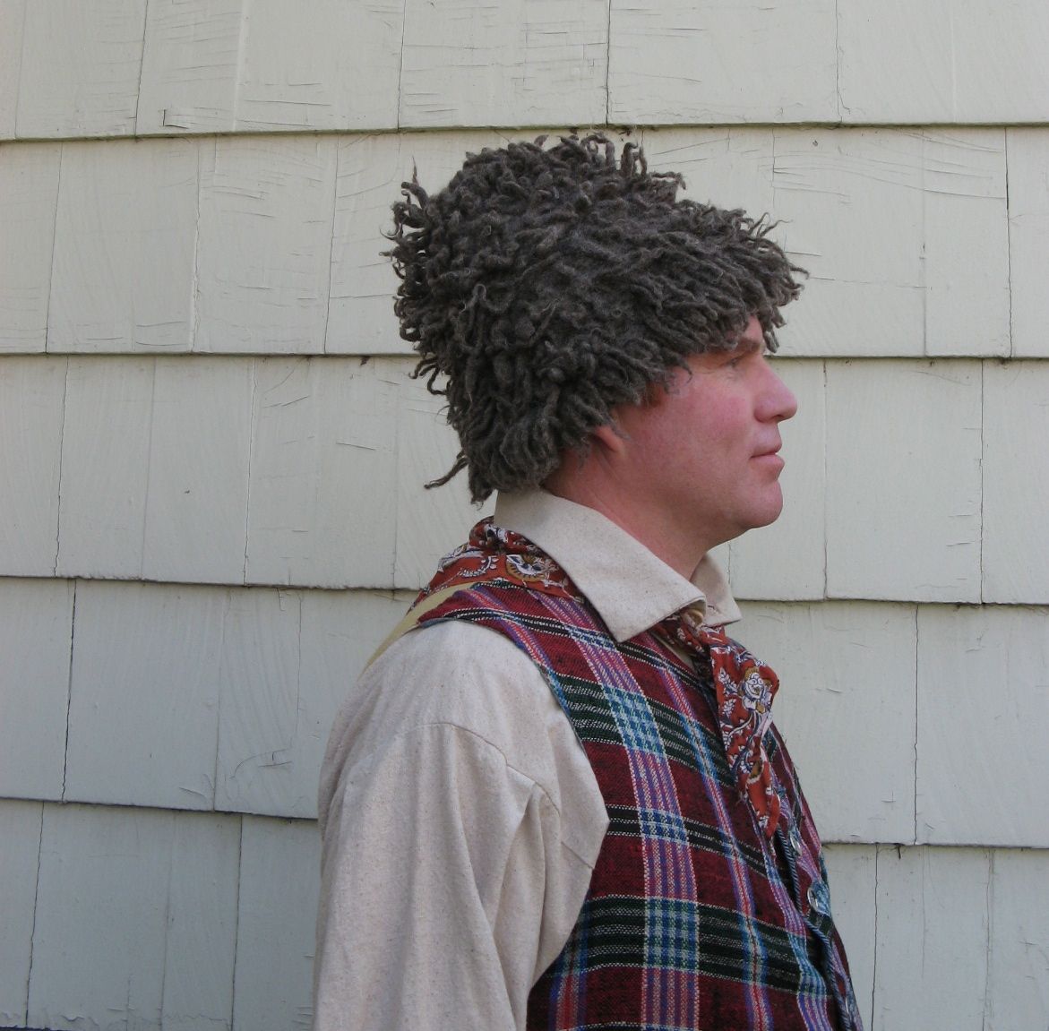
David Folger, Willowind Therapeutic Riding Center
Matt Drennan, Drennan Woodworking; Historian & Naturalist, EYOS Expeditions

This week found me back at the end of Seely Road, crossing the property of a friendly landowner into the Park –
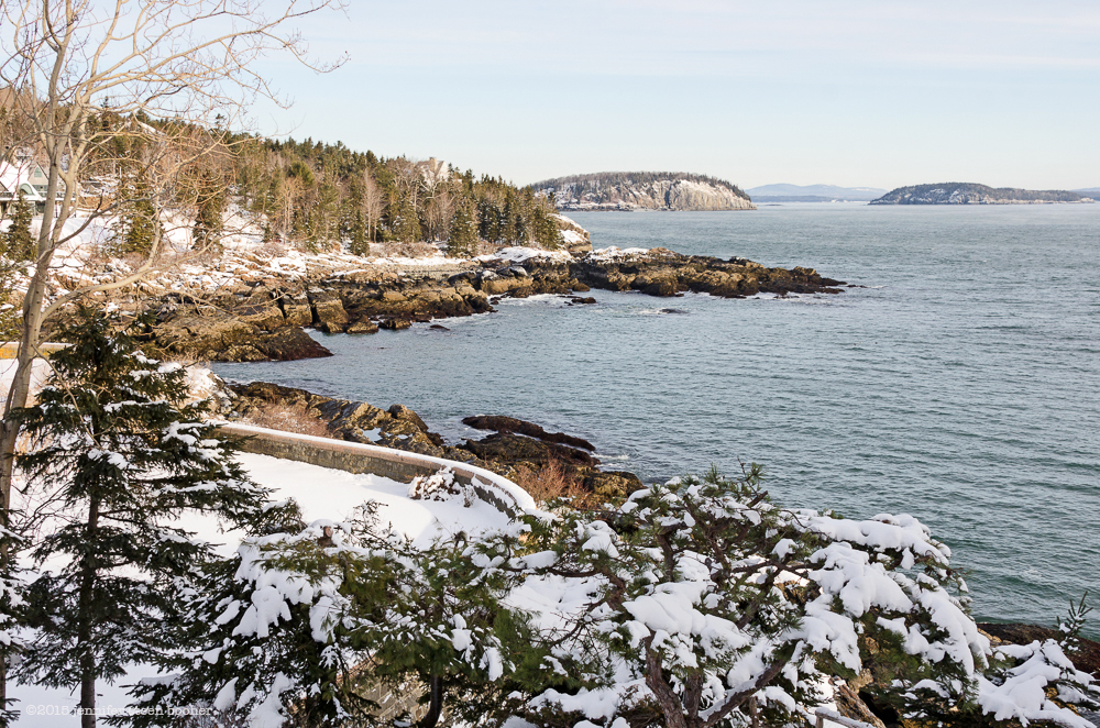
Looking north toward the Porcupines. The curved stone wall at left was part of the old Chatwold estate we talked about in Coast Walk 4.
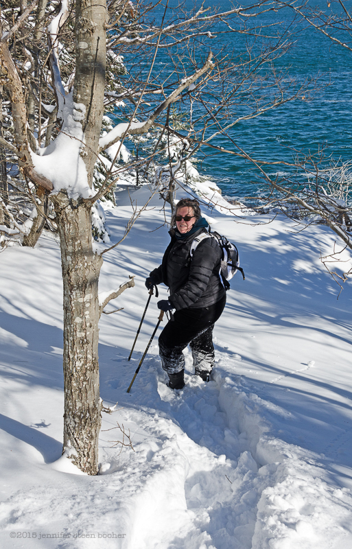
there’s a long stretch of coast to the south of Sols Cliff that I hadn’t realized was part of Acadia National Park until I started mapping the route for this project. There are no trails in this section, so it was slow going, pushing my way through thickets of spruce, over ledges, and through snow drifts.
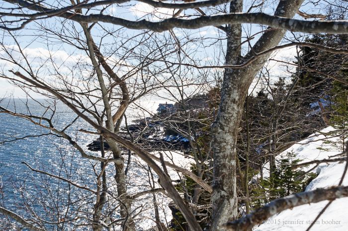
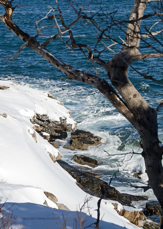
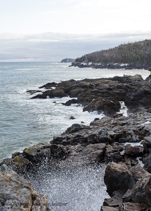
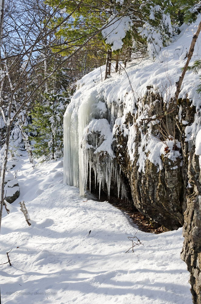 I got glimpses through the trees of the view out over the Bay, and down to the rocks on the shore about 20 feet below me. Although there was a passable shore exposed by the low tide, the drop was too steep in this area and the ledge too slippery for me to reach it.

Sea smoke rising off the bay, with Egg Rock in the distance and Schoodic Head beyond.
Much of the time I followed in the footprints of a lone fox, who was very good at spotting passable areas of ledge but who often trotted underneath spruces that were too thick for me to pass. For most of this part of the “walk” I tucked my camera into a backpack and used both hands to maneuver up ledges or hold tree branches to keep my balance. At least the vigorous exercise kept me from feeling the cold! I learned pretty quickly that Paper Birch trunks are unreliable handholds because you can’t tell at a glance if they’re alive or dead. More than one broke off in my hand. Striped Maple saplings, on the other hand, are flexible and sturdy. Several times I used the old “sit and slide” method of getting down a ledge – this is a lot of fun when the snow is deep! If you hold a spruce branch while sliding, you can swing in a nice curve, too.
Out of the corner of my eye I spotted something a little too straight to be a natural ledge:
 A foundation, I thought? Where there was once a house, there was once a road… And sure enough, there was a large clearing beyond the steps,
and beyond that, a nice, broad road trace – probably the driveway for the estate. There were some very pretty stone walls along the drive, too.

Later that day I asked Debbie Dyer which estate this might have been – this was Hare Forest:

Photo from Lost Bar Harbor by Helfrich & O’Neil

The New York Times, Sept.23, 1900. ©The New York Times
The house was built in 1899-1900 and was originally called Ledge Cliff (boring!). The name was later changed to Hare Forest (much better!), and it burned in the Fire of ’47. According to the Registry of Deeds, it was given to the Park in 1999.
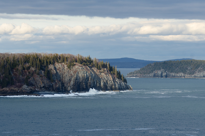
I was strolling along the old road, savoring the easy walk and wondering how I’d know when I’d reached the overlook where I was supposed to meet Matt and Dave, when I heard them talking off in the trees. In the early ’80s, while they were students at the College of the Atlantic, the two of them had worked on an ambitious survey of seabirds nesting on coastal islands, sailing out in an old ketch to investigate bird colonies. I had asked them to come along and give us a picture of how the bird populations have changed over the years. We hollered back and forth until we met up, and wandered back down the road to the clearing, where we stood and looked out toward the Thrumcap.

David: There’s not a tree left, is there?
Matt: In the early – what, late 70s, early 80s, that thing had a forest on it.
Jenn: It’s so hard to picture
M: On the north half, anyway. It seemed like a forest.
D: It wasn’t barren!
J: So are the cormorants still nesting out there?
M: Yes, there’s cormorants nesting on the south side, mostly on the spine that comes down [that way.]
D: When was your last count? Did you count? Guess?
M: I haven’t counted. They’re down, I would guess. I’ve come down here and there’s a ledge down below those trees that eagles have in the past used as a dining table. … They’ve had cormorant and gull carcasses. I think that they’re still there but they’ve been getting hammered so much by the eagles; you don’t see the immediate decline because the gulls and cormorants are relatively long lived, but I don’t think they’re producing.
D: Not enough to replace themselves.
M: Certainly not enough. So there will be a decline.
J: Because of the eagles?
M: Well, the eagles are a part of it, there’s lot’s of parts of it.
D: So well said.
M: I think that the state has a website that you can track the eagle nests through since the late ’60s when they started monitoring, and the explosion from here downeast is astonishing. I mean when we were in college eagles weren’t even on our radar, as far as these seabirds were concerned. And now they are definitely a factor.

A young eagle flew by way, way overhead.
J: So what are the other things affecting the cormorant population?
D: You look at – if herring is down,
M: Fish, water temperature,
J: So the warmer water, less food…
M: Or over-fishing, it’s hard to say.
D: Just different food sources. What else would you say? Shags, they go up and down. Before it was gulls were the major predator [of] the shags, then humans. Humans messing them up by landing on islands and letting gulls come and take advantage while the adults were off the nests. But that’s probably not so much anymore.
M: No, I don’t think so. In our collective memory there were definitely – in Blue Hill, on the other side of the island – there were expeditions to go set the shags back.
D: The salmon farms?
M: No, before that, just in general.
D: I bet here, too, when we had herring weirs up and down the coast? I know the fishermen hated those things. Shoot em on sight. But when we were out on Egg Rock, that was ’83 or so, we had over 600 pairs out on this island [the Thrumcap], it was an extraordinary number of cormorants relative to even the coast. We never had colonies of that size. Why they exploded like that, no idea.
J: When did the herring weirs stop?
D: I don’t remember seeing many herring weirs.
M: There were herring weirs in the Narraguagus but not very many.
D: Not many, and you had that one herring cannery over there in Winter Harbor
M: And Sorrento had one too
D: And there was one in Southwest. But when I came, first showed up in ’76, that cannery was just closing. It was so cool though; old, dilapidated, seagulls flying everywhere.
J: That’s the one they’ve turned into condos now?
D: Condos, yeah, and the Dysarts Marine or marina, or whatever you want to call that. But that was a classic Maine sardine factory. The fishermen definitely did not like cormorants when there were herring around.
M: But now all the herring, they don’t come inshore anymore. The fishery is out by the Rock.
D: But it was interesting why that 600 pairs started to nest out there. That’s 600 birds plus, finding food somewhere.
J: What was it before that? Before it exploded.
D: There were a few there. There were gulls there, eiders there. That’s about it that I know. And there were trees there! And then all of a sudden the cormorants showed up and started nesting in the trees and all that guano; that’s when those trees died, when the cormorants moved on [to the island.]
J: It’s so hard to imagine it with trees on it.
D: It’s so hard for me to imagine it without trees. I have to look at my slides because I know I have pictures of that. It had a dozen, twenty trees, probably. By virtue of size they must have been 30, 40 year old trees, I would guess.
M: Yeah
D: The other outrageous thing you’ve gotta think of – all the Porcupines, they had no trees on them.
J: Really!?
D: Back when the Bucksport mill [was open], that was St. Regis, they used to cut wood like crazy and tow ’em down to Bucksport for pulp. And that was in the 40s, I believe.
M: Yeah, Richard Higgins told me that before the war, him and his dad used to drive across the ice from Hulls Cove and cut wood on the islands by Sorrento and drive it back across the ice.
D: Driving wood across the ice
M: On a truck, yeah.
D: No thank you!
J: Guess it froze a little thicker?
D: I have a hard enough time crossing Hamilton Pond!
M: I don’t know, maybe that’s apocryphal, but,
D: Right. It just seems like with tides – it just seems so sketchy.
M: Well, sea ice is a lot more elastic than fresh. You can go on inches ’cause it bends rather than breaks, but driving a truck loaded with wood says to me that the weather pattern was very different, and it was wicked cold and no wind for long periods of time. Like the jet stream was different, or I don’t know, that it couldn’t have blown like hell regularly out of the north, or that ice would’ve come out of the top of the bay. And it also must have been, this would’ve been a nice warm day for three months. [ed.note. It was 7ºF.]
D: Its hard to imagine.
M: Yeah, it is.

We walked back along the road, trying to spot old trees that had survived the fire and noticing a fair number of non-native shrubs that had probably been part of the estate. My twig-identification skills have seriously deteriorated: I’ll have to go explore in the spring when they leaf out. If I can find the point where the old drive reaches the Schooner Head Road, it should be an pleasant, easy hike. Wonder if there’s anywhere to park? The guys had binoculars with them and had been scanning the sea. I had my telephoto lens, but it wasn’t showing me anything but waves and sea smoke.
J: Are you guys seeing anything other than herring gulls?
D: There’s a black-backed gull that just flew away. Which is another thing. The numbers have just dropped dramatically around here. This Christmas count, I only found one black-backed gull all day long. That makes two. but there used to be,
M: When we were scalloping in ’88-ish,
D: 30 percent of the birds behind the boat were probably black-backed gulls.
J: I saw a flock of maybe about 10 of them over at Seal Harbor a few months ago, but that was the first time I’d ever seen them.
D: They’re definitely larger and more aggressive, but they were I think more dependent on the dragger fishing fleet that doesn’t exist here [anymore.] We don’t have dumps, open landfills, so what they’re finding for food I think has just decreased dramatically. Gull populations seem to be way down, too.
M: Plummeted.
J: Even the herring gull?
D: Herring gulls. Compared to what we had when Matt and I started all this stuff.
M: Egg Rock … seems in recent years to have been a stronghold, one of the few, for gulls. I mean, I’ve counted 600 some pair out there in the past five years. … But other islands, Fisherman [Island], down by Jonesport, this side of Jonesport, … the count in the early ’90s was 650 pair, and I went out there with Glenn and Scott six years ago, it’s big, it’s as big as Great Duck, it’s 300 acres or something, and marched and marched and marched around, … and there were like ten gull nests.
J: Which island is this?
M: Fisherman. It’s down almost to Great Wass. And all the gull nests were at the base of the few spruce trees, hiding from the eagles is my assumption, but ‘all of them’ was ten, or twenty, down from 600, eight, ten years before. And three or four young eagles flying around the place.
D: Its pretty representative of what’s probably happening up and down the whole coast area, from Penobscot Bay east, at least. But you know, then, if you [go back] to the ’20s, seagulls don’t like to nest where human occupation is, they just don’t like it. And we used to use these islands a lot more, year round, and probably the seagull population numbers were way down, then, too, because they [were] just inappropriate places to nest, or just not good nesting sites, except for something like that [pointing to the Thrumcap] where a human really wouldn’t want to [go.] But the Duck islands, they were all occupied, Fisherman was probably occupied with fishermen,
M: Seasonal uses
D: Yeah, any sizable island that you could put a house on usually had residents.
M: Meaning cats and dogs and rats
J: Egg-eaters
M: Stuff that would yeah, knock the birds down.
J: So the population went down as the islands were settled, and then as they were abandoned it came back up into the ’70s and now its crashing again ’cause of the eagles? And other stuff?
M: Yeah, the eagles, but its also [that] there used to be 10 working fish draggers in that town and now there’s one,
D: There used to be a Southwest Harbor dump … good year round food sources. So many combinations.
J: And there must have been a dump on the Bar Harbor waterfront, too.
D: Yeah, … the old coal dock and the Walsh [property], all that used to be a dump, right?
M: And that’s another thing, is there’s no ducks.
J: Like, eiders? Or what kind of ducks?
M: Eiders, yeah, eiders mostly, I can’t remember any time when we used to come here birdwatching in the ’80s where … we couldn’t see a few hundred, unless it was blowing out of the east and they went and hid somewhere, and
D: Not more than ten years ago we could look out at Duck Island and see a thousand eiders rafted out there this time of year. And we’re hard-pressed. Even my old eyes.
M: No, it’s not your old eyes, you could see with your naked eye a raft that size.
D: Yeah, it’d be like a floating Sargasso Sea out there.
J: We used to see them off of the Ocean Path, off Sand Beach there.
M: Yeah. We’d come down here every day when we were in college, and look at ducks.
J: It’s pretty empty today.

J: So are the birds out on the outer islands, or are there just fewer of them than there used to be?
M: It’s hard to say. There’s fewer gulls, it seems like. Do you remember numbers from [the count on] Great Duck?
D: Numbers of gulls out there? There weren’t that many. Really.
M: And there’s still not that many.
D: Yeah but that’s the human use. But Little Duck is the real
M: Little Duck is
D: the better island to look at.
M: ‘Cause there was never anybody living there. And I for sure have pictures of hundreds of cormorants and gulls on the western shore, and I go by there regularly these days.
D: Nothing.
M: Yeah. There is not a single gull on that island.
D: There any eiders? Probably very few.
M: I doubt it. John Anderson’s students who study eiders these days, on Great Duck, say there’s twenty. Thirty. [ed.note. Anderson is a professor of Natural History at the College of the Atlantic.]
J: Twenty or thirty – ducks or nests?
M: Ducks. Just looking at them from the water.
D: One of the things Matt and I found out on our own is that humans, biological researchers, have a major impact on all these birds that they study.
J: Really? Just hanging out there and counting them?
D: Yeah, being out there and disturbing them, and you get up and you make a bird move, there’s all kinds of elements.
M: What I’ve seen in recent years on Great Gott when I’ve been doing construction work out there and there’s lots of eagles coming by, and the eagles throw the gulls into absolute frenzy of panic. If you walk outdoors, if you happen to be in the house, and an eagle goes by, you walk outside, the eagle says, whoa, human, veers off, and I think what John’s been seeing is a steady migration of gulls from the north end to the south end.
D: Oh, towards the lighthouse where the people are.
M: Cause the Barofskys aren’t there that much
D: To shoo the seagulls away. Hah! ‘Cause back in the day the seagulls were so wary of humans around they did not like to come down and sit on their eggs.
J: So now they’re preferring the humans to the eagles?
M: Yeah, the lesser of two evils.
J: Poor gulls.
M: And, out at Mount Desert Rock, …when Greg Stone and Harriet and them used to go out there in May, with a dog, there were two [or three] gull nests out there; and now, nobody goes out there unless it’s construction workers, til late June, early July, so the gulls are already committed, and there’s a hundred and fifty gull nests out there now. It’s a gull colony.

Black ducks objecting either to our presence or to the eagle who flew by earlier.
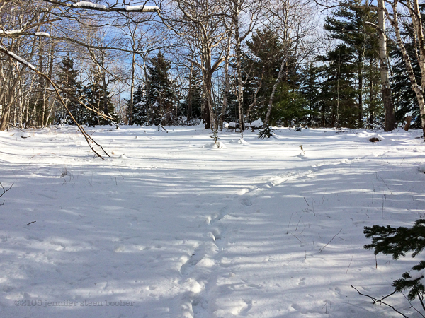
By this time the land had dipped down to sea level and we had climbed out onto the shore. The snow just above the tide line was a highway for small creatures:

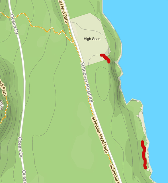
After a bit of scrambling and sliding, we rounded a corner and saw Highseas in the distance. Highseas was designed by Fred Savage, built in 1911, and given to the Jackson Laboratory in 1951. It is now a conference center and dormitory for students in the Lab’s summer program. There’s a very detailed history of the house on the Jackson Lab’s website. The most interesting bits are that the first owner designed the Precipice Trail, the second owner kept 24 Sealyham terriers, and that during the Fire of ’47, the gardener saved the mansion by keeping hoses running on the main house while his own home burned.

My car was parked at the base of that white tower (with permission), so that was the end of the day’s hike. (After a steep climb up the septic field.)
Next week Ken Cline and I may be going hunting for a sea cave he found while kayaking, although the tides are against us all week, and Brenda Beckett will be hiking the cliffs with me.
______________________
February 25, 2015
This is where the 24 Sealyhams lived:


 April 13, 2015: 65ºF, 11:40am-2pm with low tide at 12:30, sunny and warm, not much wind. One loon and two or three crows.
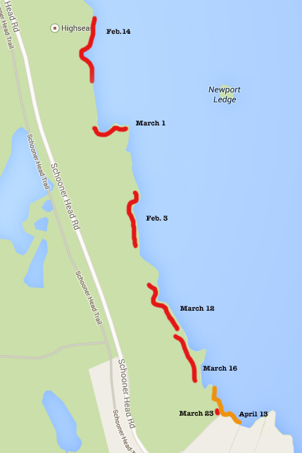
 I trekked in to the same point that I finished the last post with, just at the northern edge of Schooner Head, but this time I was able to scramble down the low cliff. It was about six or seven feet high, and I jumped the last three feet, thinking that once upon a time when I was ten I used to get a swing going six feet in the air and jump off because it felt like flying. When did a little three-foot jump start to feel scary? Anyway, I headed north to see how much I could reach of the areas I missed while hiking along the top of the cliff.
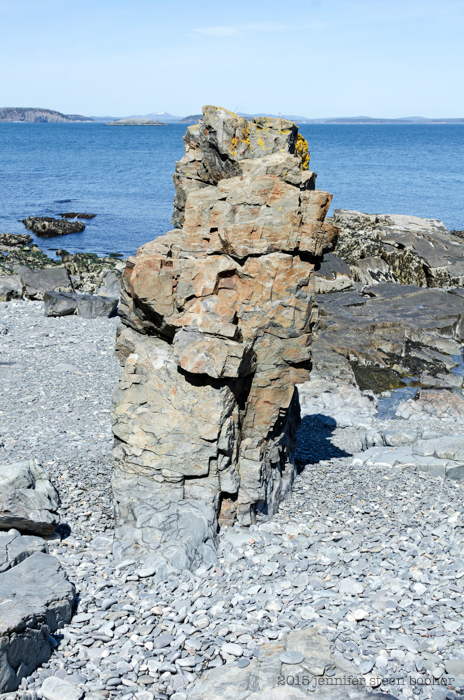 That sea stack looks a lot like Bar Harbor Formation stone (which you can see off the Shore Path by the Bar Harbor Inn.)
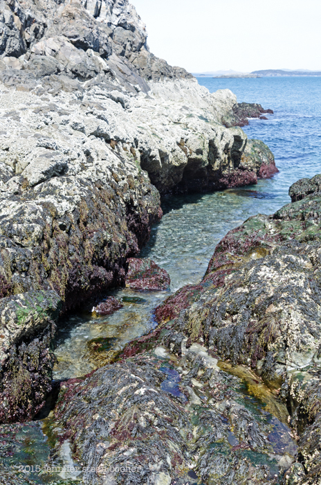 Most of the shore was pretty steep, with lots of these little gullies cutting into the stone. It made for a lot of climbing up and slithering down. You can see how thick the barnacles are, too. Definitely adventurous terrain!
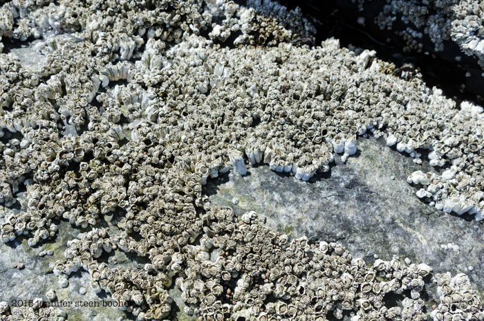 The barnacles were not only dense, covering the surfaces completely, they were really tall, probably because they were packed in so tightly. I suspect that bare patch was opened up by ice forming and then getting pulled off by the waves.
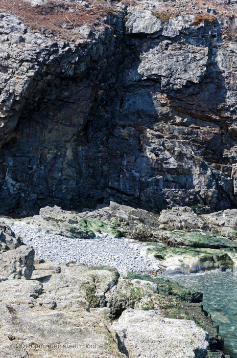 One of the gullies opened out into a small cobble beach under a massive overhang that was almost a shallow cave. Almost.
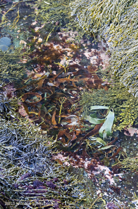 It was so nice to see the tidepools without a crust of ice. Seaweed was actually moving around, as were the periwinkles, and I saw the first scud swimming. I couldn’t get a clear photo, sorry; they are tiny and they move so fast, it’s like trying to photograph a toddler on Christmas morning:
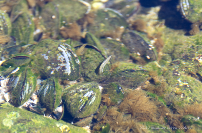 Isn’t she cute? Scud are crustaceans, related to shrimp, wood lice, and lobsters, kind of in the way I’m related to my great-grandmother’s sister’s children – distant branch of the same family. Scud and shrimp, for example, are both Malacostraca, which is a class of crustaceans, but scud are Amphipods and shrimp are Decapods. The ‘pod’ in the name comes from the Greek word for foot, and amphipods (translates as ‘different feet’) have two different types of legs, while decapods (translates as ‘ten feet’) have, you got it, ten legs. Scud have seven pairs of leg-ish appendages, so you’d think they’d logically be called septapods, but the legs aren’t all the same and then there are two more leg-ish things that are sort of mouth parts, so it was probably too complicated to explain all that in a made-up Greek-based word. Malacostraca also comes from the Greek and translates as ‘soft shell,’ although as Wikipedia points out, they are only soft after moulting. Thank you, Wikipedia. You’ll have noticed that all the Latin names (aka scientific names) in this paragraph are Greek. They’re called Latin names because the grammatical structure is based on Latin, regardless of what language the name draws from. Scientific names looked pretty uniform when all the people naming things were European, but it makes for some interesting juxtapositions now that science is more inclusive and the base language is, say, Inuit (Tiktaalik roseae, for example.)
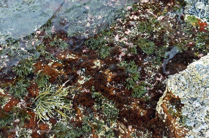
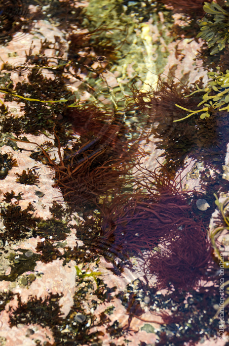 That reddish seaweed in the tidepools puzzled me. I’m not great with seaweed identification, but I’m pretty sure I’ve never seen that before. It also blanketed the rocks in a thick red mass down at the low tide line. After doing some research, I think it’s Dumontia contorta (also known as Dumontia incrassata .) It doesn’t seem to have a common name, although all the sources I found say it’s common in the intertidal zone. The bright green mats of seaweed stumped me. It could be Acrosiphonia arcta, or it could be Ulva intestinalis, or it could be something else entirely. I’ll have to look at it more closely next time I run into it. Sometimes it’s hard to know what to pay attention to when I’m out there.
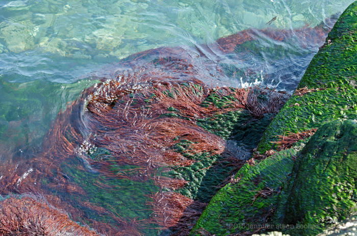 Eventually I ran into a part of the shore that said very clearly, “You shall not pass:”
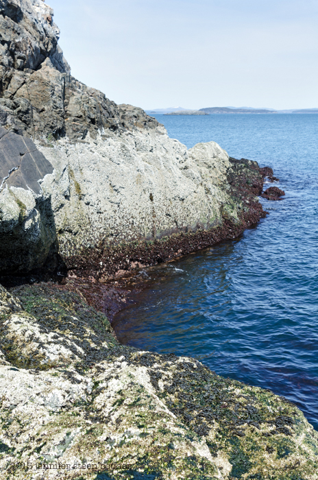 so I turned back toward Schooner Head, where the cliff drops down to a very pretty cobble beach.
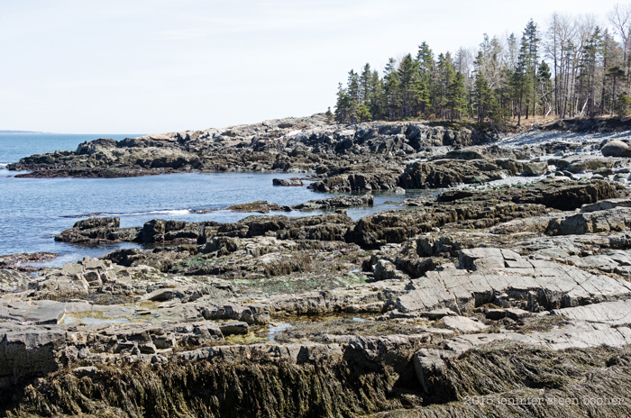
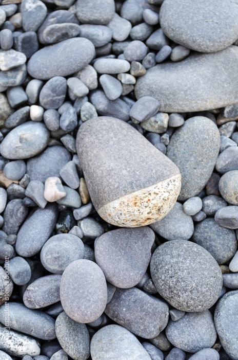
 This cobble had a shallow depression worn into the top, which had filled with seawater. As the water evaporated, it left rings of salt crystals around the puddle.
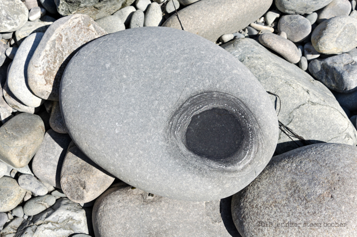 If you come on a Coast Walk with me, be prepared to squat on a stony beach and watch water evaporate. And maybe afterward we’ll go for a cup of coffee and watch paint dry.
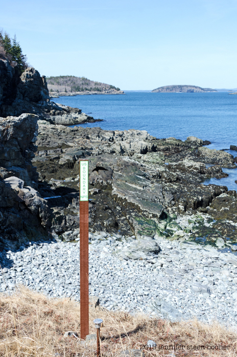
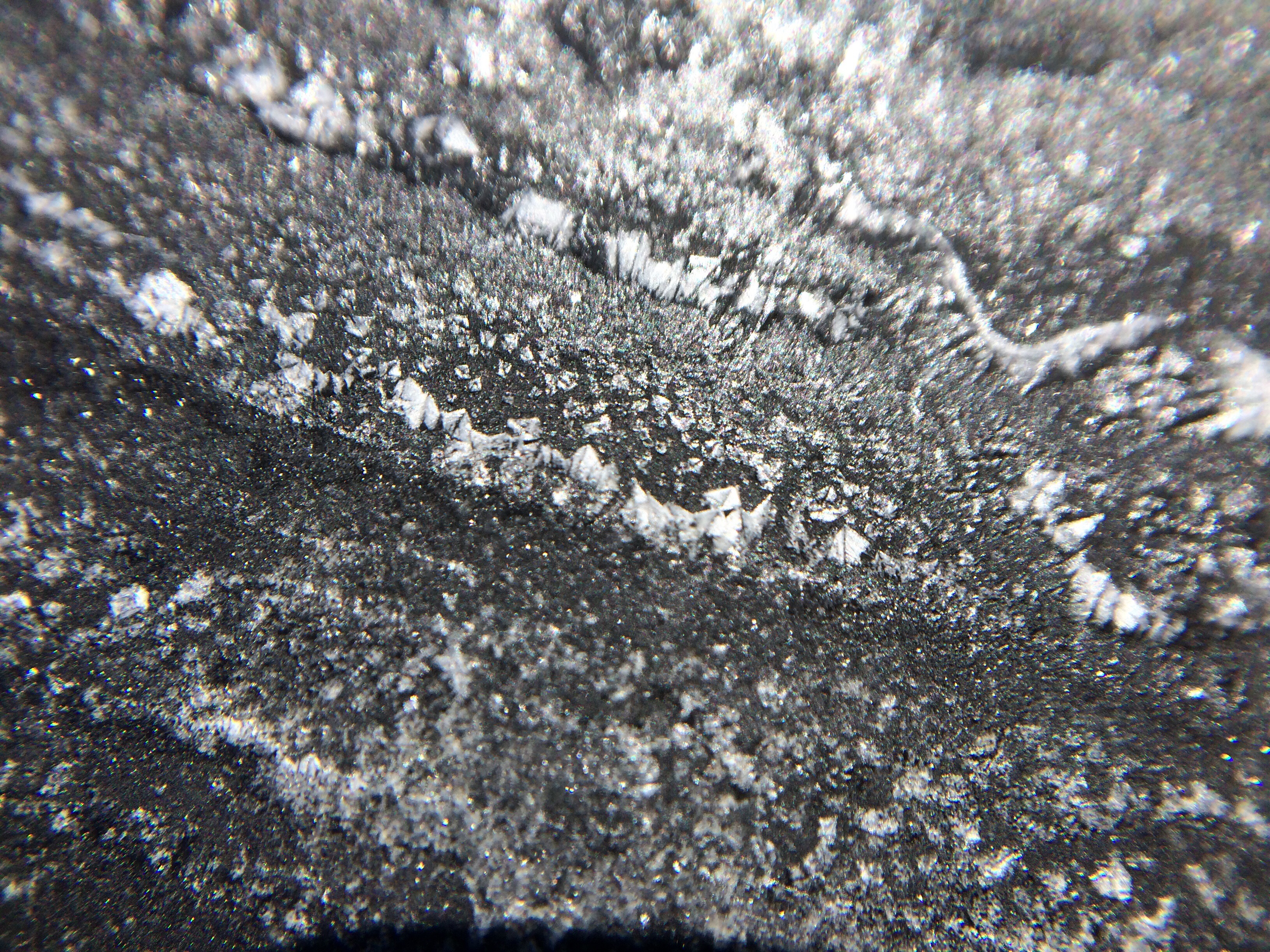 And with that, I was on Schooner Head, and had passed out of the park boundaries. Thank you Acadia, it’s been wonderful! See you on the other side (of Schooner Head.)