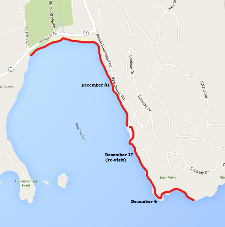
December 17, 7:45- 10:18am. 40 degrees with a stiff wind from the southeast and showers of rain. Cold, raw, and generally miserable weather. Slate-colored/Dark-eyed Junco (Junco hyemalis), 2 Ravens (Corvus corax), 2 Bald Eagles (Haliaeetus leucocephalus), a flock of about 12 Red-breasted Mergansers (Mergus serrator), half a dozen Herring Gulls, and one long-neck bird that could have been a cormorant or loon (too far off to see clearly.)
Walker: George Soules, photographer & software engineer, George Soules Photography

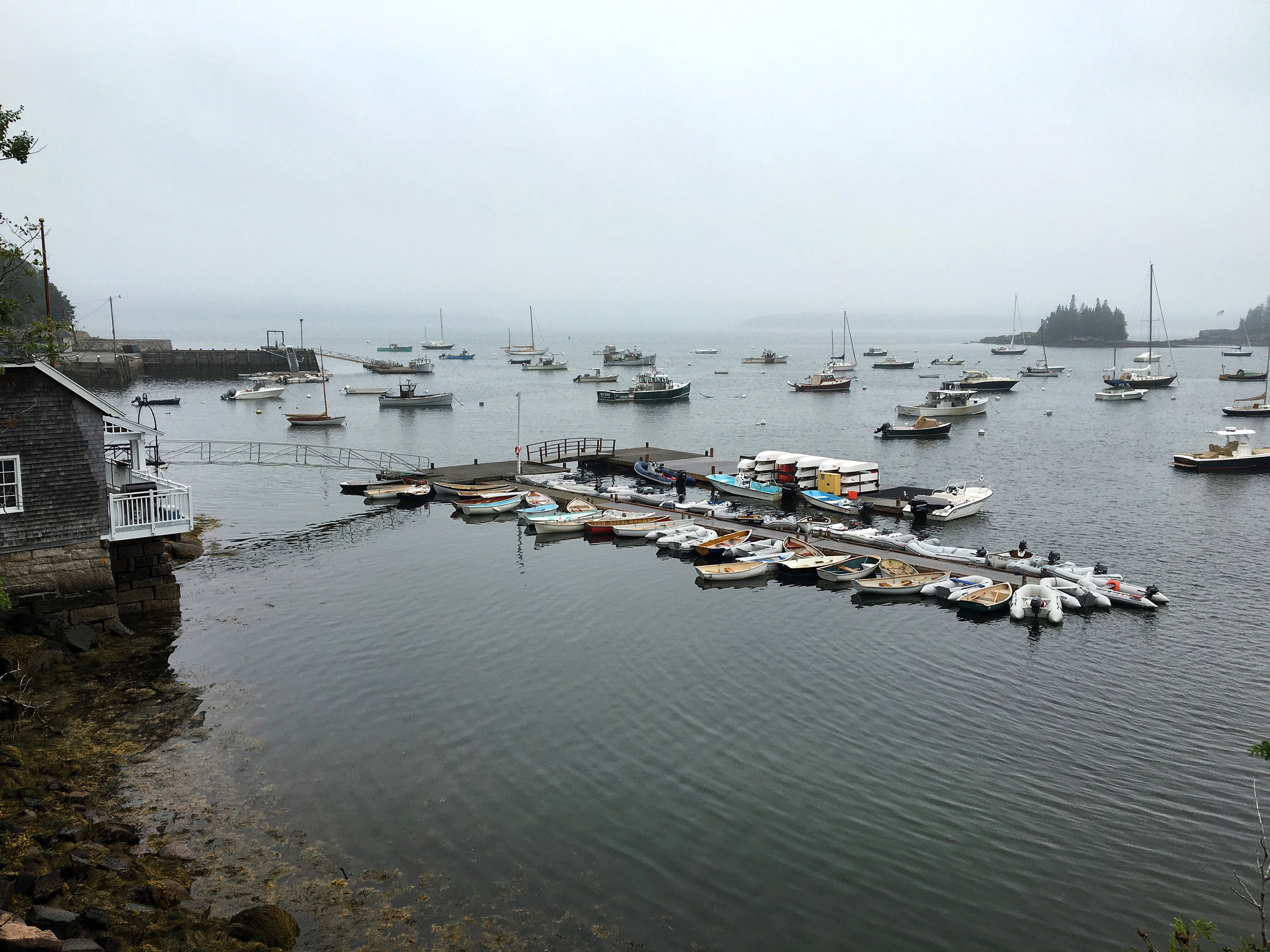
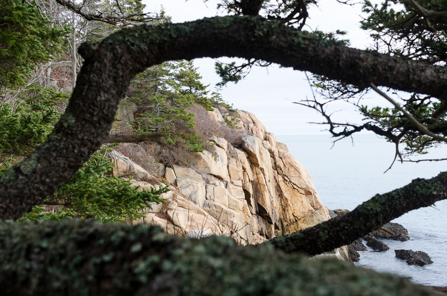
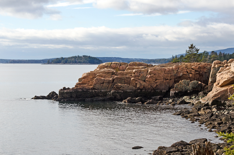
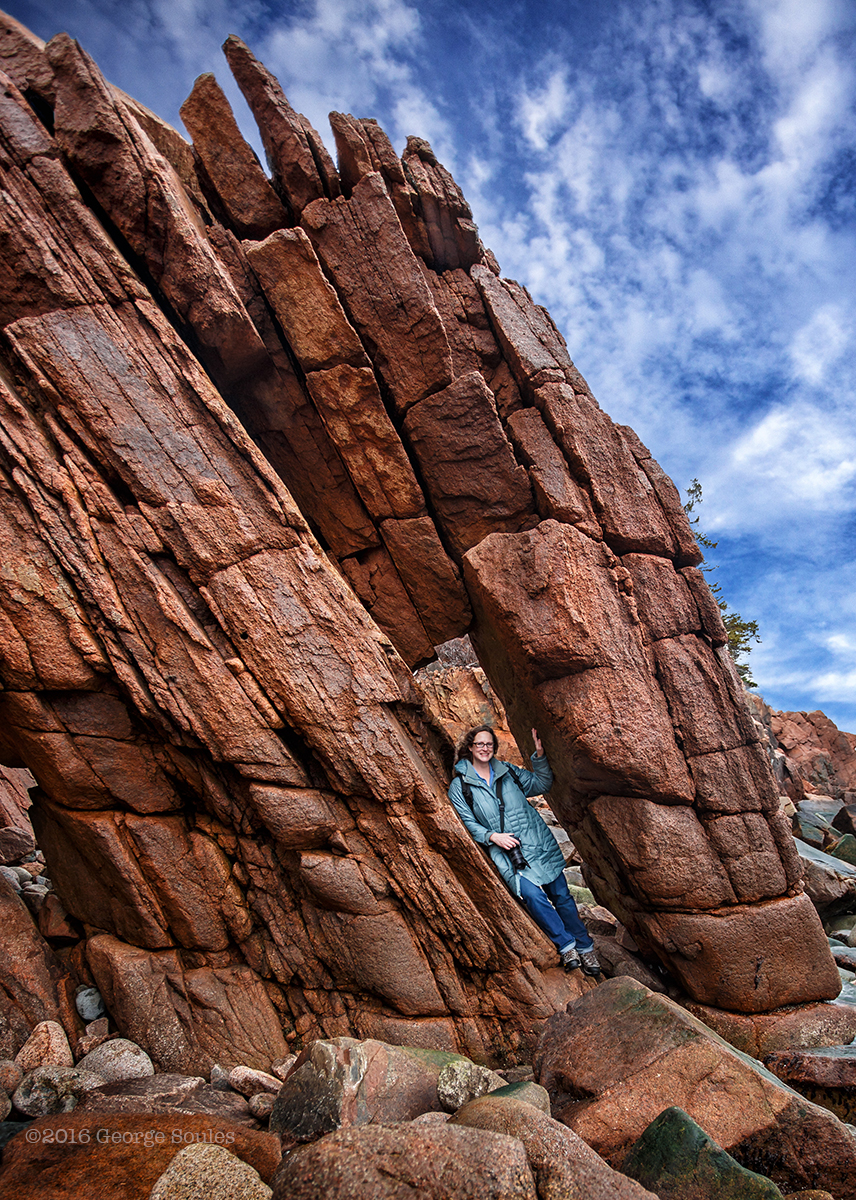
If you remember, I ended the last post with an “oops” because I never made it down to the shore. About a week later my friend George and I went back to fix that. George is a software engineer and photographer. He’s the president of the MDI Photo Club, and he took this photo of me on our walk:
So you can see he’s pretty amazing. For some reason I didn’t record our conversation, but George talked a little bit about his work digitizing the Southwest Harbor library’s archives and asked me a lot of hard questions about the impermanence of digital media and my long-term plans for the Coast Walk records (which are all digital), and it was so interesting that when I sat down to write this post I had to meet up with him to talk about it in depth. I’ll intersperse that conversation with photos from our walk.

J: So we had talked really briefly about issues around archiving digital media, and you told me a little bit about what you’re doing at Southwest Harbor. You want to start with telling me about that?
G: In the ’80s this guy, Miles Weaver, started cataloging the physical collection [at the Southwest Harbor Public Library.] We had photographs that had come from various sources, but that was [before] scanners and PCs and databases that regular people could use. About 10 years ago … two women, Charlotte Morill and Meredith Hutchins, started scanning [the archives] – people would come in with a shoebox full of photographs and newspaper clippings and letters and surveys and documents and things, so they started digitizing it and then trying to put the pieces together. [They were trying to record the connections between objects as well as the objects.] They started doing research, doing interviews, and basically trying to record information that would soon be lost if they didn’t capture [it, because] some of the knowledge is from people who are up in years, and … they’re not going to be here ten years from now. So they started amassing large amounts of information. … They created a really simple database … but more and more and more stuff kept coming in and they kept seeking out more and more stuff. I’ve created this new database that not only has the features of a typical database … but I’ve added a relationship mechanism [so now] you can go from a photograph – ‘oh, this is a photograph of Eleanor Mayo‘ and you can go from that to her biography and from that to realizing that she was partners with Ruth Moore and go from that to … photos of Ruth Moore and to her biography, … and pretty soon what you realize is that it’s like the web, it’s a network. … Eleanor Mayo’s father … had this construction company on Clark Point Road, 45 Clark Point Road, but that same location was also Chester Clement’s boat building shop and before that it was something else, and today it’s just an empty lot … but it’s there today. History isn’t ‘then,’ it’s a continuum, and the reason I bring all this up is [that] you’re doing something contemporary but everything you’re doing is tied to the past. You know, Don Linahan’s blog [Ed. note: The Memorials of Acadia National Park] is such a great example because he did all this research. … I know him a little, I’ve met him a couple of times, and he wrote that book, Memorials of Acadia. But he’s left [the island]. His blog is still there but who knows, he could lose interest, something could happen to him, … maybe Google says ‘Hey, you haven’t maintained this for two years so we’re going to shut it down’ – that information could just disappear and we’d be going ‘Oh no!’ … He’s a friend of the library, and I wrote to him and said ‘Don, could we somehow take all the stuff off your blog and get it into pdf files? Put it in the library’s digital archive so it’ll be there permanently?’ And he wrote back and said yeah, absolutely. I don’t know how I’m going to do that. I did some experiments, selecting everything in one post and putting it into a pdf. If we don’t preserve it, it could get lost and that would just be a shame. You think about the amount of effort you put into it and the value of the information. So the Coast Walk, the effort’s tremendous and the value’s really high, so that’s why in December I was encouraging you [to think about preserving it]. I understand that doing a book or something like that is a big effort but having it just be on your blog, you’re at risk that it won’t outlast you.

J: I know, and I do worry about that sometimes. I know that the blog gets backed up, so even if something happened to it it could be re-installed. But in some ways, the whole idea of backups is a theory because backups fail, too. I’ve had that happen.
G: I have this fireproof safe in my house that I put disk drives in, but I’d have to burn my house down to see if it’s really going to work. But Howie told me about this site called archive.org, it’s called the Wayback Machine, I think? And I looked up my Maps Alive website, the very first version of it, and they had snapshots of it – I was like, oh my god that was horrible. So probably if you look in there you’ll find your stuff. [Ed. note: Nope, couldn’t find myself.] But the cover page says they have 890 billion pages recorded in there; it might be in there but if nobody knows about it and you don’t know how to look for it … it’s not accessible. [At the library] we’re trying to create this database that anybody anywhere in the world who has some interest in the island or its people or its history can go there and see what we have and then connect to see what other people have.

J: I have to say, there is so much that’s online and I am so appreciative of it when I’m doing my research. Like when I was researching Sand Beach I found that whole archive of photographs from the one silent movie? Someplace in California, a silent film archive. And god bless them, they digitized everything. Put it all up there.
G: Yeah well that’s a really good example of how everything’s connected to everything. Because Great Head was given to Mrs. Satterlee by her father, J.P. Morgan, and … one of the people at J.P.Morgan was Charles or George Bowdoin who had La Rochelle built, which is the Seacoast Mission now. And then, you could just go from Sand Beach to that movie to J.P. Morgan.
J: And farther back – J.P.Morgan came to the island because he married Frances Tracy, who, Charles Tracy stayed here in Southwest Harbor in the 1840s … [Ed. note: oops, 1855. The Tracy family were among the very first Rusticators to explore the island.]
G: Is that the Tracy Log Tracy?
J: Exactly. So Charles Tracy brought Frances Tracy [ed. note: his daughter], she brought J.P.Morgan here when she married him, and he brought the entire Morgan [firm], the Morgan Men; one of them was Fabbri. Fabbri was a Morgan Man, and his son built the radio station [on Otter Point.] The Fabbri radio station was the major radio station for transmissions from Europe [during WWI.] So it’s like from Southwest to Bar Harbor to Otter Point …
G: That research that you’ve done and that you’ve recorded in the Coast Walk, I mean it’s extremely valuable. Some of it overlaps with things that are already out there, some of it covers new things, but it also gets put in a new context… . So what is your plan, how are you going to protect this treasure?

J: I just don’t know. I mean so much of what I’ve built is web-dependent. I don’t write footnotes, I link them. Because most of the time it’s on the web, which is more useful than a footnote. And in fact, when I’m starting to think about what should be done with this, it would lend itself more naturally to an app than a printed book.
G: I remember you saying that, yeah.
J: Just because it’s so photo-dependent. Even if you took my photos out of it completely, it’s still all the historical photos and maps. I just don’t see how you could make [a book] – I’ve only done fifteen miles and I think it would already need at least two books! And it’s 120 miles!
G: How long was it supposed to take?
J: Two years. I’m a year and half into into it. Yup.

G: Well when I moved here three years ago, my goal was to hike all the trails, 120 miles in the first year. At the end of year 3 I’m three-quarters of the way there.
J: Good for you! Real life has a way of getting in the way. And by real life I mean making a living.
G: Yeah, if you could just go full time it would be different.
J: I mean that’s why I made so much progress in those first six months; I was unemployed. So I just kept working.
G: I think that if you could come up with some kind of a framework that would allow you to still do what you’re doing now which is take advantage of the blog format and hyperlinks and stuff but also get the information into some structure that could be preserved. I’m trying to verbalize what I’m thinking. So let me make a side trip and go back to what we’re doing with the library.

G: So these two women started gathering all this information and they said ‘we’ve got A and B and C, and A’s related to B and B’s related to C,’ and so in the description of A they said ‘for more information about this, see B,’ and in B they said ‘see A’ and ‘see C.’ And that was all in writing. And it’s kind of like if you’ve ever read the Old Testament where it’s this long list of you know, so-and-so begat so-and-so and so-and-so and Sarah was barren and so she was without child and then this happened – it makes sense when I read it but I can’t picture it, but if you write it out as a genealogy then it starts to make sense. And then you can imagine bringing it into a digital form, like Wikipedia, you can look up any of those, you can look up Abraham and just keep following the links and get all the way down to Ishmael and all these people.

J: So here’s where it really gets crazy is the whole point of the Coast Walk, well no, not the whole point, the Coast Walk has a lot of points, but one of the reasons I started doing it was I felt like the still life photographs are limited. There’s only so much that I can present in that format. And I needed to take it to the next level but I didn’t know what that would look like, physically. But I do know that the more thoroughly I understand a subject the better I can turn it into art. Do you know what I mean? Like if you mildly understand something you can make an infographic, but to really make art out of it – it’s like you can’t tell a joke in a foreign language. You have to really know a language before you can tell a joke. It’s like that with art, I have to really understand something before I can transform it. But the Coast Walk as an art project is very open-ended because I don’t know where it’s going. And it’s not going where I thought it was, because it used to be about the objects and it’s turned into being about the connections. I’m still interested in the objects, but … . Do you know the Frenchman Bay Partners?
G: No
J: It’s a group of people and organizations that are concerned with the environmental well-being of Frenchmans Bay. They have a lot of research projects that are funded by all different entities but all concerned with Frenchmans Bay, so at their annual meeting they present a lot of very interesting topics. I had started coming at this from the marine biology viewpoint, so let’s say looking at the mudflat, I would have been interested in what lives there. Why is it a mudflat, what’s the geology of the area, how did this come to be, and what’s taking advantage of it, what lives there? At the last Frenchmans Bay meeting, someone presented work basically pointing out the link between clam-digging and heroin addiction. [Ed. note: that was Bridie McGreavy of the University of Maine.] [I’m seriously over-simplifying her presentation, but] many clam-diggers are in constant pain because of the work that they do, it literally kills their backs; they need constant painkillers, oxycontin is expensive and doctors won’t prescribe it forever, heroin is easily available and cheap. And so there’s this progression [for some people] from clam-digging to heroin addiction … and [she talked about an ergonomics study that is] trying to break that cycle. So that one talk sent out this whole burst of, I’m thinking of them as gold threads right now, all these little connections, a whole bunch of gold threads going off in a completely different direction, and I’m just kind of reeling from it, going oh my god, how do I even begin – and you know, meeting with George Neptune and talking about the Wabanaki on the island in the past but also in the present, this whole sense of the invisibility of the eastern tribes, and that’s a whole other burst of connections in that direction.

G: So what you’ve described is exactly the problem that we’ve been trying to solve because the connections grow and ultimately you have to bound it. For what you’re doing, your scope can only be so big and at some point you have to say, ‘well if you’re still interested in this then [go to this link or source, it’s] out of my scope.’ Let’s say this is your scope but your golden threads are still going out [as internet links], then if those [websites] go away you’ve got these dead threads. So that’s the nature of the web, it happens all the time, ‘oh 404 sorry.’ In a database, everything that’s there is there and what’s not there isn’t there. Sounds stupid but all the connections between everything are solid and you don’t have to go from A to B to C to D, you could can go from A to D if there’s also a relationship there. Which you can also do on the web but this is kind of what I was saying about framework, your structure. If you can visualize, if when a new piece of information come in, you can say, ‘oh I know where that goes, that is connected to this, so I’m going to add it and connect it to that.’ Oh and then I know there’s this other thing that’s a picture of this, and I’m going to connect that to that. And instead of saying ‘I’m going to write this down and just add it to the list,’ you just immediately put it into the framework. This was the problem that Charlotte and Meredith had – they just kept having to add stuff to the list and remember that all these connections existed. None of this goes to the solution of how do you do it and how do you preserve it. But maybe if you just started to think about some structure that might be a way to get to the next step. Like the blog, there’s no structure at all… your blog in particular is chronological so it has a sequence but the threads don’t work that way.
J: Although I have to say, the blog is not strictly chronological, it’s geographical. When I find stuff [for places I’ve already written about] I add it in under the Coast Walk that it belongs in.

G: So we had some discussion 6 months or a year ago about how do you find stuff on your blog? And even this morning I went and I looked and that sidebar, I don’t know what order WordPress is putting things out in the list, it’s not there. Like I was trying to find the walk that you and I went on and there was a Coast Walk 13 part 1, part 2, I couldn’t…
J: You’re actually Coast Walk 14, you’re not in there yet; I’m writing you now.
…
G: Ok. So somebody coming to your information is going to want to be able to navigate it linearly in geography. And then if they do that then even if you begin in the middle and you visited here in January and you visited again in March they’ll find January and March, hopefully, but if they have to go, the blog posts are chronological and you look at January and you need to know that there is also something written in March; so I don’t know if you put forward links in
J: I do, I link within the blog.
G: So you go back to January and put a link forward to March?
J: Ooh, good point. I don’t. I link backwards, but don’t always link forwards. That’s a good point, I should do that.
G: So that’s a subtle but super important thing [for] the threads, because the threads work both ways.
J: The other thing on the blog is that is does have a really good search function. Like if you’re interested in Compass Harbor, you can search for ‘Compass Harbor’ and it will show you all the blog posts in which I mention Compass Harbor.

G: So we’ve had this conversation twice now, I’m not meaning to put pressure on you, but
J: What am I going to do about it?
G: Well, what do you want to do about it? Is it important to you? Because let’s say you complete the whole thing and get hit by a bus. Do you want this to be part of your legacy?
J: Oh yeah.
G: So…
J: It all comes back to ‘how do you archive a website?’ Because they’re not designed to be static. The whole nature of it is that it’s fluid and constantly changing so it’s really hard to archive something like that.
G: I don’t know the technical answer to that conversation. Let’s say you archive, back up all of your pages, your WordPress site. You could probably go to your ISP or however you’re hosting WordPress and there’s probably a way to say, compress all this into a zip file that they can save somewhere, and in the future you could bring it all back and all the connections within your site would still be there and the connections off your site might not work, but that’s what I was saying, if something’s outside your scope you have to accept that that link might not work someday. So if that’s super important information maybe you need to bring it in, or at least describe it.

J: That’s one thing you learn pretty quickly as a blogger is to assess the quality of the pages you’re linking to. Like if I’m linking to information about a bird, let’s say a common seagull, I could link to dozens of different places but I tend to link either to the Cornell bird site or Wikipedia, or there’s one other all-about-birds site. Fairly big, fairly stable, feel like they’re going to be around for a long time. As opposed to somebody’s quirky, small blog, which might have more interesting photographs but might not be around as long.
G: I was having similar conversations with my daughter, Kate, who’s a PhD student. So she does a lot of research and she has to cite her work and I asked her how do you cite seagull articles? And one of the things that you do is not only provide the url but the date – July 13, 2016, that’s when I cited it – because on July 14, at midnight, someone could have gone to Wikipedia and modified the article. … But it’s kind of weird thing because it’s just ‘this is what was there on the day I looked at it.’ You go there, and who knows?
J: Which makes it less valuable as a reference, because it might not be there, in the form that you saw it.
G: Yeah, so if it was me, if I was doing what you’re doing, … I would think about everything I was posting right now and deciding what information is essential and what information is nice to have. So if the information about the seagulls is interesting but your your blog’s not going to be less without it, then I would say that linking off to Wikipedia is fine. But if, say, it’s about J.P.Morgan and all his connections, I would pick enough of that information and put it in there that you’re telling a complete story. And then you could still link off for further information. The way I would decide what’s what is I would think ‘well what if someday this went into printed form, where there’s no hyperlinks?’ Then wherever there were hyperlinks I would have to eliminate those; nobody wants to read a book that’s got “http://” .
J: I do tend to use the hyperlinks as footnotes, as citations, and also to direct people to more information than I’m including. Just like you said about the seagulls – there’s more information over there if you want it, but it’s a tangent to what I ‘m talking about here. It’s really all tangents and digressions.
G: I think some are and some aren’t
J: I mean, like this whole conversation. We’re having this conversation because of the Coast Walk. Is it a tangent, is it a digression, or is it integrally part of the Coast Walk? I don’t know yet!
G: From my perspective, it’s an integral part of it, it’s another dimension. So many things are multi-dimensional, you can look at them from so many different ways. What we’re talking about has nothing to do with the subject itself or the content of your blog, or your timeline or what you’ve done or what you haven’t done, it only addressed those things generically, it could be applied to a thousand situations, but the common theme in all of them is structure and preservation.

J: Well the other thing is, I think this is integral to the project in the way that talking about the physicality of walking on the shore is. I take photographs of the quality of things I’m walking on, like the seaweed covered rocks, and how hard it is to walk on it, what it feels like to be beside the ocean when it’s ten below zero – this is also part of that, because a big part of the project is what I’m doing on line. Maybe the final art project needs to be a hologram. This big ball of golden threads. Because a huge part of the project is cyberspace.
G: Well, but that’s only because that’s how you’ve chosen to carry it out, there’s nothing about what you’re doing that says that’s how it needs to be.
J: No, but it’s evolved that way, so it is important.
G: But I think it’s a path of least resistance. I think it’s the easiest thing to do. Because you can sit down at any time, immediately after the walk or six months later, and you can create a post and write and write and write and add pictures. If you were doing something more structured, like in a database, then it would be a little harder because you’d have to break what you’re doing into pieces and create items in the database for each piece, and given them titles and identifiers and create the thing that ties them all together. If you were doing a book, you’d say the end result is the book, so I’m going to go from the walk to the book, and you’d have to be thinking about your chapter structure, is each walk a chapter or is a chapter a section, and then there’s, is a chapter a number of walks that are a certain section. But if you think about when you were in school and writing reports, what do they teach you, you have to have an outline, right? “What are you going to talk about, what are your main topics,” and you’d have to break it down so as you did your research you’d know where to plug it in.

J: I’m not sure that I would call this the path of least resistance though. That’s kind of like saying that flying to Europe is the path of least resistance as opposed to swimming. I mean, for a project like this, I see it more as taking advantage of what technology makes possible. … A lot of the historical images and things that I borrow from other people’s books, if I were doing a book, or when I do a book, I will have that much more paperwork to do, getting permission from everybody. You know, when I did an article for the historical society, and we used all those images, I had to go back and ask permission from everybody and get written permission to reprint those photos. So it’s either ‘path of least resistance’ or the most practical way to approach it.
G: Well, yeah, practical and do-able. Yeah, I agree with what you just said but it’s also, what you said is partly what I was trying to convey, if you chose a more formal end in mind, there would be more structure required, like you would have to have a bibliography, you would have to have citations and permissions, so if you sat down to do the post you’d have to get all this stuff.

J: But here’s the thing, is that I want everything that I say to be trackable. I want it to be useable information. Everything that I’ve found, I try to leave a road map. …
G: So if I go to your blog and I say, I want to see all the books that you’ve referenced, there’s probably no bibliography.
J: No
G: And maybe if you’re using a consistent notation for book references, maybe I can do a search for that form.
J: No.
G: So here’s my word of warning and advice. It’s good that you’ve only done fifteen miles, because you’ve only just begun. Charlotte and Meredith worked on this project for 7 or 8 years before I came along and started to look at the structure of it, and now to go back through all that they’ve done and put it together and angle it – it’s oging to be years of work. So think about, if you can look down the road to when you’re done and try to identify some of the things that you think would have to be in place, let’s just say a bibliography, as one example. Some books have 30 page bibliographies, or they go chapter by chapter, this is where I got this information. Think about what it’s going to be at the end to deal with that. So if you think, ok that’s something that I’m going to have to do, well I’m going to start now, maybe just by having a notation that says ‘book reference colon’ so I can do a search and find all of those. Or a separate page on my blog, I don’t link to it, it’s just there, and now every time I cite a book I’ll just add the citation in there. So that’s something that will take several extra minutes every time, but at the end it’ll be done and it will always be there.
J: I think you’re underestimating how many minutes that’s going to take.
G: Well, compared to the weeks that it will take
J: No, you’re absolutely right, I should have a works cited section. OK. Here’s the other thing. This is an unpaid labor of love. So the reason that it’s taken me six months since my last walk is that I’ve been unwilling to rush the research on the blog posts that I’ve been doing. And I’ve been working full time on bringing an income in. So I don’t have 40 hours a week to spend on this. In a good week, I might have 5. And that’s a good week, most weeks I don’t even have that. So I always have to choose, what am I going to do in those 5 hours? Am I going to edit the photos? Am I going to write the narrative? Am I going to research, am I going to write to the next group of people for permission [to cross their land]? That takes an amazing amount of time, getting the permissions. That takes weeks. So sometimes I have to choose what I’m going to spend time on. It was really tempting to just publish our walk, without sitting down and talking it over again, but I just felt like this was such an important and really interesting conversation, I didn’t want to leave it out.
G: Well, if it gets you to thinking about it, and you start to do one thing, like start the bibliography, you’ll have improved the project and saved yourself time later, and made it more valuable to the next person who comes along … and says, what else did she cite.
J: You’re absolutely right, I should have a bibliography.
G: I’m not trying to make more work for you, but we also talked about … the geographic sequence – there’s another example where if there was a page that said, these are the walks, it would be nice if you could go
J: There is a page of maps that says ‘Coast Walk 1 is this area,’ Coast Walk 2 is this area,’
G: And will it take me to every blog post?
J: No, but I could do that. I can definitely link the maps to the blog posts. [Ed. note: Did it. Check the Schedule/Index tab.]
G: So that’s the other thing we talked about, where you have March linking back to January but January doesn’t link to March. Pay attention to that, and going from the maps to blog posts, there’s two things that, yeah, each of them’s going to add more time, but … My degree is in information science, so it’s all about what do you do with information, how do you make it accessible to other people? As important, how do you make it easy for you to capture and record the information in the most efficient way? It turns out that if you had all this structure in place then it would, and if you had all the tools in place, it would only take you a minute, ideally. Ideally you would just click on a citation and it would add it to the bibliography. Are you familiar with things like Zotero?
J: Like what?
G: z-o-t-e-r-o
J: No
G: So it’s a plug-in, a Firefox plug-in, my daughter uses it all the time. I guess researchers use it, so she goes, oh this is a wikipedia article about seagulls, she’s on the page, she clicks the Zotero button and it goes out and extracts the author, creates a citation for that page and then just adds it to a list.
J: Oh my god, that’s amazing!!! [Ed. note: downloaded it, tried it, steep learning curve.]
G: So that she doesn’t have to stop and get her mind off of what she was doing. …
J: That’s fantastic, that’s so much faster. You know what just occurred to me? I need an intern!
G: That’s what I need. What I’m working on now is trying to get interest – traction and credibility so we can go after money, grant money or donors.
J: So in your case what would traction and credibility look like?
G: It would be having people, other organizations on the island, or Maine, or anywhere else, coming to us and saying ‘wow, I saw what you guys are doing, that’s amazing, that’s what we would like to do, and how can we do that, would you help us?
J: And is there a website?
G: It’s not public yet. … When it becomes public I’ll give you a link
J: And can people contact you about it if they’re interested or curious?
G: Oh definitely. The way it works, actually, I’m a software engineer, right, so I acquired this open-source software, Omeka, that did much of what I wanted and then I’ve customized it. The thing that I’ve added is this relationship feature. … I describe what people do as ‘search, filter, and discover.’ So you search for things you already know something about, like I search for ‘hotels in Mount Desert Island.’ And then I get too many results so I filter them down to ‘hotels in Southwest Harbor.’ And then I see one and I go, ‘oh, the Claremont Hotel’ and I click on that. That’s an item on the database, then everything we know that’s directly related to the Claremont Hotel shows up with pictures and titles and part of the description in a ranking order, like most important to least important. So you might see, well first you might see photos of the Claremont Hotel, and then Mr So-and-so who was the manager or built it or something, and then you can go to learn about him, and when you get to his item you see other pictures of him and who he’s related to and other businesses he owned
J: And what his children did and their businesses
G: As long as you keep going and going back
J: I call that the internet rabbit hole

G: Well, it’s that but instead of it being hyperlinks all through the text like you’d find if you go through Wikipedia, it’s just information that appears at the bottom, so it might say ‘the item is a hotel,’ then ‘images of the hotel,’ and then ‘people’ and then these are people that were somehow related to the Claremont. And then ‘vessels’ – maybe in the picture of the hotel there’s a schooner. So you’re talking about structure, you’re reading a Wikipedia article, and the author has to put in all the hyperlinks, and that’s a lot of work. Here, in this model, there’s a mechanism where we say ‘this item’s related to this item,’ we say what the relationships are, like ‘this is a photo that depicts this’ or ‘these two things are related.’ So the data entry is really easy, and then the software anazlyzes the relationships, applies rules, decides what to show for what item and what to sequence in what grouping so that you, the person who’s putting in the data, doesn’t have to do that. It’s all automatic.
J: So you know what’s really cool about this, is you are writing software that’s enabling a different take on history. When I was in college, I was an art history major, and it felt like it was just the beginning [of a change in attitudes toward history] from the ‘great men’ changing art and being individual geniuses, to ‘every art movement came out of a culture’ and [exploring the way] changes in how art looked were driven as much by changes in the technology and changes in the government as it was by individual artists’ personal development. … There was a point before oil [paints] existed, and people painted in different media and the work looked completely different. But my point was that there’s been a change in my lifetime in the way that history is valued or told, and what I’m seeing now … is a combination of a change in our values and also a change in what’s available. The fact that we can search databases and find receipts from some random hardware store in 1840 makes a whole different class of information available. In addition to [that], we’re now interested in the people who were running hardware stores in the 1840s and not just in the presidents and the war heroes at the time.
G: So, everything that I’ve sought out in terms of trying to find a solution for us is that [with Google or a traditional database, I] somehow stumble across that receipt, and then maybe in the text it might say something about this hardware store, [but in order to find information about that] hardware store, [I have to] copy the page, put that in the search box, get a whole bunch of results, see which one is relevant, and then try to remember why I was even looking for that thing. Whereas if the page just says, ‘this receipt is from, this person made it out, this was the store, and this is where the store was located,’ it’s like, oh yes, that’s what I’m interested in. And then I go to Google Maps or I go to a biography, I can just learn and discover. And why you don’t see that all the time I don’t know. Every time I think I’ve thought of a great idea there’s a thousand other people that have thought of it, but I’m not seeing this anywhere, at least for small organizations.
J: There aren’t a lot of small organizations with someone like you willing to put the time in.
G: And maybe that’s the first time this happens.
J: And you’re building a prototype.
G: I’m hoping I’m building a model that other people will go ‘this would be great.’ … Our library’s not trying to sell anything to anybody, they’re not trying to sell a solution, and I’m not personally trying to convince anybody to do anything a certain way, but if we produce something and other people say, ‘we want that,’ then I can try to help them and for me personally that’s really the goal. So if [an] organization looks at what we have and says, ‘as a board we would like to go in that direction’ that would be great.

G: Charlotte and Meredith had all this knowledge and Meredith just died. Charlotte’s in her late seventies, maybe 77, 78, and she is well aware of her own mortality. She has said to me repeatedly, her euphemism is ‘if I oops’ then you need to be able to run with this. ‘I’m just telling you all this information so you know, just in case,’ and I told her ‘don’t die because I’ll kill you.’ … We email almost every single day. She had a vision for how this information would get out there but she’s had no idea how it might actually manifest itself, and once I understood what she had, and this whole thing with the golden threads, I really like that term because that’s one people can relate to more easily, and then being able to take my understanding of how you can represent information, now all of a sudden she has this framework to take what’s not only in her head, it’s all documented, but lots and lots of scraps of paper, there really were documents, everything that came along she wrote it down, but now we have a place where we can put it together and clean it up, and the trick is can we do it while she’s still able.

J: It’s a fantastic project.
G: I can’t wait to get it out there.
J: Do you know when you might go live?
G: I only got this mechanism working this month, so that part’s really new, so for this demo I ‘m trying to take a set of items that are related and clean up the data so that they will demonstrate well. The strategy is to go item by item and say ok, we’ve got everything in there, it’s clean, there’s nothing else to do, and then mark that as public. And then do it little by little. We’d like to have at least a couple thousand items in there before we put it up there. There’s 8500 items in there right now, and there’s at least that many probably that haven’t been catalogued. We need help. Long answer, there’s no date, we hope by 2017 we’ll be making some of it public. … Well has this been helpful at all?
J: oh, it’s been fascinating, are you kidding? It’s a very cool project!
G: I’ll wait another six months and then I’ll push you a little bit.
J: Well some of it I’ll do immediately. I’ll start the bibliography from this point forward. It’ll take me some time to go backward.
G: It might be interesting for you when I’m finally able to devote some time to Don Lenahan’s stuff. His stuff’s just in blog format like yours, there’s no structure to it, and I’m not going to rewrite his articles, I’m thinking I’ll just turn them into pdfs and put them in the database. They will then get connected to everything else as it makes sense.
J: You know what I’m thinking is ‘oh god, please let this go live before I get to southwest harbor!’ Because that’s going to simplify my job so much!
G: Well, at the rate you’re going …
J: Oh ow! I’m hoping five years at this point.
G: For completion?
J: Yeah, but that’s a hope.
G: Not to get to Southwest Harbor.
J: Well, if I get to SWH in 5 years, I’ll be doing well at this point. But I am hoping to finish in 5 years. I was hoping to be done before I turn 50. Not going to happen. I turn 49 in August.
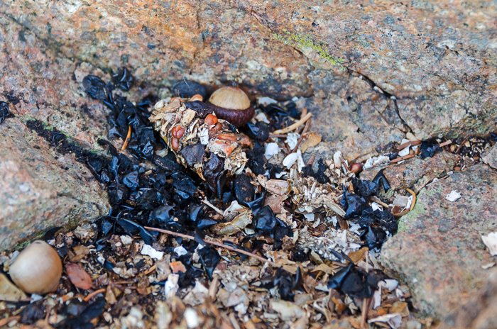
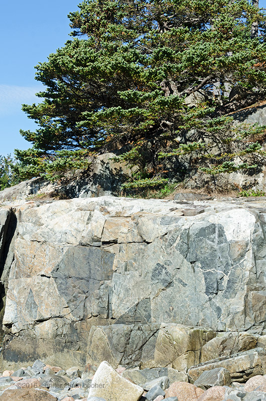
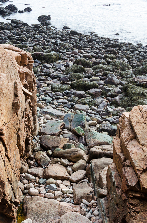
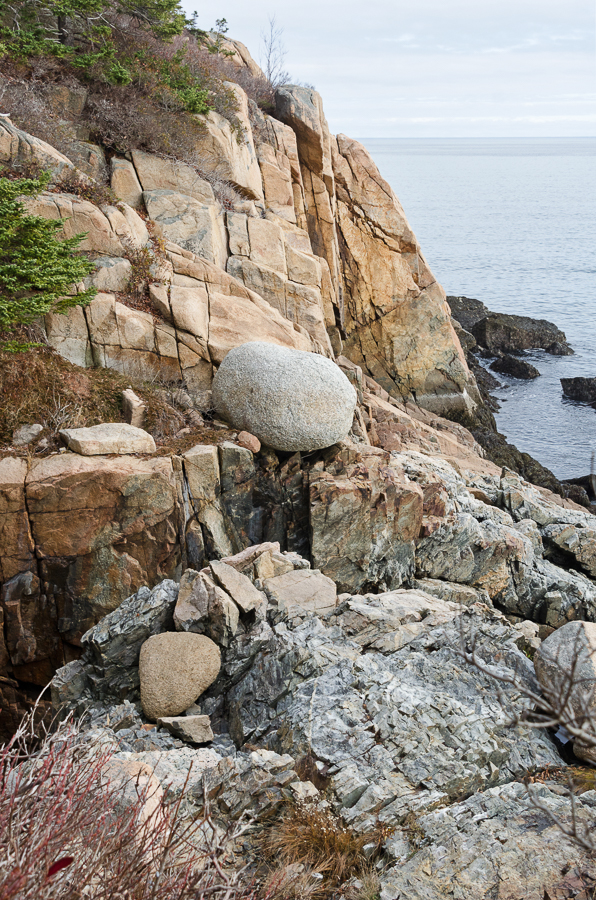
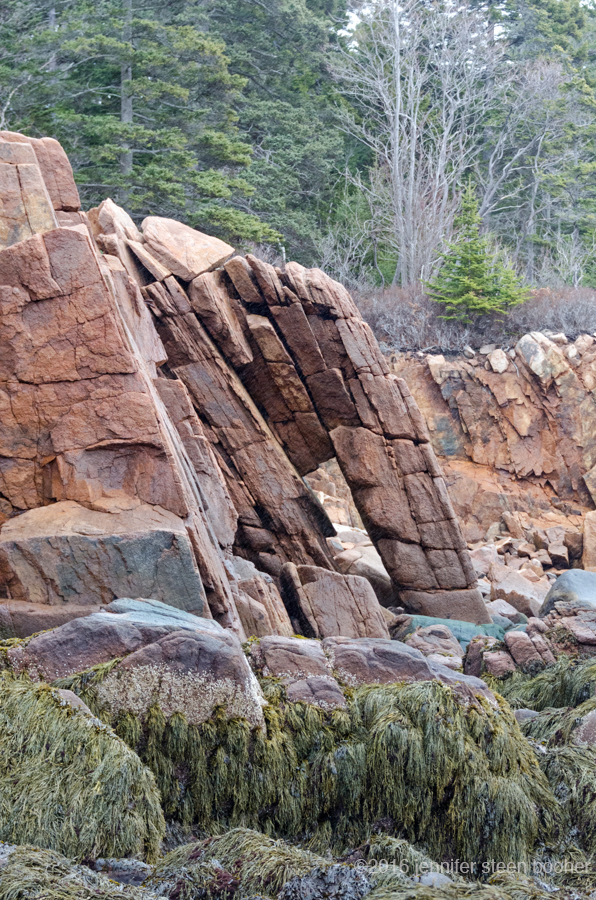
We wrapped up our conversation with a little talk about our families, and I headed home. Before I go, I did want to share this one story from the walk itself. George had been taking a class on geology through the Acadia Senior College, and as you know, I’m trying to learn something about it myself, so we spent a lot of time looking at rocks and trying very earnestly to apply what we knew. We stumbled across this formation, and stared at it for a while trying to figure out what we were looking at. The dark gray stuff, we agreed, was clearly sedimentary. So how did it end up sandwiched between layers of granite?

After a few minutes, George burst out laughing and said ‘It’s concrete!’
LOL, as they say. LOL.
_________________________________________________
Works Cited (as promised)
Lenahan, Donald. The Memorials of Acadia National Park. (unknown publisher), 2010.
Tracy, Charles. The Tracy Log Book 1855: A Month in Summer (Charles Tracy’s Diary on Mount Desert Island). Acadia Publishing Company, Bar Harbor, Maine, 1997.
Jonathan Silent Film Collection, Chapman University Digital Commons.
__________________________________________________
Addenda 8/28/16
OK, remember ‘Glengariff,’ George Cooksey’s house? It was bought by E.B. Dane in 1909, torn down, and rebuilt much larger.
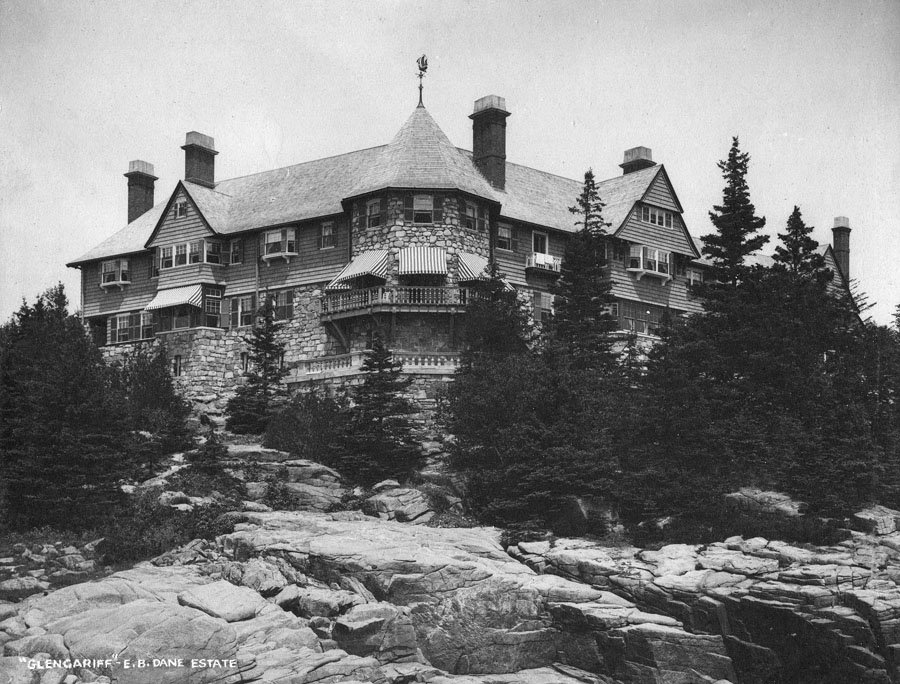
Photo courtesy of the Seal Harbor Library
Much larger! [More about the house and gardens on the Downeast Dilettante’s blog.] At 244′ long, it dominated the Seal Harbor skyline on the east:

Photo courtesy of the Seal Harbor Library.
The Danes had a similarly scaled yacht (a schooner, really), also 240′ long, called the Cone:

Photo from Vandenbergh and Shettleworth, Revisiting Seal Harbor, 1997.
The Danes built Wildwood Farm (now the Wildwood Stables) to supply the house with produce and flowers:

Photo courtesy of Acadia National Park Archives

Photo courtesy of Acadia National Park Archives
Richard Billing’s, son of the local grocer, told some stories about Wildwood and Glengariff in the 1930s in his memoir, The Village and the Hill: “The E.B.Dane family owned the Wildwood farm and a two story mansion down at Dane’s Point. They may have owned the farm, but the Manson’s [sic] lived in it. They were a great addition to our community. The farmhouse was adequate for their family, which included four children; Charlie, Jennie, Nancy, and John. A greenhouse connected the house to the barn. The greenhouse was full of exotic plants… grown to supply ‘The House.’ The farm also boasted cows, horses, pigs, sheep, goats, and poultry. It was at the Wildwood Farm that I first saw watermelon growing, and squash with the children’s names written on them. Mr. Manson would scratch their names on the young squash, and the scar would result in raised writing when the squash matured. From my home, there was a path directly through the woods to the farm, about half a mile from us …. Often the Mansons would ski to school, or ride on a sleigh driven by their father. Theirs was the only working farm in Seal Harbor.
…
At the Dane’s big house down on the point, the Liljeholm’s daughter, Elsie, was our hostess. Her father was caretaker of the house, and they lived in the heated downstairs portion of the house in the winter. They would move to the rooms over the garage during the summer, when they would give up their quarters to the summer servants. The great sport at Liljeholms was to venture into the unheated part of the house to play hide and seek. Those of us who knew the house would go immediately to the main dining room, push the catch of a secret panel, and duck through to a hidden room, completely disappearing from view. Another feature of the house was a photographic darkroom in the basement that was built like a circular maze. There was no door, you just kept circling into the center, where there was a completely equipped darkroom … very dark and very spooky, and always very cold.”
According to the Downeast Dilettante, “The Dane estates weathered the great Depression, but by WWII, things were drawing to a close. The Vanda was requistioned for duty in the war. … John D. Rockefeller Jr., in whose view shed Glengariff stood, bought the house for a song in 1946 and had it demolished (His son David later built a house on the property). ”
But Richard Billings gives a different version of the house’s end:
“One day, in the middle of winter, the building caught fire. Those of us who went to help the volunteer firemen were sickened to see most of the house consumed by flame. What was left was ruined by water and smoke. It had to be torn down, and was never rebuilt.”
The only personal information I’ve found about the Danes was a note published in A Church for Seal Harbor. One gathers that Mr. Smyth had been fundraising for the proposed new church, and received this reply, which the church historians found either amusing enough or offensive enough to preserve in their archives:

from Bechtle, Isabel K., A Church for Seal Harbor, Northeast Reprographics, Bangor, ME, 2002
Remind me never to put anything bitchy into writing, because sure as sure, that will be the one piece of correspondence all future historians latch onto.
_________________________________________________________
WORKS CITED
Bechtle, Isabel K., A Church for Seal Harbor, Northeast Reprographics, Bangor, ME, 2002.
Billings, Richard W., The Village and the Hill: Growing up in Seal Harbor Maine in the 1930′s, Day Mountain Publishing, Augusta, ME, 1995.
Vandenbergh, Lydia and Shettleworth, Jr., Earle, Revisiting Seal Harbor and Acadia National Park, Arcadia Publishing, Charleston, SC, 1997.
Save
Save
Save
Save
Save
Save
Save


 Kenn moved to the island in 1971: “My Grandma, Winifred Dole Mann, had a summer place in Southwest Harbor. My family always came up for visits in the summer and loved it. Her driving skills had deteriorated pretty badly and she was pleaded with to stop driving. When she was 90 she threw her drivers license in the fire on Christmas of 1971 and whined that she was giving up her freedom. She wanted someone to help her in her retirement to Maine. Both my sister Janet and I volunteered and it wasn’t long before my love affair with Maine and the island were established.”