The Coast Walk Project

Blog

Coast Walk 13: Hunters Beach to East Point, Seal Harbor; Part 5

CW13

Dec 16, 7:37am. 32ºF (0ºC) with a strong wind from the southwest. 4 Great Cormorants (Phalacrocorax carbo), a crow, something duck-ish but too far off for ID, a green crab, a couple of baby sea stars, sea urchins, and a flatworm (Planaria genus).

web-_DSC2704-Edit

It was a beautiful morning for a hike, if you don’t mind a strong wind on a cold day. (I don’t.)  This was all private property, so I owe a big thank you to the property owners who gave me permission to cross their land. Thank you! The geology was dramatic, with sheer cliff faces of pink granite dropping eighty feet to the water in some places.

web-_DSC2711-Edit

web-_DSC2712-Edit

As I followed this cleft down to the water line, I spotted four cormorants off in the distance:

web-_DSC2766-Edit

Through the miracle of the zoom lens I was able to get just enough information for a more knowledgeable friend to identify them as Great Cormorants (Phalacrocorax carbo). (Thank you, David!) You probably can’t see it in these photos, but some of them show the distinctive white patch under the chin. The surf was crashing over the rock they were perched on, and they seemed to be enjoying the spray:

web-_DSC2782-Edit

The rock I was perched on got hit by surf, too, but I didn’t enjoy the spray quite as much:

web-_DSC2858-Edit

Ledges like this are easier to traverse than the boulders-with-rockweed that I see so often, but they can be treacherously slippery so I moved carefully.

web-_DSC2784-Edit

I caught sight of a remnant of the old Seal Harbor Shore Path running along the top of the cliff at a couple of points. You might remember we first saw this just past Hunters Beach.

web-_DSC2785-Edit

To recap: it was built around 1896, and ran for about a mile from the Crows Nest property to Hunters Beach. Cooksey Drive, then called Sea Cliff Drive, had recently been built by William Cooksey, a real estate developer, and the path was built to provide shore access for the landlocked lots in his development. You can see it as a dotted red line on this 1896 path map:

1896PathMapDetail

It fell out of use in the 1950s, and all of it except the little bit near Hunters Beach is now private property. (See this post on the Memorials of Acadia National Park blog.) Here’s another little bit of it, about 50 feet above my head. And isn’t this boulder awesome?

web-_DSC2789-Edit

While we’re talking about Cooksey Drive (originally called Sea Cliff Drive), I found a few photos of it in a souvenir photo book from the late 19th century:

Image from "Northeast and Seal Harbors, Mount Desert, Maine" souvenir photo booklet, courtesy of the Northeast Harbor Library

Image from “Northeast and Seal Harbors, Mount Desert, Maine” souvenir photo booklet, courtesy of the Northeast Harbor Library

What a gorgeous old bridge – I need to get back over there and see if it still exists.

Image from "Northeast and Seal Harbors, Mount Desert, Maine" souvenir photo booklet, courtesy of the Northeast Harbor Library

Image from “Northeast and Seal Harbors, Mount Desert, Maine” souvenir photo booklet, courtesy of the Northeast Harbor Library

The tidepools were full of the usual suspects: starfish, sea urchins, periwinkle, barnacles, and coralline.

web-_DSC2797-Edit

web-_DSC2890-Edit

Enteromorpha seaweed:

web-_DSC2911-Edit

Doesn’t this house fit perfectly into the slope of the hill? It looks as if it had grown there.

web-_DSC2825-Edit

This was one of the most interesting things I found on the walk, mostly because I’d never seen one and had no idea what it was:

web-_DSC2834-Edit

It was a flattened, white creature less than half an inch long that moved something like an inchworm, but without making an arch of its body. It seemed to move by extending and contracting along the kelp frond. Fascinating to watch (but remember I also enjoy watching saltwater evaporate.) I posted photos on Facebook, and my friends came back with ‘Planarian.’ (Thank you Jill and Anne!) So it’s a Flatworm, related to the brown ones you may have done regeneration experiments with in college biology class.

web_DSC2843-Edit

I’m sorry the photos aren’t clearer, but it’s tiny and under about two feet of water. The closest thing I could find to show you more clearly what it looks like is this gorgeous old illustration:

Tricladen - Fauna und Flora des Golfes von Neapel (32) - Von J. Wilhelmi (1909) - Taf. 1 - BioDivLibrary page 6922192

Illustration from Fauna und Flora des Golfes von Neapel, 1909, by Wilhelmi, J. (Julius), 1880-1937 [Public domain], via Wikimedia Commons

I can’t identify my little flatworm’s species, but it looked a lot like the white one in the middle of the left side. Isn’t it cute? web-_DSC2864-Edit

web-_DSC2869-Edit

web-_DSC2870-Edit

web-_DSC2881-Edit

web-_DSC2906-Edit

Before I knew it, I had rounded the point and reached the edge of my ‘permitted zone’ so I scrambled back up the cliff, dodging the poison ivy, and looked backward into the golden late-morning haze.

web-_DSC2920-Edit

web-_DSC2932-Edit

I love this island. Flatworms, lost trails, and carpets of moss; what more could a girl ask for?

_______________________________________________________________

Addenda 8/28/16

In the original post I briefly mentioned that Cooksey Drive had been built by George Cooksey, but I’ve since found that he was instrumental in developing Seal Harbor both as a town and as a summer colony, so we should give him a little more attention.

Photo from Vandenbergh and Shettleworth, Revisiting Seal Harbor, 1997.

George Borwick Cooksey (right) with his wife, Linda Dows. Photo from Vandenbergh and Shettleworth, Revisiting Seal Harbor, 1997.

Most of my information comes from Lydia Vandenbergh and Earle Shettleworth, Jr.’s book (full citation below.) Cooksey was a wealthy grain merchant from New York. It sounds like his wife’s family, the Dows, summered in Seal Harbor (although I’m not clear on their original connection to SH, the Dows women keep popping up in my research.) Cooksey bought Eastern Point and Ox Hill in 1891, planning to create a resort development. In 1891 he also built a house, ‘Glengariff,’ which seems to have been on what is now Ringing Point. I’m not clear on its exact location yet. [More about that house in Coast Walk 14.]

Photo from Vandenbergh and Shettleworth, Revisiting Seal Harbor, 1997.

George Cooksey’s ‘Glengariff.’ Photo from Vandenbergh and Shettleworth, Revisiting Seal Harbor, 1997.

Vandenbergh and Shettleworth call it the first major Shingle-Style house in Seal Harbor. Between 1891-95, he built roads, most notably Sea Cliff Drive [now Cooksey Drive],  installed sewer and water lines, formed a realty company to sell lots, and sold lots to several family and friends who built cottages. In poor health, he moved back to NY and died in 1922. Seal Harbor already had a reputation as a more intellectual summer resort than Bar Harbor, and Cooksey’s friends appear to have reinforced that. I came across this photo in V&S’s book:

web-Dunham

Their caption reads, ” New York biochemists Edward Dunham (above) and Christian Herter … needed not only a room of special equipment but also space for animals such as geese, monkeys, and mice. Their laboratory adjacent to their cottages became central to their study of meningococcus. Family members were commandeered: children … fed the lab animals and chased them when they escaped… . After Herter’s death in 1910, ‘Miradero’ laboratory continued to be used by its scientific owners, including Henry B. Dakin, the inventor of the Dakin antiseptic solution, and later Dr. James B. Murphy, the eminent cancer researcher for New York’s Rockefeller Institute.” (p.80)

And didn’t that send me off on a series of tangents! I wondered if they were involved with founding either the Jackon Lab or the MDI Bio Lab. [Spoiler, no.] First I had to find out who Dunham and Herter were. There’s a bio of Dunham here. I couldn’t find anything online about Herter’s work, but V&S describe him as “a physician, medical professor, and scientific researcher, specializing in diseases of the nervous system. He was among the first to merge scientific investigation with medical science, and he advocated that medical schools and hospitals establish research laboratories.” So they were prominent physicians and research scientists, and each of them married a Dows, so they were Cooksey’s in-laws: Dunham married Mary Dows, Herter married Susan Dows. Out of curiosity, I looked up Henry Dakin, and according to the Social Register he married Susan Dows Herter after Herter died. Then I looked up James Murphy, and while I couldn’t find any connection to Cooksey or the Dows family, my web searches were dominated by the scandal occasioned when his son’s wife divorced him to marry Nelson Rockefeller. Phew! So none of that is directly relevant to the Coast Walk, other than establishing that there was good reason for Seal Harbor’s intellectual reputation, but it sure made for some interesting reading.

Also, Edward Dunham pops up again when we get to the Seal Harbor Green, so remember him.

Save

Save

Save

Save

Save

Save

Save

Save

Save

Save

Save

Save

Save

Save

Save

Save

Save

Share

Coast Walk 13: Hunters Beach to East Point, Seal Harbor; Part 4

web-_DSC2241-Edit

Dec 4, 9:30am. 33ºF (0ºC). Light breeze from the south. Sunny with puffy clouds after a couple of days of rain, so water was running everywhere. 4 eider ducks (2 male, 2 female), immature loon.

CW13

What a difference three months makes!

web-_DSC2387-Edit

I had received permission to walk privately owned land on East Point, and the best access to sea level was back through the MCHT property you saw in the last post, so I headed back through familiar territory:web-_DSC2101-Edit

It was 44ºF colder in December than in August! The breeze was spotty, so I’d get really warm in the sunny spots, shed my hat and gloves, and then in the shade or when the breeze picked up, suddenly I’d be freezing again. The bushes were loaded with winterberry (above) and bayberry (below.)

web-_DSC2378-Edit The morning sun was a little bit blinding, which made photography tricky. You’ll see a lot of flare in the photos – low tide rarely coincides with great lighting conditions! When I want to photograph a place that isn’t part of the Coast Walk, I often use an app called the Photographer’s Ephemeris to look at how the sun hits it at different times of day. (It also shows me sunrise and sunset at different times of year.) That way I don’t end up like this – shooting straight into the sun, with harsh shadows hiding half the landscape. But for the Coast Walk, the tide chart trumps the sun.web-_DSC2113-Edit

web-_DSC2116-Edit

I kept a lookout for the poison ivy that was all over the place last visit, but didn’t recognize it without its leaves until I saw the berries.

The white berries of Poison Ivy (Toxicodendron radicans) in its leafless winter state.

The white berries of Poison Ivy (Toxicodendron radicans) in its leafless winter state.

web-_DSC2150-Edit

Once I reached sea level, it was a bit of a scramble over the rocks,web-_DSC2158-Edit

but the tidepools were great!

web-_DSC2266-Edit

web-_DSC2268-Edit

web-_DSC2172-Edit

Basalt intrusions in the pink granite made the most beautiful stripes:

web-_DSC2319-Edit

web-_DSC2326-Edit

web-_DSC2193-Edit  web-_DSC2214-Edit

And then I found a small sea cave! (You guys know how obsessed I am with caves, right?)

web-_DSC2270-Edit

One side of it was covered with a greenish lichen or mold. The landward side of the cave was wet with groundwater seepage, and the mold only grew there.

web-_DSC2226-Edit

web-_DSC2240-Edit

web-_DSC2283-Edit

web-_DSC2291-Edit

As usual, I reached a point at which I couldn’t travel along the tide line; usually I go up and around, but this was such a sheer cliff I had to turn back.  web-_DSC2257-Edit


I found so much interesting poop on this walk that I gathered all the photos here so you can see the variety:

web-_DSC2301-Edit

web-_DSC2153-Edit

web-_DSC2201-Edit

I think this must be racoon or otter:web-_DSC2353-Edit

web-_DSC2373-Edit

I keep hoping someone familiar with animal scat will read this blog and interpret for me!

web-_DSC2367-Edit

web-_DSC2343-Edit

I’m trying to catch up to myself here on the blog (in real life I’ve reached Seal Harbor Beach) and at the same time trying not to rush through these solo posts. I’m fighting the temptation to just throw up a bunch of photos to get through them quickly, but there were so many interesting things to look at and I want to share that with you. I’m not doing as much research, I will admit that. Last summer I would have scoured books and the internet to figure out what the mold on the cave wall was, but now I’m trying to find a balance between investigating and moving forward. As soon as I catch up, I’ll work on getting permissions for the next few miles, and also start researching again.

Can you believe I thought I could do this in two years?

Share

Coast Walk 13: Hunters Beach to East Point, Seal Harbor; Part 3

IMG_6445

August 27, 2015: 2:21-4:15pm. 77ºF (25ºC). Breezy and sunny with puffy clouds. Chickadees, crickets, grasshoppers, dragonflies, bees, mosquito larvae, starfish, breadcrumb sponges, a flock of anonymous ducks, and 3 crows.

CW13

No companions today, just me celebrating my 48th birthday by photographing bugs and poop. When I’m alone, I look around more carefully and spend more time watching seawater evaporate and bugs crawl, so this one will be heavy on photos and light on text.

web-IMG_6421

It was perfect height-of-summer weather: breezy and sunny with puffy clouds in a deep blue sky.  I could hear chickadees off in the woods, and crickets and grasshoppers chirping in the grass. There were dozens of dragonflies in the air and tons of bees on the asters.

I started out at the Maine Coast Heritage Trust parking area on Cooksey Drive

web-_DSC1253-Edit

and headed downhill through a scrubby growth of young red maple, asters, raspberry-ish canes, alder, chokecherry, viburnum, bracken, low juniper, spruce trees, and bayberry.

web-_DSC1258-Edit

web-_DSC1262-Edit

web-_DSC1266-Edit

web-_DSC1267-Edit

web-_DSC1271-Edit

web-_DSC1272-Edit

web-_DSC1276-Edit  web-_DSC1292-Edit

web-_DSC1293-Edit

web-_DSC1296-Edit

Evening Primrose (Oenothera biennis)

web-_DSC1300-Edit

Looking back towards Hunters Head.

web-_DSC1306-Edit

And looking south toward the Cranberry Islands. You can just make out the monument on East Bunker Ledge out there in the Eastern Way.

web-_DSC1307-Edit

IMG_6432

There was poison ivy everywhere  – I’d never thought of it as a seaside plant, but it was growing in cracks in the cliffs beside seaside goldenrod and wild roses.

IMG_6435

Oh yeah, I finally bought new hiking boots!

web-_DSC1314-Edit

Wild Harebell (Campanula rotundifolia) growing in a granite cleft.

web-_DSC1317-Edit

I’ve been told this enormous quartz vein runs clear across the island.

web-_DSC1427-Edit

web-_DSC1325-Edit

web-_DSC1331-Edit

web-_DSC1332-Edit

Probably raccoon poo. Maybe fox? Something that likes fruit, anyway.

web-_DSC1335-Edit

Seaside Goldenrod (Solidago sempervirens)

web-_DSC1338-Edit

Bittersweet Nightshade (Solanum dulcamara), native to Europe and invasive here in Maine. This stuff is everywhere.

web-mosquito_larvae_1

Mosquito larvae and pupae (the larvae are the skinny, wiggly ones and the pupae are the dark, oval ones.)

web-_DSC1349-Edit

web-_DSC1352-Edit


web-_DSC1362-Edit

web-_DSC1368-Edit

web-_DSC1374-Edit

web-_DSC1376-Edit

web-_DSC1389-Edit

web-_DSC1400-Edit

web-_DSC1424-Edit

web-_DSC1430-Edit

web-_DSC1440-Edit

web-_DSC1446-Edit

web-_DSC1452-Edit

Heavy traffic in the Eastern Way.

web-_DSC1460-Edit

Gosh that was fun!


Share

Coast Walk 13: Hunters Beach to East Point, Seal Harbor; Part 2

web-_DSC0868-Edit

July 24, 2015: 10:15am-12:30pm. 70º, humid and sweaty with a little cool breeze, mix of clouds and sun, started to rain just after we finished.

Before we get started I’d like to thank the people who donated to the Coast Walk last month, you are awesome! (In case someone reading this didn’t get to the end of the last post,  I’m saving up for a couple of wireless microphones that should help record and transcribe the interviews better. That’s what the ‘donate’ button over at the side of the blog post is for.) Okay, on to the main story!

CW13

Walkers: Sarah Booker, personal trainer, Manchester Athletic Club; Annie Johnson, science teacher, Brookwood School; Otis and Tegan, adorable lab mix mutts.

_DSC0877-web

It’s difficult to tell exactly where you are on a map when you are at the bottom of a long cliff, and when I got home and looked at the GPS of my iPhone recording, it turned out that Tim and I had turned back a little short of the end of the publicly-accessible shoreline. My cousin and her wife were in town and up for adventure, so we headed back to Hunters Beach to fill in the missing segment.

web-_DSC0863-Edit

We took the path at the top of the cliff to about where I thought Tim and I had come up from the shore, and then headed back down toward the water.

web-_DSC0869-Edit

J: It must be humid because I’m all sweaty and I don’t feel like we’re working that hard.

S: So I have a little bit of a pulled quad … but I’m going to be kind of stubborn and I want to run up Cadillac tomorrow morning.

J: Oh my god, you’re crazy.

S: I know! Well I wanted to do it today because I thought it would be the clearest sunrise but I’ll give my muscle 24 more hours and go up on a cloudy morning. … I have a friend at work who runs up all these mountains and she posted it on Facebook and it has me totally intrigued.

J: Cool

S: Haven’t done it yet.

J: Well, Cadillac’s a good one to start with!

web-_DSC0308-Edit

J: This kind of landscape just makes me happy. With the low-growing bushes and the exposed stone…

S: Is there a landscape type that’s off-putting to you?

J: You know those municipal parks that have sundials made out of marigolds and ornamental cabbages? That.

A: How do you feel about orbs?

J: Like, round objects?

A: You how people put orbs in their yard?

J: Well, if they put it in the middle of marigolds and ornamental cabbages – not into it. But if you put an orb in this landscape it would be gorgeous. Oh look, there’s little arrows. Just in case we can’t read cairns.

S: Oh, I see some pipes!

J: Oh good, so this must be where we came up then. Oh yeah, see where it looks like there used to be a stairway? That’s where we came up from the ocean.

[Transcribing this part was tricky – the sound of waves breaking on the rocks was deafening!]

web-_DSC0889-Edit

J: Don’t you feel like a kid?
A: Yeah, just like you could explore all day!
J: Yeah, like, is that a cave under there?!
S: All these crevices and
A: And what’s in that tide pool!

web-_DSC0879-Edit

S: I kind of half expected that to be like Thunder Hole. That last wave coming in.
J: Well I’ll bet once the tide’s higher and it’s going in to the crevice there I’ll bet it does blow.
S: Low tide was at 11?
J: 11:30
S: Oh perfect! It’s 11:20.
J: So that means anything that’s still a tide pool has consistent water all the time, so these are the ones where we might find interesting things.

web-_DSC0881-Edit

[Yup, they sure were!]

 Breadcrumb Sponge, Halichondria panicea, Rock crab, Cancer irroratus

Rock crab, Breadcrumb sponge, and crustose coralline. Also barnacles and kelp.

S: The water’s pretty inviting.
J: Yeah, don’t go in here though.
A: No, bad place! There’d be bashing.
J: You’d get swept out pretty quickly, although the tide’s coming in, so yeah, there’d be more bashing than sweeping.
S: I’m not going in, but it’s inviting nonetheless.

web-_DSC0883-Edit

A: Otis, I’d like to encourage you not to put your paws on the barnacles.
S: He doesn’t care.
A: I have a feeling he doesn’t care, but he doesn’t know any better. It’s abrasive enough that it’ll totally chew up their paws, right?
J: It’ll slice them. That stuff is like broken glass. I find that sometimes I don’t even know I’ve been cut until I get [salt] water in it later and it starts to sting.
S: Is that a good way? [Pointing around a boulder.]
A: Nope. I mean, for humans, yes.

[There were a few points where the dogs just couldn’t climb, so Sarah and Annie lifted them up to the next level. Traveling through this landscape with the dogs gave me a very different perspective on it.]

web-_DSC0893-Edit

J: [Looking into a shallow depression in the rock where seawater had evaporated.] Oh cool, look at the depth of the salt in this one.
A: Oh, woah! That’s crazy.
S: Oh my gosh.
J: Salt.
S: Blech!
A: Did you taste it?

web-_DSC0902-Edit
J: Of course! … It’s sea salt. [It tasted like salt, but slightly bitter.]
S: Electrolytes.
J: It’s kind of good once you [get used to it.]
S: It is kind of good in a weird way.
A: In a very weird way. Why is it good?
J: Cause we’ve been sweating and we need salt?

Sarah loaned me a carabiner clip to hold my camera back when climbing – enormously helpful, should have done that months ago!
web-_DSC0300-Edit
J: That’s Hunters Point [ed.note. it’s actually called Hunter’s Head], Hunters Beach, where we came from, and the other side is Little Hunters Beach. You can only get to Little Hunters Beach from the Park Loop Road; you can see the cars parked on it there? And you can only get to Hunters Beach from Cooksey Drive. It’s like these two overlapping transportation systems that you can’t get here from there. Unless you go through the woods, which is what I did, the woods and the rocks. I cannot believe that I came around that point!

Eventually we reached the property line of the next estate, and backtracked up to the top of the cliff to re-find the path. It lead through wide swaths of blueberry bushes loaded with perfectly ripe berries, and as we walked, we picked handfuls. Otis and Tegan demanded their share.

J: Oh, the dogs like blueberries?
A: Yeah! We discovered this on one of our first hikes in Bar Harbor with them, we had just come from Colorado
S: The top of the Beehive I think
A: Yeah, it was up to the Beehive, and we got up there and Sarah and I had these handfuls and they came over and were like [munching noises]. And then they started eating them off the bushes themselves.
J: Oh my gosh! Smart dogs.
J: I wonder what kind of scat that is. Fox, maybe?
A: No fur in it though, eh?
J: No, a lot of berries. It’s not deer.
A: No, definitely not. It’s a lot, though, for a raccoon or a possum
J: Oh don’t step in that Tegan! Gah.
A: Oh good job, T.
J: Well, I guess raccoon…
A: And that’s deer…

web-_DSC0873-Edit
J: I’m just hoping I don’t deliver you back home covered in poison ivy and ticks.
A: There will be a big soapy scrub when we get home.
J: I’m going throw my shoes in the wash, too.

web-_DSC0889-Edit

S: I’d like to get a lobster roll before we leave, please. I mean before we leave the island.
A: I saw some place that had one for $10, which I thought was reasonable.
S: Yeah, well it’s better than Essex.
J: Thirsty Whale has good lobster rolls. I don’t know how much they are, though.
S: You can get a double for $15. It says ‘Please no sharing the doubles.’ They’re onto us.
J: You could always get it to go.
A: Why is there no sharing of doubles? That’s so silly.
S: Because the double is $15.
A: But – they can’t regulate how I eat my double!
S: Right? And it would be perfect for us since you can’t eat the bun. I assume it’s one bun with double lobster.
J: You know if you want we could just get lobsters and cook em up. Do a lobster feast?
S: I have thing about the buttered bun, fries, and the basket.
J: It is pretty awesome.
S: Coleslaw.
J: I also really like the fried clams at the Whale. You can have my coleslaw.

And then we were back at Hunters Beach, heading up the path to the parking lot. The first really sour note of the Coast Walk was running into a jerk who had loaded his pockets with rocks from the beach. I told him there was a fine for taking rocks, and, can you believe this, he smirked and said he hadn’t taken them from the beach, he was just carrying them around. There’s no cell phone signal in the area til Otter Creek or you bet your britches I would have turned that asshole in. Those beach stones are 400 million years old; it’s not exactly a renewable resource.

Then we ran into a group of people with 3 small dogs off leash, who of course came straight for our (leashed) dogs. Grr. FYI, three reasons not to let your dog off the leash in Acadia: 1) They scare the wildlife. Sometimes they hurt the animals, and sometimes the animals, like porcupines, hurt them. 2) They scare other hikers – I don’t care how cute your dog is, to little kids even a terrier looks huge, and if your unleashed dog goes bounding up to a toddler you’re going to ruin some family’s day. 3) There are other dogs there; some are friendly and some are not. Don’t be the twit who starts a dog fight.

OK, off my soapbox, sorry. I love this island, and I guess I’m kind of protective of it. All these months later and I still get mad thinking about it! How about a photo of those gorgeous stones at Hunters Beach so we can end on a more cheerful note:

_DSC0208-web


Share

Coast Walk 13: Hunters Beach to East Point; Part 1

CW13

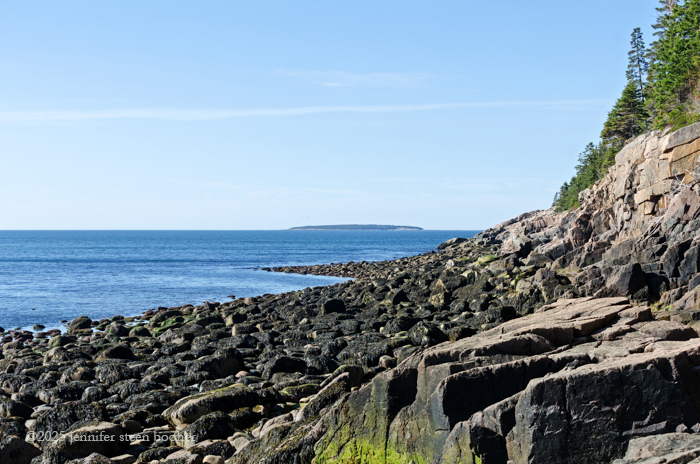
June 4, 2015: 5:30-7:45am. 45ºF (about 7ºC), overcast but bright with some patches of sun, slight breeze. By the end of the walk it was 51ºF (11ºC).

_DSC0281-web

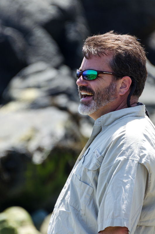
Walkers: Tim Garrity, Executive Director, Mount Desert Island Historical Society; Lynn Boulger, Dean of Institutional Advancement, College of the Atlantic; and Frankie, a labrador retriever. The conversation started up so quickly that I forgot to take a photo of everybody when we we were all together, so I have to apologize to Lynn and Frankie for inadvertently leaving them out.


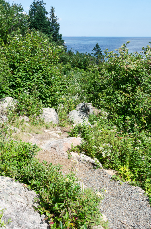
We met at the parking lot super-early one morning in June and headed down the trail to Hunters Beach. Lynn asked how I choose topics for this blog.

J: I find that actually climbing over the shoreline really forces me to pay attention to it so I’ve got a literally hands-on appreciation of geology and barnacles and stuff like that.  [What I write about] is driven partly by what I find and partly by who I’m with, and whatever comes out of it is great. I try not to go out with any kind of preconceived ideas. I think if you go out looking for something that’s all you find.

L: So do you have another profession?

J: Well, I was a landscape architect, and about, oh my god, seven, eight years ago, I sold my business to my former partner and I’ve been mostly a stay-at-home-mom. [Ed.note: Not too long after this walk I started working as a landscape architect again at LARK Studio in Bar Harbor.]

L: And how old are your children?

J: They are now 14 and 17, so yeah, I’ve been developing a career as a photographer, a fine art and landscape photographer.

web-_DSC0204-Edit

J: Gosh we picked a good morning!

T: Isn’t it beautiful? You’ve really been out in all kinds of weather.

J: Oh my Lord yes.

T: The stories about the deep snow were really great.

J: It was actually a lot of fun.  Hard work but a lot of fun.  The rain is the stuff that ends up being not so fun.

T: We were last here on Christmas Day… It was incredibly warm.

L: That’s right. … So are you trying to circumnavigate the whole coast, is that it?

J: Yeah, … about 120 miles as near as I can figure

T: How far have you gone so far?

J: I started at the Bar, so not very far!

T: How far is that?

J: Oh gosh, I’m not sure.

L: It feels far!

J: It feels far until you look at a map of the island and it’s this tiny little segment. [Ed.note: It was roughly 13 miles. ]

web-_DSC0205-Edit

J: Hmmm. How comfortable are you guys on seaweed-covered rocks?

T: We’ll do our best.

J: Okay.

[We started scrambling down the shore, and the sliding cobbles drowned out a lot of the recorded conversation]

L: The college has a press, you know.

J: Oh, like a publishing house?

L: Yeah

J: Oh cool!

L: It’s fairly new, we’ve done a couple of books … we don’t quite have a criteria for selection. We decided to republish Bill Newlin’s Lakes and Ponds of Mount Desert that had gone out print. Downeast Books, I think, had done the first one. And then somebody else came to us with a book and it wasn’t [quite right] and so we had to edit, and he was not interested in editing …

T: He didn’t want anybody to change a word?

L: Nope.

J: Well that’s too bad. It seems like half the point of working with a publishing house is so you can get their advice.

L: Yeah. … [Hesitating by a boulder] This is …

J: Pretty slick

L: This one is too.

J: I usually go fairly slowly.

T: I can understand why it would take you a long time to go a hundred and twenty miles if this is the surface you’re climbing on!

web-_DSC0214-Edit

J: Sometimes it’s like this, sometimes it’s more like that [pointing to a drier, more stable area of rock.] I do a lot of sit-and-slide. And if this is, like, no fun just let me know.

T: No, we’re with you.

J: ‘Cause we can head up the cliff. … It does make it hard to talk doesn’t it?

T: Definitely.

J: Well it looks like Frankie’s having fun. …. [Frankie was having a blast, sniffing at everything and sliding around on the cobbles.]

We chatted a bit about how we had come to be in our current jobs:

T: Well, I guess I’ve been interested in history since childhood…; I was a hospital foreman in the Navy, went to college through a program they had in healthcare administration, and ended up sticking with it to a graduate degree and worked for 25 years as a healthcare [administrator] before deciding that that’s really not what I wanted to do with my life. … I decided about 8 years ago to [change] my career to history, and I went to the graduate program at the University of Maine, and got a master’s in history. And in the process of my career transformation I worked at the Park as a ranger, and in 2010 I [became] director of the Mount Desert Island Historical Society. So we write an annual magazine [ed.note: Chebacco]

J: Which is very cool!

T: Thanks! And I became you know, a non-profit administrator and a historian; we have to raise money, we put on programs, we have an extensive educational program … we try to encourage people to write about history, and we are trying to constantly rediscover the history of this place and not tell the same story over and over again … Looking at it from different angles. Each year we pick a theme for Chebacco. This year’s theme is ‘waves of change;’ landscape history, how the environment has changed, both the seascape and the landscape. … David Fisher wrote about the lost landscapes of Mount Desert Island, particularly meadows.

J: I really enjoyed the one on Bartlett’s Island.

T: Did you?

J: Yeah, that was cool. … OK, let’s see. [Looking at a particularly large boulder] I think we’re going to have to go around this.

T: Next year’s theme is ‘borderlands,’ … history has traditionally been pulled from the perspective of national history – US history, French history, UK history – borderlands history takes up where domains overlap, like this area in the 17th and 18th century where French, English and Wabankai contested the same space, or a cultural borderland …

[We paused to study our path]

L: This may be a possibility…

J: Through here?

L: Maybe…

T: I think you can hang on here…

J: In case I didn’t mention this before, the first rule of the coast walk is ‘don’t die.’

L: No, you didn’t tell us that.

T: I don’t think there’s a next step after this.

J: Yeah, I’ll get really mad at you if you get killed.

[We turned and worked our way around a different section of the shore.]

web-_DSC0210-Edit

T: So right now, for instance, I’m working on a project … focusing around the time of the Park’s founding, the early 20th century. Immigrants came into an environment in which they were not particularly welcome, where they had no reason to expect to be welcomed. Maine had a long history of nativism, suspicion of people coming from away, the wealthy [people] … came here to get away from, among other things, immigrants in the cities. But large numbers of immigrants came here because with the growth of the tourist business in Bar Harbor they could find work, so people really came from all over the world. …

J: So are you working on Maine in general or just the island?

T: Mostly trying to focus on the island. We often have to go wider because we need more studies or parallels. [We’ve been researching an immigrant] named Julius Kurson. He came from a place called Courland in Russia [ed.note: Courland is now Jelgava, Latvia], a nation that had been occupied by Germany, and then it was occupied by Russia, a hapless eastern European state contested by major powers. He came over in … 1888, in about a year he was a naturalized citizen. He identified himself as a paper-maker, when he was 24 years old he came over here, he established a clothing business on Main Street in Bar Harbor. Met a girl in Boston, brought his brother over to help him work in the store, and he and his wife quickly became a well-accepted part of society, joining several commercial organizations, then he was a representative for the Democratic convention… . Eventually we have him retiring to Los Angeles. You can still see his house on a sunny street… . So when you tell the history of Acadia National Park, which you are kind of obligated to do for the centennial, we didn’t want to tell the same old history, so our Borderlands people, writers, are working on topics like a Scottish immigrant who was one of the principals in designing landscape gardens, a guy named Miller, and Betsy Hewlett is working on that. [Mary Holway] is asking where the Wabanaki were at the time of the founding, were they just a romantic ideal when the mountains were named for them? Norumbega, Penobscot, and so forth? Or … else they were kind of idealized with performance, a westernized version of Indians, which George Neptune wrote about. People were interacting with Penobscot Indians here while Indian wars were being fought in the West, and it was a way for people to engage with Indians in a fairly safe way. But other than that romantic ideal, we’re not finding any evidence that they were involved in any way in this ceremonial [beginning of the park], they were kind of kept at a distance.

J: Yeah, that was kind of the period when they were really being driven off the island.

T: Yes, right. Right at that time they were seen as, kind of transitioned into an undesirable.

J: Yeah, first they got driven off the shore, because that was about the time of the Squaw Hollow, right? On the Athletic Fields?

T: Oh you went around with George, didn’t you?

J: Yeah, and then I did a lot of reading, too, because it was – a lot of the encampments were along my path. Or a couple of them, any way. … [We paused to study our route again.] It’s slow work, the scrambling.

T: Have you encountered a moonscape like this before?

J: Oh yeah! This is pretty much par for the course. But this is why I never know how far I’m going to get. I usually try and allot about 2 hours for a walk, and sometimes, rarely, I can do a whole mile. Very rarely! Only when I’m [walking] up on top [of the cliffs]. I just never know how long it’s going to take me because I don’t really know what I’m getting into. Are we going to be able to get to the area you wanted to? Going this way?

T: You know, I think we’re there, because the shore is looking out at Bunker Ledge.

J: Awesome.

T: How you doing Frankie?

J: He must be having a little trouble down here.

[He was having a lot of trouble walking among the boulders, and shortly after this, Lynn took Frankie back to the car.]

Northern Sea Star, Asterias vulgaris

J: Oh my gosh, something’s swarming in here. Looks like scud. I’ve never seen them do that before.

T: What is this?

J: See all the little, they’re amphipods, oh look, a little starfish. Scud are amphipods, they’re related to shrimp. Very distantly related. And you often see them crawling underneath a rock when you turn it over. But you don’t usually see them swimming this way.

T: Cool.

J: I wonder why they’re swarming like that?

T: So this is an hour before low tide?

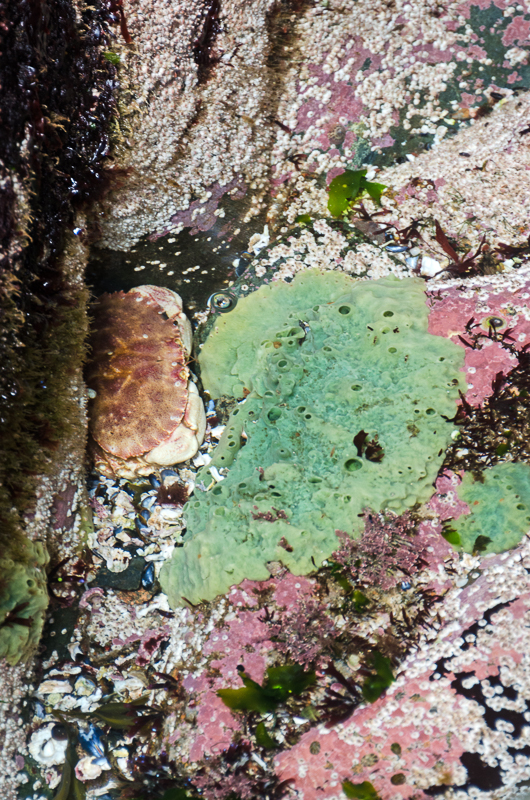
J: Yes. I find that gives me a good two hours to get through. Let’s see. There’s something else in this one. Oh my gosh, there’s starfish all over the place! There’s a little one down there. Well, two starfish, I guess they’re not ALL over the place. Oh, and there’s a crab eating right under there. It’s sometimes hard for me to tell people what I’m interested in because I don’t know until I come across it. I find every now and then I have to stop and just look around. Because when I first looked over there I didn’t even see the crab. And same for the starfish, I looked right past it.

T: I used to work and volunteer for a K-9 search and rescue team. … We would do hide from each others’ dogs to play the victim, and one of the things I found was that [while hiding] I could just sit there and just do nothing while waiting for a dog. It was amazing just sitting in the woods with no other assignment, to just sit and watch what emerged. It was all around you all the time, but you would start to notice it when you’re quiet for a little bit.

J: Exactly. So every now and them while I’m walking, I really do have to just stop and go, ‘Okay, what’s in the air, what am I walking on, what is here?’

T: It’s a new opportunity.

J: Oh look, the starfish has moved. Oh no, that’s the second one, there’s another one there. [splashing noises as I picked one up] Okay, now I’m wet.

Northern Sea Star, Asterias vulgaris

Northern Sea Star (Asterias vulgaris) re-growing a limb.

T: Are starfish one of those creatures that will regenerate a limb?

J: Yep, that’s what that one’s doing. Growing it back. Hey could you hold it for me? What’s he got on him?

T: Looks like a little scud.

J: So they’ve got eyes at the end of their arms. Right at the tip there.

T: Cool. And they get an optical view from these eyes?

J: I’m not sure what they can actually see through them. I think it’s just light and dark. But it must be so confusing getting information from 5 directions.

T: And not a lot of brainpower to interpret it.

J: But still, there are limited things they’re trying to accomplish. Oh yeah there’s another starfish down under there. I guess that means we better be careful where we step. You know, this might be one of the trickier rockscapes I’ve gone through.

T: Well we seem to have found the layer that is a little crustier than the other stuff that was just plain slippery.

J: You can tell from what we’re walking on and from the starfish that this is kind of deeper water, it’s covered longer. There’s a lot more starfish down here. Oh this is so cool!

T: Oh that’s beautiful.

J: Yeah, that’s not a photo that’s going to come out well, though, cause it’s too far down. I’m mostly going to get reflection on the surface.

T: Can you put a lens on your camera that would then penetrate the reflection?

web-_DSC0221-Edit

J: Not really. I can put a polarizing filter on, which would help. Oh here’s another crab hiding from us. It’s so cool to see the crabs now. I hadn’t seen a lot of moving things other than periwinkles most of the winter.

T: Do you know what their life is like in the winter? Did you see crabs?

J: No, I really think I only saw one live crab in the winter.

T: And they’ve started to emerge.

J: About a month ago. And starfish I only started seeing maybe three weeks ago, when I hit Otter Cliffs. And some of that might be because in the winter I really was pretty limited on the shore. I just couldn’t get down to it most of the time because the cliffs were iced over.

T: Do you know John Gillis? I think I might have recommended one of his books, The Human Shore?

J: Yes,

T: He’s a professor emeritus of history at Rutgers, he has a summer home on Gotts Island, and he lives in Berkeley in the winter, and his book on the human shore is talking about how history has become landlocked, and so often we’re talking about what happens on the land masses

J: I did start reading that one! Unfortunately I had gotten it from the library and it was due back before I finished it.

T: Well, he’s written another article for us for next year’s Chebacco, called “Unsettled Mount Desert Island,” and his idea is that islands are unsettled places, that people are constantly passing them by.

J: What do you mean by ‘passing them by?’

web-_DSC0239-Edit

T: Well, they’ve been involved in the movement of human civilization from a sea-borne peoples who, when the first maps were drawn of this coast as Europeans began discovering, the first things they articulated were the islands. They didn’t really see the shore, and they often mis-perceived the shore, they thought that the land mass was narrow, and that very soon they would get to the Pacific and an avenue to the Indies. … They never penetrated deep and far. They lived on the coast and their primary purpose, especially the French, who were here, was trade with the interior, and they mis-perceived how vast the American continent was, that their first reading was what we’re looking at here, and the center of gravity of the nation was really on its edges, in the islands, and how the islands were really the highlight. And that’s part of what I was intending to talk about is this Eastern Way, and what, if we use our historical imagination what this Eastern Way has written on it in the contrast between history of big events and important people, compared to a history that looks at wave after wave of small things, with each tide. That’s one of the things we’re trying to do with Mount Desert Island’s history, is that often the history is told in terms of first there were mountains, then there were Indians, then there were settlers, then rich people made a park, and there was a fire; a very simplistic outline

J: Broad strokes

T: when really it’s a lot more nuanced. There’s a lot more depth and complexity to the history that you can constantly explore. It all hasn’t been told. In fact we’re looking at our whole mission and vision and values for the historical society. Our mission now is to keep discovering and celebrate the history of Mount Desert Island. We’re recognizing that that needs to change to acknowledge that there are histories, plural, and many different histories to be told. And I think there once was a sense that there was an authoritative view of history and that was it. George Dorr caused the mountains to be renamed, or many of them, and his purpose was to inscribe indelibly the history of Mount Desert Island, which really can’t be done

J: or a history

T: Yeah, the history, he intended it to be the history, and he wanted every visitor who saw Champlain Mountain or Cadillac Mountain to see his perspective, to see his view of history.

J: I found it really interesting that he, which mountain was it now, right behind Sand Beach there, ah

T: Beehive?

J: No, I’m trying to remember; Beehive’s one of the only ones that didn’t change. There was a mountain that was named for an English explorer, and he changed it

T: Newport

J: Yeah, Newport, that’s it, and he changed it to a French explorer.

T: That became Champlain, yeah.

J: Right. And I was just … I couldn’t find the logic in that.

T: Yeah, well, one of the things that I’m trying to understand is the history of the history, the historiography of the place. When someone tells a history, they really tell as much about themselves and their own times as they do about the time that they’re exploring. And when Dorr was writing his history into the granite mountains, pretending that they would never change, he was really dealing with a time when there was great sympathy for the French struggle in the first World War, and a need to win over Congress to authorize the founding of the park. By emphasizing the French history he was taking advantage of a great deal of American empathy for the oppressed people of France, and it was a winning strategy; nothing wrong with it, I guess, except for its permanence. … As authors move on, as historians move on, in time, their perspective changes, and when you write something in granite, by putting the names on the mountains, that’s something that he tried to make permanent. And I think that our understanding of history is a lot more fluid than that. History has been described as a dialogue with the past, this constant conversation. What we’re trying to do with our magazine is each year have another conversation with the past, we keep moving on a bit, we look at things differently, different perspectives. We ask different questions and come up with different answers than anybody would even 20 years ago.

J: Well I think you guys are asking some very interesting questions. I loved the latest issue, it was just fascinating. The whole cod history?

T: Yeah, I think … that one is approaching the landmark category. I think that’s a very significant [study] … and the way they approached it, looking at historic documents, the customs records for Southwest Harbor, that recorded the landings of cod, and that’s the front half of the article, looking at what happens historically, and then oral histories from the elders remembering their father’s generation, their grandfather’s generation, the stories they would hear. And I think one points out the ecological disaster that the loss of the cod industry is, and the other is the cultural disaster and the loss of a way of life.

web-_DSC0246-Edit

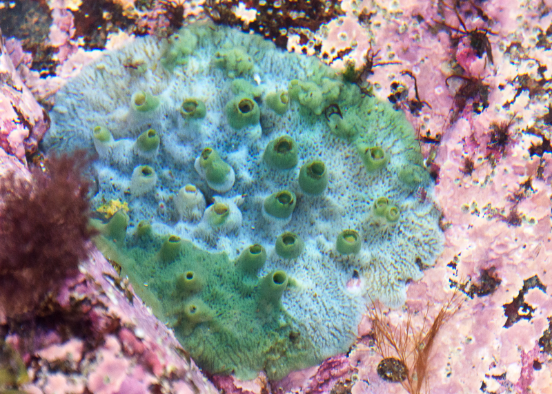
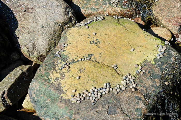
Some kind of polyp, possibly a sea anemone. Anyone know?

J: It made me worry about the lobster industry. There are a lot of parallels there.

T: One of the things John Gillis says that really stuck with me is he was hiking in California at a seaside park and there was this warning sign at the edge of a cliff that said “Never turn your back on the ocean.”

J: No kidding!

T: And I feel like the whole generation is turning its back on the ocean; I think when people visit Acadia it’s very important for them to get out on the water. We’ve given up a whole lot of working waterfront to big homes and that’s a loss.

J: It’s a kind of diversity that’s going. You know, coming through Otter Creek and reading the history there … I’ve always been an unequivocal fan of the park. I think it’s amazing; I’m so grateful that it exists. But that was the first time I ever really saw that there was a cost to it.

T: Yeah, I agree, I think we’re conflicted, aren’t we, that we appreciate what was done, but … [We got distracted by sea stars.]

J: There’s one there, there’s one, oh my god they’re all over the place, there’s one back there, there’s one clinging to this rock here. I’m starting to worry that I’m going to step on one of these guys!

T: If there hadn’t been a park here

J: It would look like Lake Winnipesaukee.

T: It would be so much worse.

J: It would be lawn all the way to the ocean. … [Splash.] Oh crumbs. Yeah, now I’m really wet.

T: How’s the water?

Northern Sea Star, Asterias vulgaris

J: Chilly. Oh my gosh, look at all the starfish here. I wonder why they’re upside down like that.

T: They don’t look so good.

J: No, they don’t. … Well, I’ll have to ask my friends … on Facebook: ‘How come all the starfish are upside down?’

T: And as far as we know that’s just the way things go. I assume they’re dead, yes?

J: I can’t tell. Their little feet are still sticking out, the little suction feet. That one looks alive. It’s still moving. … This one’s still moving.

Northern Sea Star, Asterias vulgaris

Digression: About a month later I was leading a class at Schoodic Institute and mentioned this puzzle to Hannah Webber, who’s the Education and Research Project Manager over there. She thought it was most likely that the sea stars had been exposed too long and had run out of internal water. once they were back in the water they’d be fine.  See, sea stars have an internal hydraulic system that runs their vascular system and also operates their tube feet. The usual explanation of how sea stars grip things is that their hydraulic system creates suction in the ends of their tube feet. However, some recent studies say their grip comes from adhesive chemicals rather than suction.  Either way, it’s possible that if they had been out of the water too long, then they might have lost too much internal water to operate their hydraulics and just started to lose their grip. We were brainstorming ways to test the theory – maybe this summer… I’ll let you know if I find out more. And now, back to our regularly scheduled program:

T: Did you see the crab hidden under the rock?

J: No, missed that. Oh yeah!

T: What a great lair. It’s waiting for someone to swim by.

[Just to give you some sense of what it’s like down there, the whole recording is laced with sounds of trickling water, with conversation drowned out by the occasional wave breaking over the rocks, or the sounds of pants sliding over seaweed.]

web-_DSC0270-Edit

T: Look at the short distance we’ve covered!

J: I know! But look at everything we’ve seen.

photo courtesy of the Mount Desert Island Historical Society

Shallop model by Duane Muzzy. Photo courtesy of the Mount Desert Island Historical Society.

T: We just got a model delivered to us, a fellow named Duane Muzzy is a boat model maker who lives in Saint Augustine and … he offered to make boat models for us. The first one we had him make is a chebacco boat, a two-masted forerunner of the schooner. That was a very common working vessel in the 18th century and now he’s just delivered a shallop, which was a kind of a long, broad, working boat that was actually made to be split in half and nested, and carried across the Atlantic on a larger vessel, and then re-assembled and used to explore inland waters or off the shallow shore.

J: Split in half long?

T: Crosswise and then nested and put in the hold

J: Oh wow!

T: And it’s meant to represent Champlain’s shallop, [and provide] historical perspective of this place, looking down the Eastern Way. If these rocks could talk, the history that’s gone on in this waterway. This is the route to Europe, and the Atlantic, and the West Indies. Just imagine this … the type of vessel that came in here to explore the shore. Indians used shallops, too. They would acquire European vessels, … and there was a competition to get offshore and meet fishing vessels for trade. To meet the Europeans out on the water, to be there first. A version of it was also used as a whaleboat by Basque fishermen who preceded people like Champlain in the 16th century, the mid-1500s.

J: So it’s pointed at both ends, is it?

T: Yeah, it is pointed at both ends, and there’s sideboards, on each side, kind of like an outrigger. It doesn’t have a keel, but these boards on the outside keep it stable in the water.

J: So is this [model] at the Sound museum?

T: Yes, this is at the Sound Schoolhouse. We just received it. … [In the past] we focused a lot on the first Euro or English settlers, and we’re trying to cast back a little farther, to look at an earlier history, and into that borderland of the tidal zone and kind of this challenged, unsettled place where nobody really knew who owned it, people were trying to claim it. … There’s also that poignant story of the French missionaries in 1614 who were at Fernald Point, possibly, we can’t be certain of their location, but … they had set up their settlement for about 6 weeks, you know this story, right? And they would’ve sailed right by here; some of them were killed, some of them were captured and taken to England for trial for what, trespassing? For setting up a settlement in defiance of the English king’s claim, and … the working men who were just there to do a job were put in boats, possibly like a shallop and sent to start rowing towards Europe, where they met French fishing boats and eventually returned.

J: They just sent them out and said ‘Row back to Europe?”

T: Yeah. They just released them and left them on their own, they had to get out, they had to leave. And the Indians were very sympathetic to them, they tried to help the French. They were dismayed, they didn’t know the French and English wouldn’t get along, they figured they were all Europeans, what could possibly be the problem?

J: That’s just brutal.

T: Scramble up there, or go back down and back up?

J: Either way, there’s good footholds. And no seaweed, right? [Laughter]

web-_DSC0272-Edit

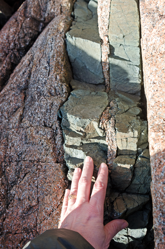
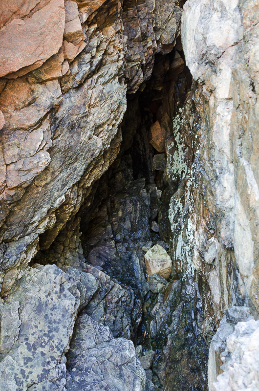
J: You see how the stone’s all pockmarked here? I think what that is, is that when the granite broke up the older stone, bits of the older stone would’ve been floating in the granite matrix, and they were softer, and so they’ve eroded.

T: That would make sense. There was a place in Turkey where there were really intricate rivulets or, what it was was really soft sedimentary rock and bubbles had come up, air bubbles, and you could follow the trail of the bubble all the way down … it was very sharp where the edges had worn away, sometimes the edge where the bubble and the rock met was extremely lacerating.

J: Wow

We paused for a bit to work out the best path forward.

web-_DSC0285-Edit

J: I have to admit there’s a fair amount of backtracking when you’re going off road. Ow.

T: This is a great way to get around, isn’t it?

J: Yeah, you certainly see things!

T: Yeah, it’s wonderful! Oh, there’s a fence up there!

J: There’s a fence over there, too. …

T: So where do you want to go? Do you want to intercept this trail up there? Or go farther along the shore?

web-_DSC0288-Edit

T: That railing goes on and on. I don’t think I’ve been there, I don’t think that’s part of the trail. Maybe there’s an alternative trail that we didn’t take.

J: I’ve never hiked up there at all so I’m not sure.

T: It looks very old-school, doesn’t it? To have a railing like that? It looks like 1890s, 1910 style trail.

J: Very ‘Village Improvement Society.’

T: Yeah, very VIS.

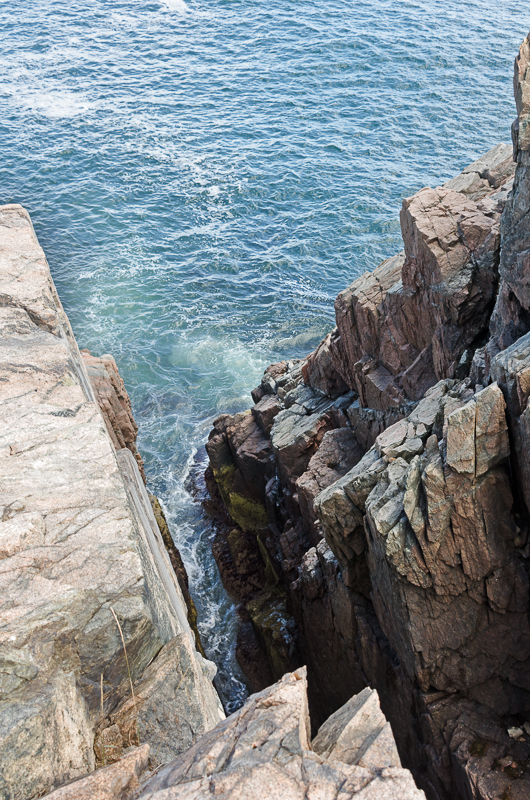
J: It looks like we aren’t going to be able to go any further, there’s a bit of a chasm up ahead.

T: Yeah, so we’ll cut up and intercept the trail? The railing?

J: Yes. Looks like it – there must be some sort of trail up there. … So, let’s head up and see what we find. What time do you need to be at work today?

T: I’m pretty open, I have to be at the Somesville museum at 9:30, that’s my first appointment.

J: OK, so we’ve got a little time.

web-_DSC0290-Edit

J: Oh my gosh, look at this! You want to try and trace this and see where it goes?

T: Yeah, sure. We’ll end up doubling back because it was above us for a while.

J: It’s so beautifully crafted.

web-_DSC0304-Edit

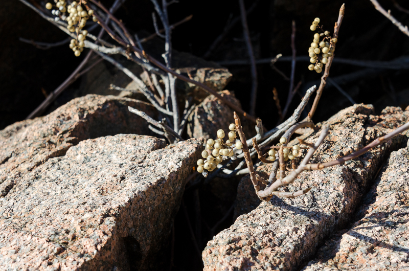
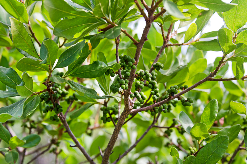
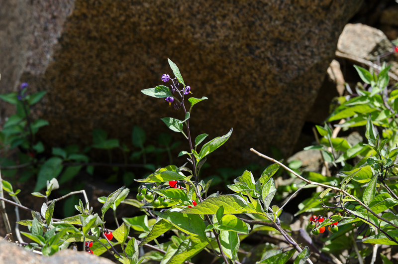
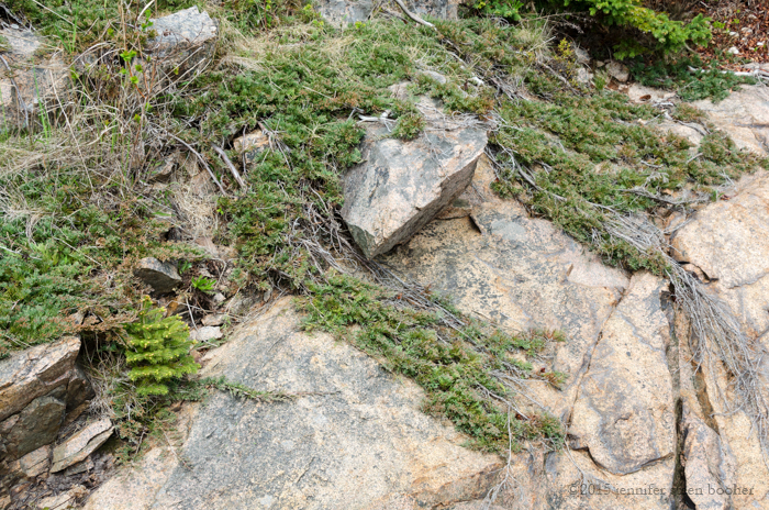
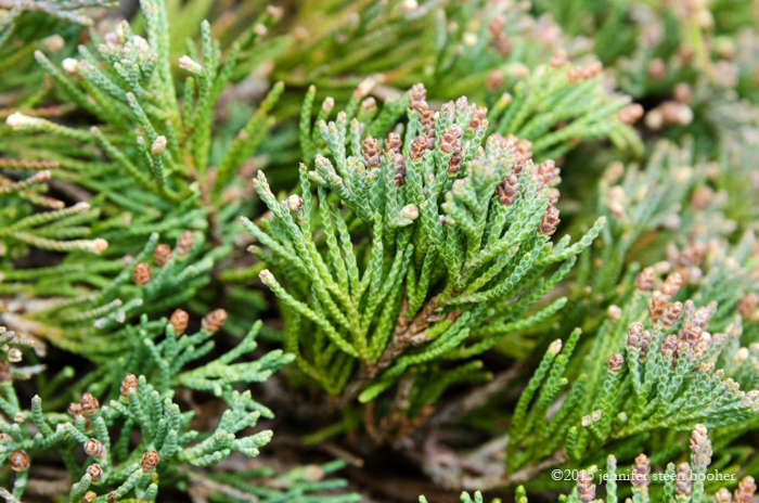
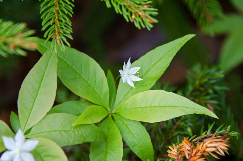
J: Look at the berries [on the juniper].

T: I was astonished when it was pointed out to me that it smells like gin. Or gin smells like this.

J: It’s where gin gets its flavor. Sometimes I think it would be fun to try and make my own.

T: It would! We were at Pineland Farms down in southern Maine, and they were selling a gin-making kit.

J: Well, why not? Beer-making kits are so, you know, last decade.

web-_DSC0282-Edit

J: Look at this fabulous lichen. I am so tickled we found an old trail!

T: You know, Don Linehan would be an interesting guy for you to talk to. And Maureen Fournier. Make it a kind of a hobby to look up all the [lost] trails. They probably know about this one.

J: Somebody’s keeping it up.

T: Yeah, well, you know, it may crisscross with whatever formal trail that’s signposted at the edge of Cooksey. There’s another cairn.

web-_DSC0311-Edit

J: Between the cairns, this path right here has been kept open … there’s another cairn over here.

T: I think this path goes down to the beach. We could retrace it that way.

J: Okay. … It’s such a pretty path. You have to wonder why it was abandoned. Was it pretty much liability along the cliffs?

web-_DSC0292-Edit

[Ed.note: it turns out we stumbled onto the remains of the old Seal Harbor Shore Path, which you can read about in this excellent post on the Memorials of Acadia National Park blog. To summarize, it appears to have been built around 1896, and ran for about a mile from the Crows Nest property to Hunters Beach. Cooksey Drive, then called Sea Cliff Drive, had recently been built by William Cooksey, a real estate developer, and the path was built to provide shore access for the landlocked lots in his development. (See the blog posts for information sources.) It seems to have fallen out of use in the 1950s, and all of it except the portion we hiked here is now private property.]

web-_DSC0298-Edit

T: [In the next issue of Chebacco} we’re trying to reflect on the history of Acadia National Park from a borderlands perspective, and that borderlands is pretty loosely defined, but one way to look at it is a place where domains overlap and there’s a presence in the middle of those overlapping domains, and there’s  a history to be told there. You know, there can be a natural history and a cultural history of the shoreline and based on what you’ve seen, what’s become of it over the last century, or the last 10,000 years, or what will become of it in the next hundred years. One of the articles we’re trying to find somebody to write is about the borderland of the present, the borderland being the place where the past and the future overlap. I think that would be a lot of fun to write, because there were a lot of projections a century ago of what the future would be a century ahead so we can look back on those past predictions and see what they missed and where they were on target and then prepare to be foolish ourselves a hundred years from now when people come back and look at our predictions for a century out.

J: Because we can’t even imagine.

J: I think we can go this way.

T: I think either way gets back to Cooksey Drive, that by way of Hunters Beach.

J: Ok, have you been up this way?

T: We descended this once. And it was variable. Sometimes the path wasn’t completely certain. It’s not a Park path, … a VIS path, I guess.

J: It’s beautiful! Which way would you like to go? I’m good either way.

T: Let’s go the way we haven’t been.

web-_DSC0306-Edit

T: I guess I don’t know where I’m going, I don’t know where this path leads.

J: This is called serendipity.

T: OK, well let’s go ahead. Look, somebody’s trying to help us out here. So the articles that are shaping up so far are, the lead article might be one by Bill Horner, do you know Bill?

J: I do

T: … More of an op-ed piece …, the working title is History Trust, or Historical Trust, in which he likens history to air or water, a resource to be shared by everyone. A century ago people looked at their domains and decided they ought to be held in trust for the public good and shared with everybody, and … historical societies … are not there yet, we’re holding our collections and often requiring the public to navigate our crazy boundaries. A researcher trying to discover the history of any aspect of this island needs to work across organizational lines, no one organization has the history that’s needed.

J: Yes!

web-_DSC0308-Edit

T: And the onset of the digital age holds the ability for these historical resources to be held in common, and there’s also a need to protect them, especially from fire and climate. Lest they, you know, turn to ashes or rot. And Bill is advocating for a historical trust …, first to enable these organizations to digitize and … properly catalog and preserve their records. And perhaps ultimately to hold them in common. So that’s the lead article. We have Betsy Hewlett writing about a Scottish gardener who came here and worked for George Dorr, worked for Beatrix Farrand, and then was one of the founding gardeners … for what’s become the Island Land and Garden Preserve. …The borderlands there are the mixture of designed landscapes with the natural landscape, and his role in that as an immigrant coming to find his way, and the new-found profession of gardener, that actually replaced sailor and fisherman as the primary occupations for MDI people. …

T: So we’re talking about anywhere from 8-10 articles, I think. … That will be our Centennial issue – the borderlands history of Mount Desert Island.

J: That’s really exciting.

web-_DSC0313-Edit

T: It’s fun to have that focus. I think it’s unique, too. It requires a pretty big commitment on the part of a lot of people to get it done. Like publishing a book each year.

J: Well I’ve found some of your back issues are really useful references. I’m pretty sure it was one of your back issues that I read about the mountain names in.

T: The mountain naming controvery? Yeah.

J: Down this way? I think it’s a path.

T: Looks like it, yeah. Sounds like it. [waves on cobbles in distance]

web-_DSC0315-Edit

T: We’re going through a transition in editorial and production of it. Emily Beck has been the editor but it’s a monumental job. For somebody who works full time, it’s a tremendous sacrifice on her part and she’s at a point where we really need to go at it in a different way. So I’m going to sit down with Earl Brechlin in a couple of weeks and get his ideas on who we could talk to and how one does publishing. Who should we talk to about being the editor and being responsible for every last typographical error. Someone to be the managing editor and coordinate all aspects of it from the line editing to the design to the printing process.

J: Someone fairly meticulous.

web-_DSC0325-Edit

T: Why did you stop landscape architecture?

J: A whole bunch of things happened at the same time. I was having health troubles, and I had two toddlers, well not toddlers, my youngest had just started kindergarten, and I was missing them growing up because I was working in the construction industry – [I spotted poison ivy growing up a tree] oh, don’t touch that! Woah, that is the first time I have seen that on the island. Yeah, so between the kids, and the health issues … . So that’s where that path goes! Neat. … Did I answer your question?

T: Yeah, a transition. I had a very similar experience. Oh my god what a big difference it’s made.

J: Yeah, and sometimes you do just need a change. I’d been doing landscape architecture for almost ten years

T: It’s easy to say as a hobbyist without having to rely on it day after day, but I think some of the most satisfying work I’ve ever done was laying a brick patio and brick pathway. Just this enormous amount of labor and digging a trench, laying down brick, and I know there’s a lot that’s unappealing about that work but man, it was satisfying. Each brick had a tremendous cost to it in how much work it took to find a place for it, but it was so satisfying to see it completed. At the time I was doing this administrative work where you could labor all day and not see anything … come of it, and it was such a contrast to have that simple path.

J: There were things that I loved about it. I didn’t actually do the construction part, I was the designer and I managed the construction projects, so I found it incredibly stressful having the responsibility for getting it built without having control of the money to pay the contractors or over the contractors’ actual schedule. I was kind of stuck in the middle between client and contractor. And the smart contractors knew that even though I wasn’t actually paying them directly they needed to stay on my good side because I controlled all the jobs they were getting. But a lot of them didn’t. And those I didn’t work with more than once.

web-_DSC0300-Edit

T: Well I converted from being a hospital CEO with a few hundred people under my, you know I was responsible for the organization; to [working] for the Census for a time, riding a mountain bike to all the empty properties in Southwest Harbor to certify that nobody was present there on April 1, 2010; to working for the Park where I was an interpretive ranger and reported to 6 or 8 or 10 levels of the US government, and you know, was at the bottom of the pile, to going to the historical society where I was the sole employee, and learning which way the letterhead needs to go in the printer. And how does one put an address on an envelope? You know, like how do you feed an envelope into the printer and make it come out right? You do all those tasks. And … we now have 5 employees and there’s an organization to be managed and I find myself wondering ‘Now what is my job exactly?’ You know, what am I supposed to be doing from one minute to the next now that I have all these people?

J: That must be really exciting! Growing that way.

T: It’s wonderful. To be able to do the kind of work you love and I never get tired of it. The research is my favorite part, the writing. …


T: When I was a ranger, I was taking people on tours of [inaudible] Mountain, and I wanted to describe to them the kinds of people who lived along the road, and [inaudible] the cemetery and there was this tombstone that said “John M. Gilley, Company C, First Maine Cavalry Regiment, fell at the Battle of the Wilderness, May 5, 1864, age 45.” And I started to research that, and developed this whole biography that I published in Chebacco, and learned that this guy hadn’t fought at the Battle of the Wilderness, his company was 20 miles away, and on May 5 he was wounded and captured, and probably died about three weeks later, and he was age 45 …,, as his tombstone accurately stated but the army thought he was 7 years younger because he lied about his age to get into the cavalry. I learned all these things about him: he built the pro shop at the Causeway golf club, he helped build the Union Church in Somesville, he was a prominent citizen of the town, but chucked it all, sort of the ideal patriot, left everything behind – his wife, his farm, everything he had – to become a soldier. I learned a lot about him … and there was this moment when they sent me his photograph; out of the thousands of people who served in the war only a few thousand of the photographs are identified, and all of a sudden I came face to face with this guy. It was really a stunning experience to have learned so much about him and to kind of meet him.

J: It’s like a treasure hunt, when you find things in the archives.

web-_DSC0319-Edit

And then, boom, just like that we were back at the parking lot saying goodbye. Thank you so much for hiking with me, Tim!

I’ve got two more posts to write, and that will bring us around the point into Seal Harbor Beach, and we’ll be up to date at last! I hope that my hectic family and work life will slow down at the end of next month and I’ll be able to concentrate on the Coast Walk again. If you’re getting impatient with my rate of progress (god knows I am!) there’s something you can do to help.

The two things that slow me down the most are getting permission from property owners and transcribing the interviews. You can’t really help with the first one, but you might be able to give me a hand with the second. Part of the problem is the audio quality – half the conversation gets drowned out by waves or wind or the sound of my camera shutter, or the sound of snowpants scraping over barnacles – that one is amazingly loud, and I spend ages playing the same phrase over and over trying to decipher it. I’ve been reluctant to get microphones because I’m worried that it will feel too formal, but there’s no way around it. Good quality audio will save me hours.

But the thing is, good-quality wireless microphones run about $100 apiece, and the Coast Walk is a ‘labor of love’ which is a roundabout way of saying it’s self-financed. There are a few other things that could help: certain software, for example, and I need new snowpants for next winter (shredded mine on the barnacles, they’re basically made of duct tape now). So if you’re enjoying the Walk and you’d like to help out, I’ve put a ‘donate’ button on the blog. It works with Paypal, but you can use a credit card there.

The Coast Walk is not a non-profit, so the donation won’t be deductible, you just get the joy of knowing I can deliver posts a little faster!

__________________________________

Addendum

8/28/16

I found a couple of photos of the Seal Harbor Shore Path in its heyday. No date on them, I’m afraid, but the woman’s dress looks 1900-ish.

Photo courtesy of the Seal Harbor Library. Dunham Collection No.579

Photo courtesy of the Seal Harbor Library. Dunham Collection No.579

Seal Harbor's Shore Path. Photo courtesy of the Seal Harbor Library. Dunham Collection No.578

Photo courtesy of the Seal Harbor Library. Dunham Collection No.578


Save

Share

Coast Walk 10 Still Life


Coast Walk 10: Otter Cove (East Side) May 11-20, 2015


Top to bottom, left to right:
1st row: Fucus sp. covered with bryozoan colony (Membranipora membranacea), driftwood, aluminum Schlitz can top
2nd row: Fucus sp. with Spirorbis borealis, aluminum can top, Horse Mussel (Modiolus modiolus) with Barnacles (Semibalanus balanoides), Green Crab (Carcinus maenas), Jonah Crab (Cancer borealis), Slipper Shell (Crepidula fornicata)
3rd row: wax covering for Baby Bel cheese (or similar), Slipper Shell, Smooth Periwinkles (Littorina obtusata), Horse Mussel with Coralline (Corallina officinalis), Common Periwinkles (Littorina littorea), aluminum can top, Common Periwinkles
4th row: Kelp holdfast, sea glass, mashed fish skeleton, Horse Mussel with Barnacles and Coralline
5th row: aluminum can top, Northern Toothed Polypore tree mushroom (Climacodon septentrionalis), Common Periwinkles, Horse Mussel with Coralline, brick fragment, coal fragments


Points of interest:

-It takes a long time for an aluminum can to degrade – those beer and soda can tops have been in the ocean for about 25 years.

-That weird yellowish thing in the 2nd column from the right is a fish skull. I only know this because if you look very closely at it you can see half a jaw with tiny teeth. I’ve no idea how it ended up so thoroughly flattened and dried out. It looks like Godzilla stepped on it.

-These are some of the biggest barnacles I have seen in Maine!

-There’s a first time for everything, and this was the first tree mushroom I’ve found on a beach. It took a long time to dry out.


Share

Women’s History Month


March is National Women’s History month, and the libraries around the island are hosting a series of art shows and lectures to celebrate. My friend George has been working on a series of environmental portraits (photos of people in their workplaces or places that are special to them.) He took this photo on a Coast Walk in Seal Harbor back in December, and it will be part of the Women’s History Project show at the Southwest Harbor Library.  The opening reception will be Tuesday, March 8 from 5:30-7:00 p.m. You should come!

And you can see more of George’s environmental portraits on his website: www.georgesoules.com


Share

Coast Walk 12: Blackwoods to Hunters Beach

web-0132-Ranger_talking_to_campers

“Ranger talking to campers,” Photo courtesy of National Park Service, Acadia National Park, Catalog #ACAD 29258


CW12map

May 27, 2015: noon-3pm. 71 degrees, sunny, strong breeze, light clouds.

web-_DSC9411-Edit

Walker: Brian Reilly, Senior Consultant – Natural Resource Assets, Cardno

On a gorgeous morning in late May, Brian Reilly and I parked at the Blackwoods Campground (a perk of being an Artist-in-Residence) and started strolling down the camp road to the shore. We’d met a couple of times, once through the Frenchman Bay Partners and again at a friend’s party, but all I knew was that he was an outdoorsy person doing something vaguely environmental for a living. Brian turned out to be a strong and adventurous hiker, which was a good thing given the steep terrain we found on this hike!

Before we start the narrative proper, while Brian and I are still wandering around the access roads looking for the path to the shore, let me fill you in on my research. [My main sources were: Cultural Landscape Report for Blackwoods and Seawall Campgrounds, H. Eliot Foulds, Acadia National Park, National Park Service, Boston, 1996; and Presenting Nature, The Historic Landscape Design of the National Park Service, Linda Flint McClelland, National Park Service, 1993.] 

Image from Foulds , Cultural Landscape Report for Blackwoods and Seawall Campgrounds, 1996.

Image from Foulds, Cultural Landscape Report for Blackwoods and Seawall Campgrounds, 1996.

The first public campground on MDI was on Bar Harbor’s Athletic Fields, down at the end of Ledgelawn. Before it was either the Athletic Fields or a tourist campground

web-IMG_7675

Image from Foulds, Cultural Landscape Report for Blackwoods and Seawall Campgrounds, 1996.

it was one of the last Wabanaki communities on the island. This is where they went when development pressure drove them off their traditional campsite above the Bar (we talked about that on Coast Walk 1.)

web-IMG_7682

Image from Foulds, Cultural Landscape Report for Blackwoods and Seawall Campgrounds, 1996.

For various reasons, mostly aesthetic, the Park (aka George Dorr) developed a public campground, this one officially part of Acadia, near the old racetrack at Robin Hood Park (also called Morrell Park) around 1927. According to Foulds, Bear Brook was “typical of national park campgrounds of the 1920’s, … campsites and parking were provided randomly at the edge of clearings or in areas where the forest understory had been removed.” Basically, you drove in, parked next to the road, and pitched your tent wherever looked reasonably flat. You know how my mind always boggles at some point during a Coast Walk? Coming right up…

web-IMG_7698

Image from Foulds, Cultural Landscape Report for Blackwoods and Seawall Campgrounds, 1996.

Those random campsites in all the national parks led to – surprise – cars parking on tree roots, compacted soil, dying undergrowth, erosion, and general deterioration of the camp area. E.P. Meinecke, a forest pathologist with the Park Service, analyzed a lot of these failing campgrounds in the late 1920s, and came up with a series of recommendations.

This is the mind-boggling moment. Picture a car-accessible campsite – any campsite, pretty much anywhere in the world. There’s a place to park; there’s a relatively flat place to pitch your tent; there’s a place for a fire; and there’s usually a picnic table. That didn’t just happen. It was designed. By E.P. Meinecke. In the late 20s. I don’t know about you, but I totally take campgrounds for granted. Like toothbrushes. Or wheels. They just seem sort of obvious, and it’s really weird to imagine a time when they didn’t exist. Meinecke’s ideas were codified in the Park Service design manuals and incorporated in all NPS campgrounds from that point forward, from which they spread pretty much everywhere.

web-IMG_7685-ed

Image from Foulds, Cultural Landscape Report for Blackwoods and Seawall Campgrounds, 1996.

Before Meinecke invented the campsite (and why, we should all be asking, is there no E.P. Meinecke Day celebrating this?), you just pulled over and camped wherever. Because see, before the 1920s, car-camping didn’t exist. For the most part, only wealthy people could afford to take a train out to a National Park and stay in the hotels there or hire a guide to take them out to the back country. Then cars became common in the middle class, and suddenly everyone could get to the parks. And in the early 1900s, the Fresh Air movement, the Boy Scouts, the Girl Scouts, the YMCA and Teddy Roosevelt had all spread the popularity of camping and outdoor activity.  So you had a lot more people wanting to camp, with the ability to reach the parks. Which was awesome, but also a conundrum that the Park Service is still trying to solve: how do you provide access for everybody (which is part one of the NPS’s basic mission) while preserving the resource (which is part two)? [P.S. You can read more about Meinecke and campground development here.]

web-IMG_7717

Image from Foulds, Cultural Landscape Report for Blackwoods and Seawall Campgrounds, 1996.

Anyway, in 1932 Bear Brook was renovated using Meinecke’s principles. Poking around in the Park archives, I found a letter from the 1934 campground ranger setting out all the details of his job – how to welcome campers, when he allowed campfires, organizing talent shows and naturalist programs … it’s awesome!

webIMG_7742

At the end of the letter was this tally sheet of all the campers in 1934 showing profession, annual income, how they arrived – all kinds of stuff! Looks like most campers in 1934 were “professionals” (I assume they mean doctors, lawyers, and so forth) making more than $2,000 a year, on their annual vacation, which was two or three weeks (practically nobody checked the ‘one week’ box), and arriving by car. Cool, huh?


Photo courtesy of Acadia National Park Archives; “September 13, 1934 Report of Campground Ranger for summer season 1934", Box 74 , folder 3

Photo courtesy of Acadia National Park Archives; “September 13, 1934, Report of Campground Ranger for summer season 1934″, Box 74 , folder 3


Photo courtesy of Acadia National Park Archives, Catalog #ACAD 29539

Photo courtesy of Acadia National Park Archives, Catalog #ACAD 29539

I found the photo above in a fairly random box of photos in the ANP Archives. It was only labeled “Hikers on Lookout over campground.” I think it must be Bear Brook, because there’s no pond at Blackwoods and I can’t think of any big hills around Seawall. The Bear Brook campground was closed and converted to a picnic area by 1962. And I think that’s probably plenty of time spent talking about a feature that isn’t even remotely on the path of the Coast Walk! Let’s get back to Blackwoods.

webMap1893EdwardLRandDetail

Blackwoods trivia: The earliest map I’ve seen that names this area (1893, above)  calls it “Dark Hill.” I read somewhere that it was named for the spruce forest that covered it, but I haven’t been able to find that reference again. By 1911, it’s labeled “The Black Woods:”

Map1911WHShermanDetail


John D. Rockefeller, Jr., who has snuck into pretty much every frickin’ post since we rounded Otter Point, financed a private campground here that opened in 1926. According to Foulds, “Another subtle yet important political benefit of the Blackwoods site was the campground’s isolation ‘from the finer residential sections of the summer people’ which were located near Bar Harbor and Seal Harbor.”

The country sank into the Depression years, and when FDR took office there was a flurry of activity that resulted in two Acts directly influencing our story. The first, the Federal Emergency Relief Act (FERA), which was designed to help families move off Dust Bowl lands, started designating “submarginal lands” (in order to help people escape them.) In one of those rare moments of bureaucratic brilliancy, FERA ordered the Park Service to find any recreational potential in those submarginal lands, which were to be developed as “Recreational Demonstration Areas (RDA).” Guess where Blackwoods and Seawall came from?

web-1327-pulpwood_operation_at_blackwoods

“Pulpwood operation at Blackwoods.” Photo courtesy of National Park Service, Acadia National Park, catalog #ACAD29539

The second was the establishment of the Civilian Conservation Corps in 1933. MDI got two CCC camps right away –  NP-1 was set up in May of 1933 on McFarland Hill in Bar Harbor, and NP-2 was set up on Long Pond in Southwest Harbor in June. They started work on the Bear Brook renovations in 1933 and on Seawall in 1935. Finally in 1937 the CCC started surveying and clearing land for the Blackwoods campground.

web-IMG_7706-NOTES

Images from Foulds, Cultural Landscape Report for Blackwoods and Seawall Campgrounds, 1996.

Blackwoods’ early layout was planned to accommodate trailers as well as cars. Rather than a spur for parking a car, Blackwoods sites used  “bypass”  and “link” designs which allowed the car and trailer to drive off the camp road, park, and drive back on without turning around. The initial plan was ambitious, and would have provided about 400 campsites (Seawall only had 63) and much of it was never built.

When World War II broke out, it diverted funds and labor away from the CCC, construction slowed, and as gasoline rationing was imposed, tourism declined as well. When the CCC in Acadia was disbanded in 1942, Blackwoods was not operational. Campground construction basically stopped, resuming after the war when tourism surged again. Blackwoods’ Loop A finally opened to the public in 1946, and the Fire of ’47 promptly redirected all park money and personnel to clean-up. In 1949, only the Bear Brook and Seawall campgrounds were being publicized. Over the next few years comfort stations and the amphitheater were built. In 1956-61 the second campsite loop at Blackwoods was built, abandoning the bypass-style campsite for the spur type – you can see the changes comparing the design with the as-built in the plans above.

Image from Foulds , Cultural Landscape Report for Blackwoods and Seawall Campgrounds, 1996.

Image from Foulds, Cultural Landscape Report for Blackwoods and Seawall Campgrounds, 1996.

“President Eisenhower appointed the Outdoor Recreation Resources Review Commission (ORRRC) in 1958 … . The ORRRC was given the broad charge to propose a national agenda for outdoor recreation and conservation …  The sensitivity of the ORRRC report toward private vendors of recreational services and opportunities, may explain why bathing and laundry facilities were not developed at either campground … . Although these facilities were originally planned as a part of campground development, local vendors of campground services had filled the vacuum caused by the lack of on site facilities during the postwar vears.” And so the Otter Creek Hot Showers are still with us.

web-IMG_7710

Image from Foulds, Cultural Landscape Report for Blackwoods and Seawall Campgrounds, 1996.


Although most of Blackwoods was built post-war, the remaining pieces of the CCC installation qualified it for the National Register of Historic Places: Loop A, “five historic comfort stations,” the entrance drive, and the camp court. [Foulds, 1996] Is anyone else juvenile enough to giggle at the idea of historic toilets?

Maybe I should just get back to the day’s travels…

web-0128-Blackwoods_campers_with_string_of_pollock

“Blackwoods campers with string of pollock.” Photo courtesy of National Park Service, Acadia National Park, Catalog #ACAD 29258

Brian: I hardly ever come in to Blackwoods
Jenn: No, me either. I’ve been here once for a Boy Scout campout.
B: Yeah, that’s why I’ve been here. Now you’re not a Boy Scout?
J: No, I was a Den Mother. My husband was actually a leader, what do you call it
B: Pack Master, Pack Leader
J: Yes, Pack Leader. This was Cub Scouts. We didn’t make it to actual Boy Scouts.
B: That is so too bad, because, so I was a Scout Master, I was a Cub Scout, I was an Eagle Scout, or I am an Eagle Scout.
J: Awesome! No kidding.
B: I was a scout leader in Illinois when we moved here, Cub Scout, and then when we moved here became a scout leader in Northeast Harbor. And I was the scout leader for many years in Northeast Harbor and now I’m actually still involved in the district. … I’m the committee chairman. And it’s so too bad, because so many kids get burned out in Cub Scouts, that they don’t go on to Boy Scouts. And Cub Scouts is great but Boy Scouts is so much more fun.
J: Well, how should I put this, Christopher made it into Boy Scouts, and was still having a good time but there was that whole thing with homosexuals [a controversy within scouting leadership about whether gay youth and leaders should be allowed to participate], there was that whole flare-up, you know, five, six years ago? And the leadership of the troop in Bar Harbor had very different opinions about that than Brian and I did.
B: Oh, okay.
J: And we didn’t actually have a falling out with them, we tend to be somewhat diplomatic, but it cut down on my personal enthusiasm for the whole organization.
B: Sure. That’s too bad. … And I don’t know what your beliefs were or anything, I know that when we started the troop in Northeast Harbor, so I re-started the troop, … and remember I was From Away, right? So I’m the guy from away who’s starting a Boy Scout troop, they don’t know me from Adam, so I had to kind of call up and chat with the guy who ran the troop before me, Bill Ferm, wonderful guy, and he basically asked me what my thoughts were on homosexuals and religion in Scouts. And my personal opinion was I didn’t care. I don’t care. You believe in what you want to believe and as long as you respect other people’s beliefs, there you go. … And he said, ‘Great, here’s the key to the, here’s the checkbook,’ basically, and there you go.
J: That sounds a little more inclusive. Our troop actually had a disagreement with the Congregational Church and moved over to the Baptist. That was the point at which I started feeling, ‘It’s okay if you don’t want to go to Boy Scouts anymore.’
B: I don’t care. As long as the boys, [you] teach them to respect other people’s opinions and to respect other people and to respect themselves and have a good time.
J: That’s where I am. I don’t think people need to be left out.
B: Oh god, no! No, we didn’t leave anybody out. We were very inclusive. And then we had some people who were very religious and some people who were very atheist. And that was a delicate balance. Cause the religious people would like to say a prayer and we had to respect that, but then we also had to respect that we couldn’t go over the top. And you know there was a little bit of checks and balances on the leader’s part. We had to make sure that everyone felt included.
J: That sounds like a much more sensible approach.
B: Yeah, we were kind of a non-typical troop.
J: Yeah, it’s a shame because it’s a great organization.
B: But we took all the boys in, half of them became Eagle Scouts, no one’s in jail.
J: That’s how you know you’ve succeeded, right?
B: That’s where I’m at!
J: I was a Girl Scout. I was a Girl Scout up until, I made it through the Junior level. [Nope, I was a Cadet when I stopped.] But then I went to a different school and couldn’t make the meetings anymore or I would probably still be a Girl Scout.
B: I liked the Boy Scouts. When I was a boy … I went for a time when we had a bad leader so I dropped out for a while and then I joined a different troop. We went camping, like wilderness camping, white-water rafting; the troop that we had here, we treated it like a high adventure troop, so we didn’t have a trailer, we never car-camped. If we wanted to go camping we carried everything on our back. We hiked in several miles and we went camping.
J: Awesome!
B: They didn’t like Camp, they didn’t like Boy Scout Camp because it was too programmatic, so when we went camping, like for our long term camping, … we went down the Allagash for a week, or we went and hiked the AT for a week [ed.note: Appalachian Trail] and that was our Boy Scout Camp.
J: That’s amazing.
B: Yeah. So I kept the boys in all the way through senior year of high school. From 5th grade through senior year of high school.
J: That should go on your résumé. That’s like a life achievement.
B: We had great, great kids so it made it really easy. God, look at this weather!

Otter Cove, Acadia National Park, Maine, looking out to Baker Island and the Cranberries.
J: So this is where I stopped last walk, and it looked like we had a series of outcrops and then small bouldery beaches coming up.
B: OK. Do we walk down at the water? You’re the leader, I’ll follow you.
J: Usually I like to get down as close to the water as I can, but scoping this out, let’s just see. I also know that in this kind of terrain I have got about two hours of energy. So. It looks like there’s a point there where there’s like a bouldery beach kind of thing. I’ll bet it would be easier to get down right there, so let’s walk along the top right to there and then go down and then go along the shore from there. Plan?
B: Plan!

web-_DSC9431-Edit
B: … We could go that way and that would get us closer. We couldn’t go that way anyway because there’s a giant, um,…
J: Cleft?
B: Yeah
J: Yup. We could go around the outside, it’ll be easier.
J: Hey Brian, hold on. Sorry. The camera slows me down a lot. … [Sounds of scrambling, some swearing, and I guess we backtracked a bit where I couldn’t get through.]  I don’t know if I mentioned this but the first rule of the Coast Walk is ‘Don’t die.’
B: Oh, good!
J: So don’t break my rules, ok?
B: So when my field teams go out I give them all certain rules, too. ‘Be safe’ is the number one, ‘Have fun,’ and then actually because I deal with oil spills, it’s ‘Don’t eat the oil.’
J: Eew
B: Have fun, be safe, don’t eat the oil.
J: So, are you doing logistics for cleanup? Or you actually out in the field cleaning?
B: Fortunately I don’t actually clean, I deal with what they call ‘natural resource damage assessment’ so I figure out how bad, how much impact did the oil spill have on the environment. And then we come back in and restore the environment to compensate for any damage. So if an oil spill impacts pelicans, say, we have to come back in and maybe make new baby pelicans to bring the population back up to baseline.
J: So like breeding them in captivity and releasing them?
B: No, you find out what the limiting factor is; like for pelicans it’s space to breed. They breed on islands, so what you do is you build an island.
J: Oh cool!
B: And when you build that island, pelicans will come back and breed there and you get credit for the new pelicans that are born there that wouldn’t have been born otherwise.
J: You know I never thought of it as … it’s like a ledger, like accounting, inflow and outflow.
B: We count it as debit and credit.
J: That’s the words I was looking for.
B: That’s exactly what it is. And I work with economists every single day to do that accounting. So there’s a pelican debit, and we create a pelican credit, and when the two equal, we’re done.
J: So are you working on the spill in California now?
B: No, in fact I thought I was going to have to go out there but I’m not. There’s only a couple of firms that do what I do, but they happened to hire a different firm if you can believe that. So I’m not on the California spill. I do a lot of work in the Gulf. I recently had a spill out in Illinois, [and one in] North Dakota.

web-_DSC9428-Edit
J: I keep thinking I should hand everyone who walks with me a 4 pound piece of glass, so I can keep up to them.
B: I thought about bringing a camera, I thought about bringing binoculars, and I’m glad I didn’t do either.
J: It’s so much easier with two hands!
B: If you want me to carry anything or need any help let me know.
J: Naw, I need to carry my own camera and the other stuff is on my back where it doesn’t matter.
B: [Looking over the edge of a deep cleft barring our way] I think this might violate your rule of dying, so maybe go up and around?
J: [Sighs] Let’s see. No good. [We climbed around the edge of it.] It smells good to wade through, though. The sweet fern. There’s the road again.
B: I know we want to avoid the road, should we head back down that way?
J: Yeah, actually, let’s do that. Lot of up and down today, huh?
B: When you have to walk back, how do you walk back? On the roads?
J: Yeah, I take the easiest route back.
B: So when you’re done with the project, what is the plan?
J: Write a book. I mean I’m writing a blog as I go, which is really helping kind of pull stuff together, but I think it’ll make a great book, the question is gonna be how do I fit it into a reasonable size book? There’s so much information.
B: It’ll take you a year, right?
J: [Laughs] More like three.
B: Three years? Oh my god Jenn, hurry up, walk!
J: Well there’s this making-a-living thing, you know?
web-_DSC9460-Edit
J: I’m going to go around and see if we can get down that side.  … Nope. it’s pretty sheer. But I think we can get down that. …
B: Bad day to die!
J: Is there ever a good one?

B: Let me know if you need a hand.
J: Thanks. I’m getting pretty good at this [climbing one-handed with the camera tucked under my left arm.] This thing on the end of the camera is technically to cut glare … but it’s most useful at keeping my camera lens from smacking against cliffs while I’m climbing. I’ve killed one filter. I keep a clear UV filter on the end of the lens, and I [scratched] one this winter which made me really glad I had it.

B: [Looking down at a possible route to the shore] Right here you were thinking?
J: I was hoping! No? Does it look do-able from up here?
B: Well, it would be tricky. Could we do it? Yeah we could!
J: Only if we were willing to jump 6 feet!
B: Yeah, we could get over on this way and kind of hug our way down.
J: Let’s check out the next one.
B: I’m thinking the next one is…
J: No, this one’s not looking any better
B: Well down there we could, clearly.
J: What do you think, go through the woods and see if we can get onto that slope-y bit?
web-_DSC9463-Edit
B: So I went to Africa last fall.
J: Oh my gosh, where?
B: Down the Zambezi River.
J: Wow!
B: So we started, we saw Victoria Falls. Oh, we could go right here! Do you think we could do that?
J: No, cause once we got to that jumping off point, it looks like another 6 foot jump to me.
B: I think we need to continue on through here. So we started at Victoria Falls and then went whitewater rafting for three days down the Zambezi. 21 sets of rapids, 10 of them were Class V.
J: Oh my god
B: It was great. That was really amazing. Then we went down to the lower Zambezi where we spent 4 days canoeing with hippos.
J: Oh my goodness! That’s kind of dangerous, isn’t it?
B: Oh it was great fun. Yes! It is dangerous, and yes, it was great fun.
J: Just like the Class V rapids.
B: Yeah.
….
J: [We finally found a passable slope] There we go! God, all the pollen coming off of these things! Whew! [The conifers were shedding pollen like snow.]
B: Gonna be a little bit of a drop but I think we can do it.
J: I’m gonna hand you my stuff.
B: Got it. Yes, there you go, you got a good one there [foothold].
[Sounds of scrambling and plopping.]
J: Okay, I’ll take that back.
B: We’re covered in pollen!
J: Oh my god look how gorgeous that is  …  I’m just getting the pollen off my lens.
B: [Looking out along the shore] Beautiful, look at that. You have a good job.
J: I wish it was a job!

Rockweed covers boulders at low tide off Hunters Point, Acadia National Park, Maine

Rockweed covers boulders at low tide off Hunters Point, Acadia National Park, Maine

B: Okay, you’re the boss, how do we – do you go down closer to the water?
J: Let’s go down
B: So what do you do for a real job?
J: I rent my house out in the summers. And I mean I earn something from photography but definitely not a living. This year I’m going to be giving workshops over the summer, too. [And a couple months after this walk I started working as a landscape architect again, too. I’m with LARK Studio in Bar Harbor.] I think that’s a black-backed gull over there. God they’re huge, aren’t they? Now we just kind of pick our way through the seaweed. Carefully.

Periwinkles and several forms of coralline in a tide pool, Acadia National Park, Maine

Periwinkles and several forms of coralline in a tide pool, Acadia National Park, Maine

J: Look at the colors in here. Between the striped rock and the coralline? That’s so cool.
B: Whoop! It’s a bit slippery!
J: Thanks, I appreciate the warning.

J: OK, I’m going to take your picture now.
B: Really?
J: Yup. Smile.
B: Ok. I don’t know about that.
J: It’s ok, I’ll [pick] the one where you’re not making a funny face and your eyes are open. Although you’ve got sunglasses on, so …
B: I always wear sunglass
J: so it doesn’t matter. I always take 4 or 5 pictures of people because I learned after the first time that someone is going to close their eyes and have their mouth half open.

web-_DSC9412-Edit
B: I love these rocks. My wife used to collect rocks like this that looked like bird eggs.
J: I have so many.
B: I do too, absolutely, they’re all over.
J: People at the Park were a little concerned about my beachcombing in the Park, and they were mostly worried about rocks, and I was just like, ‘You know what, I have way too many rocks already, you don’t need to worry.’
[Wind drowned us out]
J: I’ve actually got an old CD storage thing, it looks like an old filing cabinet but the drawers are just CD-sized, it’s just filled with rocks. Because all our music is digital now.
B: I like the lucky rocks. The striped ones.
J: Yeah, and … when you think about what went into making this?
B: Yeah.
J: Like this is probably the older rock, and this is the volcano coming up through, and then … thousands of years right there just making the rock, and then time for it to fall off and weather …
B: Millions of years old.
J: It’s just kind of mind-boggling when you think about the process of making these. Which I never did before I started this walk. I was just like, ooh, striped rocks! But I’ve been learning about all kinds of stuff.

J: Jane Disney was out [on the Coast Walk] once. She’s waiting for me to get back around to the mudflats.
B: I’m meeting Jane today. …
J: What are you guys working on?
B: The Frenchman Bay Partnership is working on a new tool that my company’s helped develop, which is an ecosystem services [tool]
J: Oh! I was part of that! I came to the [community workshop] at Galyn’s [Restaurant]… That was a very cool thing. [About thirty members of the business community came together to discuss priorities for Frenchmans Bay – aquaculturists and seafood dealers were concerned with clean water and species populations, kayak tour guides were concerned about preserving views and public access, things like that, and Brian’s process helped sort out the concerns and prioritize them, which was a first step in developing a management plan for the bay.]
B: So we’re gonna do that again on the other side of the bay next week. And once we have more information we should be able to take it now to the next level.
J: It’ll be interesting to see if the priorities are the same on the other side.

B: Whoa.
J: You okay?
B: Yup. I would not recommend taking that route.
J: Would you admit it if you were not okay?
B: Yes.
J: Good, just checking.
B: I am well beyond that in my life.
J: … My first reaction after hurting myself is always, “I’m fine, I’m fine” and then, “Um, no I’m not. Maybe I need help.” I mean not right now.
B: I’ll admit, it depends on how I hurt myself.

A Herring Gull holding a crab in its bill is startled from its perch by crashing surf, Acadia National Park, Maine

A Herring Gull had caught a crab and was trying to pull its claws off when a big wave crashed nearby and startled it off its perch.

J: Whoa! Did you see that?
B: Yeah. [Laughing]
J: It didn’t drop its crab, either. Oh man, I hope I caught that. …

B: …On the Zambezi just below Victoria Falls there were these giant columns of that black basalt sticking up and you could tell that they were lava tubes, and the river had come and eroded all around them. And they were as big as a house, just coming straight up about 400 feet.
J: I would love to see that. I’ve just started learning about geology and it’s just – my mind is constantly getting blown. I’m surprised there’s anything left up there.
B: It’s really cool and people don’t know it, they think ‘oh it’s just a bunch of rocks,’ right?
J: Yeah, it’s just sort of there.
B: Look at the black there.
J: Oh yeah. [Looking at deep grooves in the rock.] So do you think this is glacial?
B: I do. And right here you can see … where they crossed. It blows my mind that the Georges Banks is a terminal moraine. And that that’s where the rest of our island is, is out creating the Georges Banks. And this was the Wisconsin Glacier, so it’s what covered pretty much the north half of North America.
J: Wait, this wasn’t the Laurentide? Or is that part of the same one?
B: Well, I’ve always understood it to be the Wisconsin Glacier. Now, I don’t know if this is a different lobe? If you know something different, I could be wrong.
J: I don’t know, I could be remembering wrong. Like I told you, I’m new at this!
B: There were multiple lobes to the glaciers, so this could be, what did you call it, the Laurentide?
J: Laurentide. From the St. Laurence Basin. …
B: I remember reading about the Wisconsin because that’s what we were dealing with in Illinois.
J: Oh so you come halfway across the country and you’re still in the same glacier.
B: Exactly.

[We were both right – the Laurentide Ice Sheet was one of several ice sheets included in the Wisconsin Glacial Episode. The Laurentide covered this area and melted about 20,000 years ago.]

Masonry retaining wall supporting the Park Loop Road, Acadia National Park, Maine.

[Sound of gulls and wind in the background]
J: Check out that wall. That is gorgeous. [And nobody sees it unless they come down here.] They really did amazing work, all the Park masons.
B: I like the rock in front of it, the jagged, more the basalt, small squares versus some of this granite.
J: The juxtaposition.

B: [looking into a tide pool.] I’m always amazed there isn’t more stuff. But I guess it’s a very difficult environment.
J: Part of it is also that we’re higher up. The lower tide pools have more diversity. But they also have thicker seaweed so it’s harder to see. Yeah, I’m just seeing a couple of blue mussels and mostly periwinkle.
B: Right.
J: Couple of limpets. Scud.
B: What’s the little swimmy things?
J: Probably scud. Wow, it’s almost getting warm enough to start walking in the tide pools. I think come summer I might start hiking in my scuba boots.
B: Oh, yeah.
J: So I can just walk in through them.
B: How are they on the sole, though. Do they have a hard enough sole?
J: They wouldn’t be great. The barnacles would destroy them after a few hikes.
B: Well my thing is I don’t want to feel the rocks under my feet.
J: Yeah.
B: You don’t want to go hiking in tennis shoes
J: Yeah, that’s why I’ve got these. Well, I think it’ll depend on the terrain I’m going through.
web-_DSC9414-Edit
J: Hard to see anything from up here.
B: There doesn’t look to be a lot in here. I see a couple of periwinkles, I don’t see any mussels at all.
J: I’m looking over where the kelp is, and I can see there’s a lot more coralline growing over there and what with the big kelp it looks more promising, but there’s no way I’m getting over there. [Laughs] Turning around [is tricky,] it’s like a 12-point turn.
B: Yeah, careful.
J: It’s actually harder now than it was in the winter.
B: Oh really?
J: Yeah, cause in the winter I had creepers.
B: Right.

J: I have got to get actual hiking boots. [I was wearing my winter snowboots.]
B: I’m not sure what boots would be good on this terrain.
J: Well, these are just a little bit sweaty. Non-insulated hiking boots would be an improvement. But mine literally fell apart – the soles of both of them came off.
B: Saltwater’s not good for them.
J: Yeah. Well they were also 20 years old.
B: Oh that would do it. Sounds like a trip to Cadillac [Mountain Sports] is in order.
J: I just haven’t made the time so I’ve been hiking in snowboots.

web-_DSC9446-Edit
B: I’m sure you’ll do that more gracefully than I just did.
J: No, probably not. … Yeah, definitely not.
B: This is incredible. This is really really pretty.
J: And we are not getting down to it.
B: I want to get down into it.
J: There’s no way. Unless there’s a … no.
B: And if we got down into it there’s no way to get back up either.
J: Well getting up’s always easier, but no. …. I think we’re just going to have to look at this one. … Wow.

web-_DSC9452-Edit

J: [sounds of plastic clattering against stone] Ow. I’m okay. My camera’s okay.
B: I almost brought my backpack with the first aid kit.
J: I have a little first aid kit. Bandages and alcohol wipes, mostly.
B: I figure alcohol is for after.
J: Yeah, we’ve earned a drink.
B: I can keep going on up here, probably easier than going around.
J: Okay.
B: You okay?
J: Yup.
B: Nothing broken?
J: Scraped, but not broken.
B: Scrapes heal.
J: Exactly.
B: You know what, we probably should head up to the road.
J: I think you’re right. Save a little wear and tear on ourselves. ….

B: I hate taking you away from the water.
J: [Starting to sound pretty tired] It’s okay, it’s still shore. Close enough. Don’t put your hand in the deer poo there.
B: Oh, thank you. How about you.
J: I missed it, thank goodness. [Looking at a crab shell.] See we’re still on the shore, there’s marine life up here.
B: Thanks to the seagulls.

B: Should we go down?
J: Um, if you don’t mind, let’s walk up here a little bit, I’m kind of needing the rest. …Walking along a level surface is a rest!
B: I don’t mind. If this is all good with you?
J: This is all good with me. The point of the project is to understand how the different parts of the island all fit together and how one kind of landscape turns into another. I feel like I’ve got a pretty good sense of this shore now, and it still looks pretty much like what we were climbing over. If there was a big change, I’d be like, ‘Oh, we gotta go down,’ but …

web-_DSC9489-Edit

B: Yeah I was thinking we could’ve gone down there but then we be stuck [climbing up this.]
J: Yeah, but you know, that’s what this whole thing has been like. You go down, you go as far as you can, and at some point it drives you back up. .. But when I start slipping and drawing blood then it’s time for a rest. That’s where I really need new boots. Because these, my foot slides around inside. Gotta get my butt down to Cadillac.
B: Maybe if you agreed to put a Cadillac sticker on your backpack they’ll give you boots.
J: Oh heck, I’d wear a Cadillac flag if they’d give me boots. Wouldn’t that be sight to see!
B: We’d know where you were.
J: Put a bumper sticker [slaps a particular body part] right there.
B: Back in Illinois [there’s] tall grass prairie and I went hunting for the first time and the question is [when] the grass is taller than the people, how do you figure out where the hunters are? So what we did is we’d take bike flags and [inaudible] this is your spot. Turns out that they didn’t really like that spot, so they ended up carrying the bike flag with them as they walked around, and we could stand up on an observation tower and watch all these bike flags moving around.
J: That’s hysterical! Wait, are we there?

web-_DSC9463-Edit
B: This is Little Hunters
J: Let’s go down! I can handle stairs.
B: I’ve never been down here. Little Hunters Beach.
J: I haven’t been down here in a long time. My kids were toddlers.
B: Oh this is perfect. If only there were stairs on the way back up! Or maybe we’ll come back up.
J: Well, if we get to Hunter’s Beach, there’s the path. Not if, when we get to Hunters Beach.
B: That is the problem with having the car there.
J: Yeah, exactly, we will get to Hunters Beach! And we’re practically there, it’s just around the point.

web-_DSC9472-Edit

B: God, I need to get out hiking more. So we had a friend visiting, he’s younger, visiting with his girlfriend, he asked us where to go hiking and we rattled off our favorite hiking spots. He pointed out that they’re all less than two miles in to the ocean. Hunters Beach, and Ship Harbor, things like that. Yeah, that’s where we hike. Less than two miles to the ocean.
J: And why not? I mean, what more could you want in a hike?
B: He was crazy, he hiked mountains and things!
J: Oh I did that. I had a friend, she moved away, but while she was here she wanted to climb every mountain on the island. So there was one summer where she would just be like, ‘Ok, I’m coming to get you,’ and she’d come drag me out and we’d climb a mountain.
B: Well that’s a goal we had for a while, hiking every mountain. And we hiked a lot of them.
J: But not all?
B: Nah. Why would I hike Cadillac, I can drive up it?
J: I’ve heard that the North Ridge is pretty cool.
B: I understand, but you still hike all the way to get to the top and go
J: Yeah, … tour buses. No, I kind of agree with you, I’ve never hiked it. But then I don’t usually do mountains any more. [because all my spare time goes to the Coast Walk] We used to try and haul the kids up when they were too little to argue.
B: Oh, we did it when they were old enough to argue, and then we got tired of listening to them.
J: Yeah. That’s pretty much… when they were probably about ten it started to be more trouble than it was worth. Because up until then we could lure them onward with M&Ms. Then once they got to be about ten or eleven it didn’t work so well.

J: OK, there’s something swimming in this pool. What is that? … Where’d it go? … Well, gone now.
B: Saw it. Oh, there’s a water strider.
J: Oh, mosquito larvae. There’s something there. Some kind of larva. It doesn’t look like a tadpole-y sort of thing. It’s so depressing seeing mosquito larva. Oh, there’s a whole bunch of these little black things swimming around.
B: I just saw that little one over there.
J: Let’s see what happens if we move a big rock.
B: What’s underneath that rock? Critters?
J: Looks like the cast-off skins of something. [Loud splash.] Ah! Sorry. Slippery.
B: That’s not a worm is it? Oh, that’s seaweed right there.
J: A waterstrider. Oh, a couple of them.
B: Yeah, I’ve been watching, there’s one there.
J: I wonder what these white things are. It looks like something used to be attached, doesn’t it?
B: Mmhm. Are they slimy? Is is a snail trail? There was something attached!
J: I got one! It’s a shrimpy kind of thing.
B: Oh cool.

web-_DSC9476-Edit
J: Looks more like a shrimp than like a scud. But what on earth is it doing all the way up here?
B: Quick hands! To catch that.
J: That was fun. It’s like being a kid. Catching things in tide pools.

web-_DSC9484-Edit
[Another deep cleft – shatter zone – the Cadillac Mountain granite intruded into the older rock – BH Formation/Series and diorite]
B:  Oh boy I think we’re
J: going around?
B: unless you feel like jumping!
J: Yeah, no. Wow. Oh, this is amazing. …  didn’t I just say, ‘ oh it’s just around the bend?’
B: But I agreed with you.  It is just around the bend, we didn’t know about this!
J:  We didn’t know how many bends there were around the bend.
B:  I want to go that way but I think we’re better off going this way.
J:  Yeah, that looks painful.
B: And it looks like something has gone here.
J:  Well there’s deer hoofprints.
B:  oh dear!
J: Hmm?
B:  Bad joke
J: Ha!

I think this might be the cleft I found in these photos:

web1242-raven_chicks

“Raven’s nest” Photo courtesy of National Park Service, Acadia National Park, catalog #ACAD29539

A little background on the photos – I came across these in a box of unidentified, apparently random photos in the park archives. Certain photos are labeled “Flying Squadron Mountain,” which gives us a good idea of when they were taken. [Flying Squadron was called “Dry Mountain” on early maps, renamed “FS” around 1918, and re-renamed “Dorr Mountain” after Dorr’s death in 1944, so the photos are from the ’20s or ’30s.] The box was full of photos of wildlife, with labels like “Kildeer Eggs in Nest.” This particular sequence started with the raven chicks above, then

web-1246-Photographing_Raven's_Nest

“Sully photographing the ravens nest” Photo courtesy of National Park Service, Acadia National Park, catalog #ACAD29539

showed the photographer perched on one side of the cleft (at right) looking down at the ravens’ nest (lower left.) The photographer is identified as “Sullivan” on other photos, so I’m guessing “Sully” is a nickname. Then it starts to get really good:

Photo courtesy of Acadia National Park Archives; ACAD29539 Box 44 #1317

Photo courtesy of National Park Service, Acadia National Park; ACAD29539 Box 44 #1317

Apparently they wanted to band the raven chicks, so there are 2 guys on top of the cliff with a rope, lowering a third guy down the cliff face. Can you see him there? The nest is directly below him, near the middle of the photo. In the photo below he is dangling with his toes barely on a crack in the rock.

Photo courtesy of Acadia National Park Archives; ACAD29539 Box 44 #1322

Photo courtesy of National Park Service, Acadia National Park; ACAD29539 Box 44 #1322

And now he seems to be sitting on the nest:

Photo courtesy of Acadia National Park Archives; ACAD29539 Box 44 #1320

Photo courtesy of National Park Service, Acadia National Park; ACAD29539 Box 44 #1320


The look on his face is very expressive, isn’t it? “If you drop me I will haunt you.”

web-1291-Banding_Ravens

“Banding Ravens” Photo courtesy of National Park Service, Acadia National Park, catalog #ACAD29539


B: [inaudible, something like Hunters Beach is one of my favorite hikes.]
J: Now why is that? Not that I don’t agree with you, I’m just curious.
B: I love the trail going down there. I love that you start walking down, you can hear the creek going as you’re walking on the path, and then you see the creek, and then as you’re walking down and then you hear the waves crashing
J: And the rocks
B: and the rocks, they’re moving, ch-ch-ch-ch. You hear it before you see it and then when you see it it’s absolutely amazing. And I love doing it in the wintertime because I love that creek in the wintertime when it’s all kind of frozen … I come here a lot because I live down the road; a lot of times for work, like at lunchtime if I want to take a break from what I’m working on, I’ll quickly come do this walk, get rejuvenated.

web-_DSC9499-Edit

J: You know the kind of beaches that I go to when I’m beachcombing are completely different. I mean, this one’s not even on my list for beachcombing because [the things you find you aren’t supposed to take out of the Park.] Hulls Cove is an ideal beachcombing beach.
B: But this one, to me it’s the sound. It’s all of the senses.
J: No, I agree with you, I love both this one and Little Hunters Beach.
B: I had never been to Little Hunters before. You gave me a new area.

J: I’m glad we’re doing it this time of year, these raspberries would be a real pain.
… [halfway down the rocks at Hunters Beach]

[And then my recording stopped abruptly! No idea why.] We went straight down that cliff in the photo above, and then sort of diagonally across its face to Hunters Beach. It was geology up-close-and-personal!

web-_DSC9508-Edit

We’re back in the shatter zone again, and there were some pretty good sized quartz intrusions.

web-_DSC9511-Edit

You can see the pink granite intrusions pretty clearly against the older (dark) diorite in the background above. And there’s Hunters Beach, so close and yet so many steep drops away…

web-_DSC9514-Edit


web-_DSC9519-Edit

This was the final scramble to sea level – you can see a thick band of barnacles just above the water:

web-_DSC9522-Edit

In the middle of scrambling down that pink granite spire I spotted this Sphinx Moth caterpillar, and had a quick session of Photographer’s Yoga trying to photograph it (many thanks to Anne Swann for identifying it!):

web-_DSC9531-Edit

And then suddenly we were safe on Hunters Beach, listening to the stones rattle in the waves.

web-_DSC9532-Edit

I looked back up at the rocks we’d just climbed in equal parts disbelief and pride. I had no idea I could do that! (Thank you, Brian!)

web-_DSC9534-Edit

In the next episode Tim Garrity of the MDI Historical Society and Lynn Boulger of the College of the Atlantic join me in wondering why hundreds of starfish are peeling off the rocks at the other side of Hunters Beach.


Share

Coast Walk 11: Part 2 – the West Side of Otter Cove

lithothamnion, feeding, marine, bivalve, mollusk, mussel, Horse Mussel, Common Periwinkle, Littorina littorea, coralline, crustose, Acadia, Acadia National Park, Maine, Mount Desert Island, New England, coast, coastline, seashore, shore, shoreline, snails, snail, encrusted, tidepool, tide pool, Modiolus modiolus, Horse Mussels, periwinkle,

May 21, 2015: 7am, 52 degrees at start, bright and sunny. 2 Surf Scoters (Melanitta perspicillata) one male, one female; huge flock of about 81 birds, too distant for positive ID, but possibly more Surf Scoters; 2 female Common Mergansers (Mergus merganser); a lone bird that could be either a Black Duck or a female Mallard (I can’t tell them apart!) Bluets along road, blueberries in flower, spruce buds.

CoastWalk11

Many of the historic photos and much of the information in this post were taken from two sources: Charles Smythe’s Traditional Uses of Fish Houses in Otter Cove, 2008; and Douglas Deur’s The Waterfront of Otter Creek: A Community History, 2012. Both can be downloaded at those links.

_DSC9124-web

Walkers: Karen Zimmerman and Dennis Smith

Karen and Dennis live in Otter Creek, and are passionate about the history and wildlife of the area. Karen is a graphic designer: we met years ago when she designed the logo for my (former) landscape architecture firm, and she writes a wonderful blog called ‘Maine Morsels.’ I knew Dennis from his work monitoring alewife runs with the Somes-Meynell Wildlife Sanctuary.

We met on the Otter Cove Causeway early one sunny morning in late May:

Jenn: You know what was really funny is [when I was hunting for images of Otter Creek] I went to the Acadia archives and I looked through the finding aid at the Mount Desert historical society and I looked at Bar Harbor, and everyone [said], ‘You should go talk to Karen.’ Apparently you are the resource!

Karen: I collect what I can, but yeah, I mean I love it, I’ve moved to Otter Creek, I’m a transplant, but … it’s a big piece of my life. I love our little village and want to keep its history alive as much as possible.

web_DSC8819

Dennis: You see this line of rocks? That’s the Otter Creek ledge. It had to be something that they [built] …, when they were doing the granite up here, because as you are probably aware there was a big quarry up here. It stretches from there and goes to the other point over there.

J: Yeah, I actually noticed when I was walking by how shallow it is right off that little point there.

D: I wish I knew the history of it.

J: Must make it really hard to get a boat in and out.

K: Yep, which is why a lot of fishermen left here. One of many reasons that they left here is the difficulty of the harbor. But we’re planning on getting a boat and starting again.

J: Awesome! Fishing, a lobster boat?

D: Five traps. Five trap license. If she has five traps and I have five traps, we’ll get all the lobsters you want.

K: Yeah, not doing it commercially, but just part of our growing our own food, that whole thing.

K: Did you get up to the lookout tower from World War I?

J: No. But I saw your blog post on it. It’s right near the parking lot there, near Fabbri? [Ed. note: the Fabbri picnic area.]

K: Well, part of it’s near Fabbri, but the tower itself is by the other parking lot, the one where the high road/low road goes? It’s just like a skip from there. But that whole point is filled with artifacts and traces of the old buildings.

J: I’ve had to kind of stick closer to the shore, ’cause there’s just so much!

K: [There’s a] little fish house on the inner cove

J: Oh cool, there’s another one?

K: Yes. It’s in the book, there’s a picture of it. … [Ed.note: see below]

Deur-InnerCoveFishHouse

Photo from Deur, The Waterfront of Otter Creek, 2012


J: I wasn’t clear that there were 2.

K: Yeah, there’s that one, they actually expanded, it used to be just a blind, like a hunting blind, now it’s really adorable, I’ve slept in it a few times. It’s like a ship inside, with built ins and a woodstove. And … windows that look out over the water. I was there one night and I was … awakened by this sound that I had never heard before, dawn or whatever it was, 5am, and it was 12, 14 blue heron out there and they were screaming at the top of their lungs. You always see them being nice and peaceful – I mean they weren’t being war-like but I have no idea what it was all about.

J: I’ve never seen that many blue herons!

K: Yeah, it was one of those once-in-a-lifetime things.

J: Then suddenly you’re not quite so upset about having been woken up.

K: Exactly!

K: So, how do we do this?

J: We just start walking and talking!

D: Did I tell you about my first encounter right here on this causeway that I can remember?

J: No?

web©-_DSC9333-Edit

D: I was five years old and my babysitter brought me down here – we had a path come right from the house. Down here, fishing pollock. Her name was Wilma Walls, and I every time I saw her since then I was back here getting ready to fish.

J: And were your parents into fishing?

D: Not really. My father hired a boat one time and we went to the harbor flounder fishing. We did not get any. I think that was Harry Park Richardson, he had a boat here, a skiff, something like that. My father hired him, I don’t know what he paid him, he may have just traded him something … I caught a lot of pollock, I remember that, and I’ve been in love with fishing ever since.

K: Driving force in his life.

J: So how did you get into fishing; did you work on other peoples’ boats or get your own?

D: Well when I say fishing I’m not lobster fishing, not commercial fishing. Sport fishing more. Salmon, trout, that type of thing. I did go lobstering once or twice but Mount Desert Rock in February was not my cup of tea.

J: Yeah, that’s a hard life.

D: You’re familiar with the new trail here, right?

J: No, I’m not. You know, I’m embarrassed to say how little I knew about Otter Creek before I hit the Point and started researching. I mean you can’t – it’s invisible!

D: It is

K: And we like it that way!

D: This trail here is an extension of the road where they used to haul granite up beyond my house down here to the ships.

web©-_DSC9334-Edit

The Quarry Trail at its intersection with the Otter Cove Causeway.

D: The road which they built this trail on was a great road. Still got culverts that they put in over a hundred years ago. They hauled the granite all the way from the Seal Harbor side of my house down here to the ships.

K: It’s the Roman road of Otter Creek, it’s just this phenomenal road that has an embankment almost 8 feet tall of well built granite… And it’s still sound and you can see the tunnels under the road that have not filled in at all in a hundred years. They build new ones and they’re falling apart in fifteen years.

J: I know, I was just thinking the DOT needs to come take lessons!

K: So the Park decided to put a path in and met with the Aid Society of Otter Creek, which I’m glad they did because we had a lot of issues about it being destroyed, and they were just thinking, ‘Oh good, we’ve already got a kind of foundation for a footpath.’ So we teamed together … it was going to be “the Blackwoods Connector” and now it’s called the “Quarry Trail” and instead of hiding the Quarry Road it’s interpreted.

[You can read a little more about the Quarry Trail here.]

D: Are you interested in the history of the fish houses and whatnot here too?

J: Yes!

FishHouses

Photo from Deur, The Waterfront of Otter Creek, 2012.

D: You’ve seen the pictures, there were quite a colony of them over that way, and all within my lifetime. I used to be scared to go in one because there were so many damn spiders. … I suppose they ate the flies that came in for the fish. …We used to be able to go all the way down from my father’s house down to shore here as I said before.

J: And did you guys build this house?

D: Stephen, my brother did.

J: And when was that?

D: [Sighs] Gracious god, fifteen, twenty years ago?

J: There was nothing there?

K: There were the foundations of the prior one, there was always a fish house there.

D: Yeah, the old house.

K: They reconstructed it. So historically there was something there, and there were bits and pieces of it, and there was the old wharf, which I guess got chainsawed out about six years ago, unfortunately.

J: Wait, what wharf?

K: There was an old wharf.

J: Oh cool. [Was it] granite or wood?

Photo from Smythe, Charles, Traditional Uses of Fish Houses in Otter Cove, 2008.


K: They were wooden posts and they stuck up this far, and you’ll have to talk to Steve Smith about that because it was one of those clean up days and somebody got ambitious and just chainsawed all these posts off, a hundred and fifty years old. Oops. …

J: I got the sense that the Park’s attitude toward cultural landscapes is changing?

K: Thank god.

D: Well, it is but

K: Too late for many things, unfortunately.

web_DSC9358-Edit

Last year’s female cones, with male catkins in the background, on a Speckled Alder (Alnus incana)

D: I’ll deviate a little bit, you see the alder right here, the catkins, I’m pointing out the male catkins, there’s the male catkins, and out on the end of the far limb there’s the female catkins, see those little …

J: The little berry things

D: The little fat, brown ones. [Laughs]

K: The males are long and dangly, the women are round and fat,

J: I’m not going there!

K: if you want some mnemonic device to help you remember which is which!


Dennis had to leave at this point, and Karen and I started climbing down to the shore.


J: So when did you come to Otter Creek?

K: Oh goodness, fifteen, eighteen years ago, somewhere around there. From Bar Harbor.

J: And did you grow up in Bar Harbor?

K: No, in Connecticut.

J:  How did you end up here?

K: I was married to a COA student. COA brings many of us here. And I found my place. We moved up here for a couple of years while he went to school, we got divorced, then he graduated and left, and I’ve been here ever since. And then I moved to Otter Creek because I wanted to get out of downtown, fun though that was for many years. I wanted more space and less noise, and I found the house in Otter Creek, major fixer-upper, and did that. And that’s where I met Dennis.

J: While fixing up? How did you guys meet?

K: I was going for a bike ride and this adorable twelve-year-old came running out saying, ‘Stop, stop, come look!’ And he dragged me over to show a big snapping turtle that was laying eggs.

J: Oh my gosh!

K: And it was Dennis’ grandson, and Dennis was there looking at it and saying, ‘Have you ever seen that?’ and I went, ‘Well, no,’ and we chatted and that was my first introduction to him, and then I forgot all about him. … Then I was on the Warrant Committee and … in between that period he got divorced … and there was the Warrant meeting, and he was in there and I knew someone he was standing next to, so I was waving at my friend and he thought I was waving at him. So he came right over and chatted me up, and we went for a hike, and there you go!

J: So you met over a snapping turtle.

K: And our first date was climbing…

J: Oh that’s fantastic!

K: and poking at scat.

J: Clearly the right sort of person.

K: I have never walked this, down below.

J: Really!

K: Yeah, we drive down there, typically, and sit on those rocks and have tea. And … go to the fish house with all his grandkids … We try to get them down there so we can tell them history and share stuff. A lot of them don’t live nearby anymore so it’s … ‘Let’s go down and have some lobsters at the fish house and we’ll tell you about grandpa and great-grandpa and great-great-grandpa. And Dennis is about to be a great-grandfather.

J: Congratulations! That means that you’re a great-grandmother, though.

K: [laughing] Exactly!

J: I’d like to know what you find most interesting about living here or about the history.

K: I grew up in a similar small village in Connecticut … and history was a big part of our lives growing up. So when I moved to Bar Harbor that kind of fell away, and when I came to Otter Creek it just was like coming home. A different place, but it had the same heart, the same sense of small community, almost a sense of not ‘us against the world’ but ‘us together,’ whatever it is.

By now we had wandered almost to the fish house:

web©-_DSC9144-Edit

K: This is where high tide comes in … we have bonfires right here, cooking lobsters … .  This is owned by the Aid Society of Otter Creek, so everyone who lives in Otter Creek and joins the Aid Society is technically a part-owner of this, which I think is nice.

J: Yeah, it’s like the village hall. In a small way.

K: It is. The things that are deeded are the Hall and this. Those are the two pieces of property that are owned by the Aid Society.

J: This is cool [looking at rock in deck] So was the original fish house built around the rock?

One of the late Virgil Dorr's lobster pot weights, marked with his name and license number

One of the late Virgil Dorr’s lobster pot weights, marked with his name and license number

K: No. [Pointing to the concrete weights on the rock.] These were all local fishermen, they would put them in their traps for weight. … You can always tell if somebody’s been here since you were here last.

J: I can tell it’s been windy [looking at candle.]

web©-_DSC9137-Edit

K: I love that it’s communal.

J: Do you ever come down and find people are already here?

K: No. [Pointing down toward shore.] Somewhere down there, I don’t know if Cynthia talked to you about them, are rocks that have black stripes of tar, because the ropes would get coated in tar to preserve them

J: Oh cool!

K: And they laid them on the rocks to dry, and then even sixty years later there are many, many rocks out there that …, you pick up this rock and go ‘what’s this black thing, it’s not an algae,’ but it’s the remnants of the tar. Would you like to see inside the shack?

J: Yes, please!

_DSC9140-web

K: There’s a treacherous path up there [to the fish house from the Park Loop Road]. … The one down [side] is that the Park-Aid Society relationship goes back and forth: … we used to have access historically, for a very long time, and we’d exit through Blackwoods campground. You’d come in here, do your fishing, put your traps on, go out, because it used to be, before it was the Park, a community road back to Otter Creek. But there was a party here, I’m not sure what; raucousness, … people drinking, being stupid, and now they gate that road off. So fishermen have to go from here, or visitors or family or whatever, all the way to Seal Harbor. Out by Jordan Pond and back to Otter Creek. You know, legally they can do it, but they’re just making a point, and it’s just kind of irritating. … So here we have … buoys, I think he’s fishing this year.

J: Is that Stephen?

K: Yeah, and we will be.

J: So then there’ll be three people fishing out of here.

web©-_DSC9138-Edit

K: And there’s a little … place that you can sleep upstairs. It used to have a dormer, which was wonderful, so you could lie up there and look right out here. I’ve tried to talk him into putting the dormer back in.

J: What happened to it?

K: The roof fell in, … when it was repaired it was easier for them to just pull it off and roof flat.

J: I love everyone’s names written around [on the walls.]

K: Have you ever been in the back of theater at the Grand?

J: No. Names?

K: Names.

J: Seriously?

K: Phenomenal. Wall to wall, upstairs, downstairs, every inch with people. They’re beautiful, they’re really really beautiful. Some of them are graphically drawn and some are scribbled, some are people who I guess have become famous who visited, it’s just a whole story.

web©-_DSC9145-Edit

K: Last year we had veggies growing back there so when we had a lobster feed we could pick cucumbers. And that’s Steve’s traps.


I’m going to interrupt our narrative here to talk about the fish houses. Most of the historical information comes from the studies by Smythe and Deur cited at the very top of this post. On the off chance that you haven’t run into them before, fish houses are found all over Maine (probably all over the world), although they aren’t as common as they used to be. They’re usually shacks or sheds that individual fishermen use for land-based stuff like storing bait and gear and tools, building and mending traps, or prepping trawl lines. According to Smythe’s study, “They were often formerly associated with flakes (drying platforms) used for curing salted cod. They also provided a social space for fishermen as they worked preparing gear and bait for the next day’s fishing.” Here in Otter Creek, they were built without foundations directly on the rocks just above the high tide line. “Interviewees for the current project recalled that, for a time in the early 20th century, the economic importance of these small structures was so universally appreciated that the Town of Bar Harbor actually dispatched staff periodically to maintain the shoreline in front of the fish houses, removing rocks tossed there by waves and performing other minor maintenance.” [Deur]

“Norman Walls describes the use of the fish shacks in Otter Cove during his lifetime: ‘Most of them were shacks, basically, made to hold [bait]. See, you could get your bait in the summertime but they had no place to keep it in the wintertime so they used to get it and store it in the big barrels in there, salt it down. … They were just something that they stored their gear in and their bait in to go lobster fishing. And they used to have to keep it, you know, buy it in the fall of the year to keep it all winter because most of those guys did fish in winters.'” [Smythe]

“My father had two [barrels], and the secret amongst the fishermen was you had to have bait that really was rank. They would make “the Italian fish sauce”—you could smell that stuff for four or five hundred feet. When the shedders started coming in they were all fragile down there and they hide under the rocks because they’re soft as a jellyfish after they shed. So in order to entice them to come out, the fishermen figured you had to have something pretty potent. So they’d make up this bait of herring. I guess some used menhaden or porgies. . . let that ferment real good, you know, and then you’d bait the traps with that.” [Carroll Haskell of Deer Isle, quoted in Smythe.]

Smythe’s report includes some interesting statistics on the fishing population of Otter Creek: “”In the 1870s, there were about 30 fishermen in Otter Creek, and there was a small satellite community with more fishermen on the Bar Harbor side, in the immediate vicinity of the fish houses, which had its own school by 1881. ” There were 27 fishermen on the Mount Desert side of Otter Creek in 1870 (occupation listed as “Cod Fishing”), 33 in 1880 (“Fisherman”), and 10 in 1910 (“Lobster Fisherman”). In 2015, there is 1. These were all in-shore boats, not deep-sea. “While detailed records for 19th century Otter Creek are elusive, the official 1880 catch records for nearby Frenchman’s Bay (in Bar Harbor) is perhaps instructive of the diversity of species caught by early fishermen of Otter Creek. In that year, cod was far and away the predominant catch – its quantities representing almost 90% of the total 73 million pound catch reported for Frenchman’s Bay. Making up the remaining 10% of the catch, there was – in declining order – lobsters, hake, haddock, herring, mackerel, pollock, clams, and cusk.” [Deur]

View from Green Mountain by Sanford Gifford, 1865. That’s Otter Cove in the distance, full of boats.


The fishermen didn’t necessarily own the land the fish houses were built on. “In the 19th and early 20th centuries, land along the shore was not as highly valued and restricted as it is today, and landowners were less concerned about its use by fishermen. If a site was suitable for working (fishing), coastal land was generally viewed as available for use.”

The earliest deed to mention fish houses in Otter Creek was written in 1861, describing a property as “the lot of land on which he … now lives … together with fish house and shed on the shore nearby.” [Smythe] Deur raises some interesting points: “The partition of lots, beginning no later than the 1860s, perhaps reflected a collision between British common law traditions and Yankee legal standards relating to land ownership. References to fish houses on Otter Creek cove appear in deed records as early as 1861, … . Numerous references to fish houses then appear in deeds from 1868 through the end of the century …, suggesting that the exchange of legal title became commonplace at that time, and fish house lots were being partitioned accordingly … . It is unclear, but this timing and sequence of events might suggest that the first generation of fish house builders on Otter Creek cove were, after some 30 years of settlement on the cove, finally being forced to contemplate questions of succession for these informally ‘deeded’ fish house sites. … Perhaps significantly, some individuals were reportedly reluctant to engage in the process of securing deeds for their properties if there was no compelling need to do so, due to the expense, difficulty, and continued ambiguity over the veracity of individual claims.” That ambiguity and the informality of the fish house properties led to trouble in the 20th century …

webOtterCoveFishermen

Photo from Smythe, Traditional Uses of Fish Houses in Otter Cove, 2008

So if the fish houses were so important that town staff helped maintain them, where did they go? Thereby hangs a tale! In short, John D. Rockefeller, Jr. had big plans for Otter Cove (remember the swimming pool and causeway in the last post?) and during the Depression, he bought up most of the land on the cove to become part of the National Park. The story is a lot more complicated and interesting than that, though, and I highly recommend reading the section in Deur’s book titled “Rockefeller and NPS Acquisition of Otter Cove.” It’s a pretty even-handed account of the conflicts caused by that process and the mixed feelings many locals had about Rockefeller and his work. Over the course of about 10 years, Rockefeller engineered the closing of local roads and the elimination of  Otter Creek’s right-of-way to the water, and persuaded the Navy to move the Otter Cliffs radio station. Deur summarizes the controversies involving Rockefeller’s land acquisitions in Otter Creek, Appalachia and Wyoming, noting similarities between the cases and  pointing out that he and his land companies were cleared of all formal charges but in all three cases the local communities remained alienated.

“Otter Creek oral tradition seems consistent on the point that Rockefeller used strong-armed tactics in these meetings to secure the vote to cede title to the landing. Some suggest that he packed these meetings with men who were on his payroll, providing transportation to and from the meeting from around the island. … While there was vociferous opposition from some quarters, the proposal to cede public claims to the right-of-way to the Otter Creek cove waterfront passed a March 3rd vote, effectively rescinding the Town of Mount Desert’s public right-of-way to the cove. In retrospect, some suggest that the community was truly divided as “about half the community was gratified to Mr. Rockefeller for the employment” and were not inclined to vote against him even without direct coercion.” [Deur]

Apparently there were legal challenges to many of these moves – I gather that among other things it is not legal to block a navigable waterway – and Rockefeller came up with a plan to allow fishing to continue in the cove while preserving the ‘wild’ look of the area.  This was to consolidate the fish houses on the east side of the cove, and build an underpass into the Park Loop Road for an access road (it’s now called “Fish House Road.”)  “He 
is reported to have traveled along the shoreline, providing “handshake deals” [to the fishermen] that he would not extinguish their access to the eastern cove and the fish houses in that location, provided that they would raise no further claims against the loss of rights to access on the inner cove and perhaps on the western shore as well … .” Even with all of this maneuvering, the title to the lands in Otter Creek was so complicated and ambiguous that it took years for the National Park Service to accept them. With all the headaches and misunderstandings they’ve had with the people of Otter Creek ever since, I’ll bet the Park’s early managers sometimes wished the land had stayed private! Deur notes: “While the NPS was not directly involved with Rockefeller’s transactions on 
the Otter Creek waterfront, the modern agency was the inheritor of the lands and the frustrations that came with them like some sort of ‘political encumbrance.’ The agency was at an additional disadvantage, because so little was recorded of what are reported to be Rockefeller’s “handshake deals”  … Some kind of collision between park and resident interests was probably inevitable as Rockefeller passed from the scene and the NPS was left to manage these lands – acquired with considerable friction, no matter the legal ramifications.”

Contemporary attitudes have changed a lot since the early days of the NPS. National parks and even the concept of ‘wilderness’ are more widely considered to be artificial constructions, and “cultural landscapes” are now actively interpreted within the park system. See this post for an interview with Rebecca Cole-Will, Acadia’s current manager of Cultural Resources, who takes a much more inclusive view of working landscapes like Otter Creek than earlier generations of NPS managers did.

“A few interviewees suggest that, to Rockefeller’s credit, the waterfront dependence of Otter Creek may not have been clearly apparent at the time to Rockefeller, the NPS and other outsiders… . The houses and businesses, they note, were situated on the ridges above the cove by necessity, as the shoreline was steep and waves threaten most of the waterfront in storms. The practice of building fish houses below and ‘commuting’ the short distance between them had been seen as the most practical solution to these challenges, yet it left the waterfront looking sparsely settled and still quite “natural” by the standards of urban America. So too, many note that Rockefeller was a benefactor of great importance … to the communities of Mount Desert Island … .  There were few arenas of Mount Desert Island life in which he did not exert some influence, reshaping the island to fit his expectations. Some appreciated his efforts, while others objected on complex grounds – that his actions had concrete and adverse impacts, or that they found the disproportionate influence of a single man on their lives to be profoundly distasteful. Despite even the conflicts between Rockefeller and some of the Otter Creek fishing families, some interviewees – descendents of these families – express enthusiasm for his acquisition efforts in preserving the cove shoreline. His legacy is complex; modern responses to it are even more so.” [Deur]


Right. So, messy history of a lovely spot. Back to the Coast Walk!

web©-_DSC9186-Edit

K: So you walk a mile?

J: I try to to. Sometimes more, sometimes less.

K: Where does this one end today?

J: I usually try and walk for about 2 hours. And sometimes that gets me farther, and sometimes there’s a great tide pool and I get nowhere because I spend like an hour at the tide pool.

web©-_DSC9195-Edit

K: You did it yesterday?
J: Yeah.
K: I thought you did it once a week?
J: Well, that was the original idea. But … sometimes it just takes a whole lot longer, so I go out more than once a week. But I find that, depending on the terrain, [after] two hours, I’m pretty darn tired. Yesterday, after doing 4 [hours on seaweed-covered boulders], I went home and … I lay down and I couldn’t move for the rest of the day. … I’m just trying to get a look at this duck-y little thing here. [Squinting through the camera’s telephoto lens.]
K: What are they?
J: I can’t tell. Maybe a guillemot? It’s black with a little white on the back of the neck.
K: It’s not a bufflehead, is it?
J: No. Oops, it went away. When it comes back up I’ll hand you the lens so you can take a look. Maybe you’ll have a better idea. … I’ve learned so many birds since I started.
K: You did? Neat!
J: Well my whole, I don’t know, natural history education is – I see something, I take a picture of it and then I figure out what it was. Because I don’t have any background in marine biology or birding or anything. Oh, there it is again, here, take a look. Oh, and it went away again.

Otter Cove, Maine, Mount Desert Island, Otter Creek, Acadia National Park[I finally got a good look at it when I enlarged the photos on my computer – it was a Surf Scoter.]

K: This is natural, which is cool [gesturing to cobble seawall in front of us]. It seems to keep getting higher and higher:

web_DSC9128-Edit
J: Really?
K: Yeah. We were just talking about that, ’cause you’ll be sitting on the deck and you can barely see over the top of it now,  … [but] we used to sit here and see the whole expanse. I mean, you can see it standing up, but sitting down…
J: I wonder what’s changed?
K: I don’t know. The number of storms?
J: Cause I would have assumed something like this got built up during the winter and then pulled back down a bit.
K: Right. Like Sand Beach.
J: Yeah.

J: Like I said, I am curious about what you find most interesting. Like what are your favorite stories and finds?
K: Probably, interestingly enough, just the opposite of the Park. I like the people stories. I like the stories about the people who lived here, … how they made their living, why that bar is there, what they burned in the lighthouse, in the tower.
J: There was a lighthouse?
K: The lookout tower. I love the natural beauty. And that’s why people came here. But I like the cultural impact that people have made on it.
J: Yeah, and I found it really really disconcerting, I had no idea about any of this, how thoroughly it’s been erased. Like walking around here, you’d never know there was a town right there, and that there was all this amazing colonization of the landscape. I want to see more of that. I like the old pilings. I mean, that’s, frankly, the old pilings are what started this whole thing. It was the remains of the herring weir off Bar Island. If you go out at a really low tide, kind of just off the Bar, there are these stubs of posts that stick out maybe six inches, and they’re obviously in straight lines, but they couldn’t possibly have been a dock, just from where they are, and I wondered about them for years. You know, what the hell are these? And then a couple of years ago the Bar Harbor Historical Society posted a photograph of the Rodick herring weirs.

Photo from the Bar Harbor Historical Society Facebook page

K: Oh! And you went
J: I went, ‘Oh my god there’s so much I don’t know!’ Starting with, ‘you mean herring came inshore?’ There’s no herring in the harbor now. Just the scale of change.
K: We got herrings, and then we made pickled herring.
J: Yum, that’s one of my favorite things. Herring in sour cream sauce.
K: Yup, exactly!
J: So where did you catch it?
K: Dennis came home with the herring. I don’t know if someone gave it to him. We had done it previously with pickerel, which is not my favorite fish at all, and I found a cream [recipe] because my dad, he loved pickled herring. We had all these pickerel, just wanted to try it, so we did, and it was amazingly delicious. Not quite so salty-vinegary. We brined it for days, then pickling spices, and rinsed it and packed it with vinegar, peppercorns, allspice, juniper berries, dill, and cream.
J: That sounds amazing.
K: And now we’ve got six jars in the refrigerator.
J: You’re making me hungry!
K: I had some for breakfast, actually!
J: Oh that’s great. … My grandmother used to make black bread – we’re Baltic, so pickled herring [with] kind of a rough, black, crusty bread – heaven.

web©-_DSC9290-Edit
K: I have no idea how we’re going to get up to the land again from here, you know.
J: Well, sometimes I can get up, sometimes I have to go back.
K: I know this is very steep, because Blackwoods … there are benches up there, and there’s a little in between where the benches are, … [there’s] a place where otter live, it’s like an otter den, and otter paths and scat and all of that. They’re freshwater, they’re not sea otters, but they happen to live next to the ocean.

K: So what do I love about this place? Hmm. I just love the people.
J: I know. Besides the amazing community and the stunningly gorgeous landscape, what do you love about Otter Creek?
K: The history of food, old recipes…
J: Otter Creek recipes?
K: Not terribly old, but you know, women’s club things, jello salads and [inaudible]

web©-_DSC9158-Edit

K: I’m going to have to get down and crawl.
J: In some ways winter was easier going through landscapes like this, cause it was all frozen and I had creepers on.
K: Good readership?
J: I think so?
K: I see more people referring to your project, which is great.
J: A lot of, like the historical societies and Friends of Acadia are sharing the posts on Facebook.
K: Wonderful.
J: So I don’t even know how many people are actually reading it. Because I can’t track them.
K: You can’t? What is it, WordPress?
J: It’s WordPress and I have it set up with Google Analytics, but I can’t quite figure it out.
K: There’s something called Jetpack, it takes about 20 seconds to put on, it may not be as complicated, it may not give you as much information as Google Analytics – it comes with all the Bangor Daily News blogs, and I ended up putting it on my site. It gives you site stats, tells you how many per day, where they were coming from, if they clicked on any of your links, outgoing; it’s minimal but it lets you know.
J: Yeah. Google Analytics is almost too much, I can’t quite follow what they’re telling me.
K: I’m going to try and go [up the rocks here.] Mmm, maybe I’m not. Want to give me a push?
J: Yup. [Karen climbed up a steep incline to a shelf of rock.]
K: Oh, but how are you going to get up?
J: I’ll get up. You got it? I’m going to send my camera up first, though. The camera really slows me down. [I passed her my camera and awkwardly scrambled up after her.]
K: I would imagine!
J: But, it’s kind of the whole point, so… There are plenty of times I have to put it in my backpack and climb. [Karen extended a hand.] I’d rather not pull you over! Got it!
K: Excellent!

web©-_DSC9288-Edit

K: Are you going to walk the cliffs in Seal Harbor?
J: Yup. I’m working on getting permission.
K: Do you know where the Maine Coast Heritage Trust has a path that goes down off of Cooksey Drive?
J: No, I know they have a property there, I didn’t know there was a path.
K: Yeah, there’s a path that goes down to the water, perfect for sunrise yoga, one of my twelve spots, but if you’re down at that point and you look to the right you might see something white …. Take the time to walk over to it because it’s the beginning of the biggest quartz intrusion that we have on MDI, and it goes for almost two and a half miles. Dennis and I have followed it – you can’t follow it because you walk into property problems – but we’ve seen it and picked it up and seen it and picked it up. At that one particular point, it’s about this big. And it’s white.
J: OK, and that’s on the Maine Coast Heritage property?
K: It’s actually on the private property, there’s a borderline there. I mean you can get close enough to get a good photo of it without actually stepping on the property.
J: You know, one thing I’ve found really interesting is, all of the tourist spots on this island were private property. Anemone Cave, Schooner Head, Great Head … but they were still popular tourist places and people went there. And I’m so curious about how that worked.
K: Different attitudes. Not ‘mine’ but …
J: Yeah. It kind of reminds me more of the British walking trails, which I know very little about, but they go over private property but they’re [ancient] and people still use them.

—-

K: I’m still thinking about your question about what do I love about it here. What do I find satisfying? It meets needs in so many ways. I mean we have a garden, but we also do a fair amount of foraging and gathering and hunting and fishing. Our grocery bill is pretty minimal. We have a root cellar… we’re just now finishing the last of the carrots and vegetables and potatoes. Which is perfect because now we’re about to plant and get …
J: Get the next round
K: And I do want to know about this bar.
J: Who built it?
K: Yeah.
J: It seems like that would have been quite the undertaking.
K: I don’t even know how old or how long it’s been there. When did the Conservation Corps do their work?
J: 30s?
K: That would have been a perfect Conservation Corps [project], the harbor – [inaudible] kind of shaped the harbor to begin with. That could have made it.
J: Yeah, but they left a lot of records.
K: Ahh. But maybe it’s there in the records and nobody’s ever looked.
J: Oh, yeah. That’s a good question. See, when I asked the Park archivist, I just said I was interested in the Otter Creek area, and the way it’s organized is by sort of as the collections come in, they’re kept as a collection, so I got the sense it was a little hard to find [certain subjects], but if you said you were specifically interested in the CCC activities here she might be able to help.
K: I’ll add it to my list.
J: And of course those records might be in DC. Field trip! I love poking around in archives. It’s the serendipity. Oh you would have loved this. So she brought out these random boxes of photographs
K: Careful up here, this is super slippery.
J: Okay, whoa! [My feet went right out from under me and I sat down abruptly on a squashy mass of rockweed. Whoops.] … And I’m not sure what the collection was. It seemed like it was all one person’s photos.
K: That’s kind of cool.
J: And I’m guessing it was someone who was a ranger or attached to the Park. Whoa. I’ll talk when I’ve gotten through this. [It was another thick patch of rockweed.]
K: Yeah, that one stretch is tricky.
J: Okay, so it was a collection of photos mostly of birds and animals around the island. Really good ones. Like somebody who really knew their stuff. Pictures of wild seabirds that had just hatched, or sitting on their eggs, ‘kildeer on nest’ kind of thing. And those were cool. But then, so there was a picture of ‘ravens in nest.’ Ok that’s cool. So the next picture is titled ‘Sully photographing the ravens’ nest.’
K: Who?
J: Sully. It just says Sully. I think it’s short for Sullivan, ’cause there’s a Sullivan who shows up later. I’m pretty sure it’s the rocks on Hunter Point and the ravens, it turns out, are on a cliff, like two-thirds of the way up, and it’s a cleft in the rock and Sully is perched with a tripod on the other side of the cleft.
K: Nice. Wow.
J: Yeah but then, next photo, ‘Banding ravens.’ So, there’s two guys, one’s on the top of the cliff with a rope, and the other guy is dangling getting down to the ravens’ nest and there’s this whole series of pictures of him clinging to the cliff wall, standing on the ravens’ nest while the ravens are there. Those are going on the blog!
K: Wonderful.
J: Yeah, as soon as I get to Hunters Point those are going up. That’s what I mean by serendipity. But it takes time.

web1242-raven_chicks

Here’s the photo of the raven chicks; I’ll show you the others when we get to Hunters Point. Photo courtesy of Acadia National Park archives.

K: Which cliffs? Because there’s a ravens’ nest that has had ravens for over a hundred years until somebody bought the property and did some changes and they’ve been gone now. But I would bike out and watch them put the twigs in, because every year it decomposed, get the deer fur and line it, and then lay the eggs, and sometimes there was snow on top of them, and then the eggs would hatch. I was there once when I saw a head open the shell, great big eyes, all you saw was these big eyes, and then we would watch them until they grew until they were like sardines in a can, and then when they were teenagers they could barely fit in the nest. And that’s when I realized well, that’s why the nest doesn’t last to another year, because they got so big they started pushing it…
J: Oh, they sort of burst out?
K: Yeah, it didn’t have its integrity so much anymore. And then they were gone.
J: Wow.
K: That’s on Cooksey Drive, and where’s Hunters Beach in relation to that? I mean, the ledge is, there’s still remnants of the nest there.
J: Darn, I was hoping to see ravens when I went round.
K: Well, this may be a different nest. [Some of the photos have ‘Hunters Point’ in the title, which is the point of land between Hunters Beach and Little Hunters Beach, so they are not in the same location as the nest Karen saw, which was off Cooksey Drive.]  …  You can just drive down Cooksey Drive and look at this place. The estate is called Raven Ledge, imagine that.
J: And then of course they chased the ravens away. You know there’s an old joke that developments are named for the animals they drove out?
K: [laughs] Oh my god that’s so true isn’t it?
J: Orchard Estates, Fox Run.
K: Ouch.
J: … It’s kind of black humor.
K: Yeah. This looks like a relative easy up, and I may just do that, because past that rock it gets really steep. Are you going to keep on going?
J: I am.

But we weren’t quite ready to part yet, so we sat on a ledge, soaking up the spring sunlight, and chatting a little longer. It got so warm that my iPhone (which I carry pinned to the front of my coat in a black sock to record these conversations) overheated and shut down!

_DSC9377-web

This one’s a crow, not a raven. Raven tails are more diamond-shaped. I don’t think I’ve ever seen a raven in the wild, only at the Tower of London.

K: Are you meeting with somebody to go around that point?
J: Oh, next week? Yeah, Brian Reilly.
K: Who’s that?
J: He’s an environmental consultant, and I’m blanking on the name of the company he works for.
K: Cool, how’d you meet him?
J: He’s friends with Anne Krieg, so we met at a party. And I think he’s working with Frenchman Bay Partners.
K: I don’t know who they are?
J: Jane Disney? Most people know her for the eelgrass studies and water quality? She’s at the Bio Lab.
K: OK.
J: The Frenchman Bay Partners is like a loose consortium of people who are concerned about the Bay, and they’re doing studies on mudflats, clam populations, eelgrass, and they’re also doing long-term I can’t remember what they call it, they’re … talking to all the different constituents for the Bay, like the tour operators and the fisherpeople and the tourists and people who live here, trying to prioritize what’s important. And then come up with a long-term management plan for the Bay.
K: That’s what I love about the Coast Walk. It mixes so many different things, from intimate personal tales to the big picture of the coast and its dynamics.
J: Sometimes my brain gets full.
K: I don’t feel like I’ve shared enough about the fish houses, which is what you wanted to talk about. The majority of them were over there. And I’ve got some beautiful paintings of them by Thelma Wass who was married to one of them. I could give you that if you had any interest in scanning it.
J: I do, actually.

It didn’t look like our schedules would allow a meet-up to look at Karen’s archives before it was time to write this post – too much prep work for the summer rental season for both of us –

K: We’ll do it anyway, even if it doesn’t work into the blog.
J: That’s true, cause I can add it back. I’ve actually been going and adding things, because the more I do this I find things… because I’m writing a book, you know. The blog isn’t the end of it.
K: Wonderful!
J: My friend Kelley [says] this needs to be an app, so when people come here, and they’re like, ‘what’s at Otter Cliffs?’ they bring up the Otter Cliffs portion of the [app]…
K: oh my word
J: So she’s looking into that. How one does that.
K: Oooh
J: Wouldn’t that be cool? So … whenever I find stuff I add it into the portion of the blog I’ve already written.
K: So the fish houses were there until the 1960s. 1961 the Park decided they were an eyesore and they were on Park property. So I’m not sure if they tore them down or burned them down, there was a lot of real unhappiness about this. And a couple of people picked theirs up and physically moved them. Other people left because they didn’t want to be here when that happened. After all was said and done they got in trouble. So for people who asked they rebuilt.
J: The Park got in trouble?
K: Yeah. They didn’t have permission to do this, whatever. I don’t really know all the details. All I know is that Mike Bracy, whose fish house was down there, got a new house from the Park, but he was so mad at the Park that he didn’t want to be here because everybody else was gone, so he picked it up and moved it to the woods in Otter Creek where it is to this day.
J: It’s on your map, isn’t it?

IMG_7339-arrow

Detail of “The Village of Otter Creek,” hand-drawn map by Karen Zimmerman. Available here.

K: Yeah, Mike Bracy’s fish house. Why is there a fish house in the middle of the woods? Because Mike Bracy didn’t want it down here. Nobody was fishing down here anymore. So it turned into his cabin in the woods.
J: Can’t really blame him.

web2-MikeBracy-beavers-ed

Mike Bracy with friends. Photo courtesy of Karen Zimmerman.

K: He’s somebody I want to write a story about but there’s so much I’m intimidated by it. He talked with animals and he fed beavers and he was about this tall [with a] shock of blond hair, graying hair, his sweaters were always frayed and he mumbled to himself all the time. So he was one of those people I didn’t really connect with all that much when I first moved here. And Dennis thinks he had Alzheimer’s or something near the end. But when he died, they had the funeral in the cemetery across the street from our house, and Dennis was there and all these people gathered around the casket, and a young deer comes out of the woods, walks over and stands there among the crowd at the service and somebody reached out and the deer let him pet him and the deer kind of walked around and lots of people petted him. Dennis took photographs of this young deer at the cemetery at Mike Bracy’s [funeral], and it was one of the first things he showed me because it’s one of the stories he likes to tell. And then of course our house burned down and in it went the scrapbook with all those photographs that nobody had thought to scan … . Did you see the house after it burned?
J: No.

IMG_6457.JPG
K: It was just … black chimneys and occasional black hunks of wood. So we were in there with our suits on, because there was still [some] stuff but it was totally sodden, and there was a piece of an old bookcase. So we lifted the bookcase up, and [there was a] pile of my clothing drenched with goopy stuff, so we pulled that away and underneath was the photo album, totally black, scorched around the edges, but there were the pictures of Mike Bracy.
J: Oh my gosh!
K: So they survived the fire, unbelievably survived that fire. … So that’s part of the Mike Bracy story.
J: So why are you intimidated about writing about him?
K: Because every time I talk to somebody about it they say, ‘oh, do you know all this about him?’ And it’s like, ‘no, I didn’t know that.’ ‘Oh, ok.’ ‘Do you know all about him going to the Philippines?’ and they keep telling me other things that I have to include. And he had … it’s kind of like Stevie Smith in a way, I guess he had a huge following of people who really liked him; he had a run-in with one of the Rockefellers and another one hired a plane to come up and have him take them up to the beavers, maybe it was Peggy, I’m forgetting all this stuff, so I have to do the research to find out: alright who was it who came up with the plane and went down to … see the beavers with Mike Bracy? There are two pictures of Mike Bracy in Jordan’s breakfast place, because he used to go in there for breakfast every morning.
J: You really need to write this! He sounds amazing.
K: I know, I do need to write this, but …, in the meantime, take whatever you want of it. And that’s part of why I love Otter Creek, I guess. Because everything you tug on is connected to this whole giant world of things and sometimes you can follow them and sometimes you can’t because there’ll be another one tugging on you and ….
J: I’m finding that about the whole island. Here’s an example. You know the post I did on Sand Beach with the movie photos?
K: Oh, yeah!
J: So there was a picture of a young girl looking grumpy, which I thought was hilarious. Turns out that’s Tasha Higgins’ great-aunt. And so Tasha’s looking up what became of her. Apparently she became a nurse in the Navy. And Tasha said she always sent each of her great-grandchildren a dollar on their birthdays.
K: Aww.
J: So that’s like, when I say I need to add things back in, that’s going to get added in when Tasha gets a little more [info.] But I’ll bet you if we write something about Mike Bracy we will get so much stuff about Mike Bracy, especially if I say that you want to write something. Do mind if I do?
K: No, of course not!
J: Well let’s do it! It’ll be like an ad for information.
K: I put a picture out of somebody at the fish houses, it was taken by, oh famous photographer from the fifties, he was kind of a swashbuckler guy, I know you know him. Oh, he did a whole mass of black-and-white books, Downeast Maine, The Maine Coast,
J: Sarge Collier?
K: Yes! Thank you. So he did a photograph of a woman at one of the fish houses.
J: I’ve seen that! And she’s in a dress and totally like [strikes a pose] … yeah.
[Both laughing]

Photo by Sargent Collier, ca.1950, from Karen’s blog

K: And I asked everybody I knew, nobody knows who this is, so I put it on and the story was about not knowing who this person was, and it wasn’t up for an hour and somebody told me who it was! Wow. So I had to go back and write ‘Editor’s Note: by the way, we now know who she is.’ The identical picture is in the Manor House on West Street, and Stacy Smith who owns the Manor House inn grew up seeing that picture, and it was her girlfriend’s mother. … Stories within stories with stories! Aren’t they wonderful?

And then it really was time for Karen to head in to her office, so she scrambled up the rest of the cliff to the Park Loop Road, and I continued on.

web©-_DSC9212-Edit

One of the first things I noticed once I started focusing on the details around me was the change in the the velvety, bright green marine algae covering the rocks. Back at Otter Point, Chris Petersen had pointed out that the periwinkles were eating it, and by late June it would all be gone. First I noticed patches like this, where the periwinkle had surrounded it and were munching inward:

Common Periwinkle, periwinkle, feeding, eating, snail, snails, granite, pink granite, Otter Cove, Acadia National Park, Maine, spring, May, early spring, Acadia, Mount Desert Island, New England, Otter Creek, Otter Creek Cove, marine biology, marine, marine alga, marine algae, seaweed

Periwinkle snails (Littorina littorea) feeding on marine algae (prob. Ulothrix laetevirens)

And then I found even more patches like this, where they had fed along cracks in the rock, and then struck out across the fields of seaweed like little lawnmowers.

 Periwinkle snails (Littorina littorea) feeding on marine algae (prob. Ulothrix laetevirens); Common Periwinkle, periwinkle, feeding, eating, snail, snails, granite, pink granite, Otter Cove, Acadia National Park, Maine, spring, May, early spring, Acadia, Mount Desert Island, New England, Otter Creek, Otter Creek Cove, marine biology, marine, marine alga, marine algae, seaweed

Then I got distracted by things swimming in one of the higher-elevation tide pools, and spent a good fifteen minutes trying to get a good shot of this:

web©-_DSC9169-EditAfter a whole lot of research the only thing I can say for sure is it’s some kind of amphipod. After that I worked my way down to the tidepools close to the low tide line. The area was completely encrusted in barnacles,

web©-_DSC9234-Editwhich made kneeling for photographs kind of painful.

web©-_DSC9237-Edit

The light was good, though, so it was totally worth it. Often the sunlight is from above, and the glare on the water surface obscures everything in the pool, so when I get sunlight coming in from the side, like this

web©-_DSC9196-Edit

Dumontia spp.

I rejoice.

The lower areas of this tide pool were completely encrusted in a pink crustose coralline (Lithothamnion maybe?) that was also covering the horse mussels and limpets.

lithothamnion, feeding, marine, bivalve, mollusk, mussel, Horse Mussel, Common Periwinkle, Littorina littorea, coralline, crustose, Acadia, Acadia National Park, Maine, Mount Desert Island, New England, coast, coastline, seashore, shore, shoreline, snails, snail, encrusted, tidepool, tide pool, Modiolus modiolus, Horse Mussels, periwinkle,

lithothamnion, feeding, marine, bivalve, mollusk, mussel, Horse Mussel, Common Periwinkle, Littorina littorea, coralline, crustose, Acadia, Acadia National Park, Maine, Mount Desert Island, New England, coast, coastline, seashore, shore, shoreline, snails, snail, encrusted, tidepool, tide pool, Modiolus modiolus, Horse Mussels, periwinkle,

I looked up from this tide pool just in time to see an enormous flock of something fly overhead and land far out in the bay.

web©-_DSC9265-EditAfter blowing up the photos on the computer as far as possible and staring at the little details ’til my eyes went blurry, my best guess is they were:

web_DSC9271more Surf Scoters? Black Ducks? No idea, sorry, they were too far out to get useful shots, which was really annoying since it was the biggest flock of anything I’ve seen in years.


Soon after that, I reached a deep cleft in the shore and had to scramble up the cliff to the Park Loop Road. There’s a nice lookout point near the path to the campground there, and I sat on the benches and looked ahead to the beginning of Coast Walk 12:

web©-_DSC9312-Edit

Up on dry land, signs of spring were everywhere. Even the junipers

web©-_DSC9277-Editwere showing off new growth.

web©-_DSC9279-Edit

Everything was budding and leafing and bursting into flower:

web©-new-leaves-Edit

web©-_DSC9302-Edit


web©-_DSC9309-Edit


web©-_DSC9322-Edit

but by the time I’d walked all the way back to the Causeway, where I’d left my car, my legs were wobbly with all the squatting-by-tidepools and climbing-of-cliffs, and I was more interested in a hot shower and a nap than the glories of springtime. As usual. And also as usual, by the time I reach the end of one of these posts, I’m all talked out!

Next we head towards Hunters Beach with Brian Reilly. It take me about 40 hours per post to edit photos, transcribe interviews, research history, identify plants or animals, and just plain write. Let’s see if I can get this next post done by Christmas!


Share

Coast Walk 8 Still Life

I’ve finished the still life for Coast Walk 8:

polypropylene trap line, acorn, Rock Crab (Cancer irroratus), Fucus sp. with Spirorbis sp., feather, holdfast, driftwood, lobster trap tag, seaweed covered in bryozoan colony, feather, trap rope, driftwood, spruce cones, sunglasses lens, Ascophyllum nodusum, birch bark (Betula papyrifera), painted wood peg, Tortoiseshell Limpet (Testudinalia testudinalis), feather


Left to Right, top to Bottom:

Polypropylene trap line, acorn, Rock Crab (Cancer irroratus), Fucus sp. with Spirorbis sp., feather

Seaweed holdfast, driftwood, lobster trap tag, seaweed covered in bryozoan colony

Feather, trap rope, driftwood

Spruce cones, sunglasses lens, Ascophyllum nodusum, birch bark (Betula papyrifera), painted wood peg, Tortoiseshell Limpet (Testudinalia testudinalis), feather

Share