
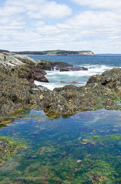
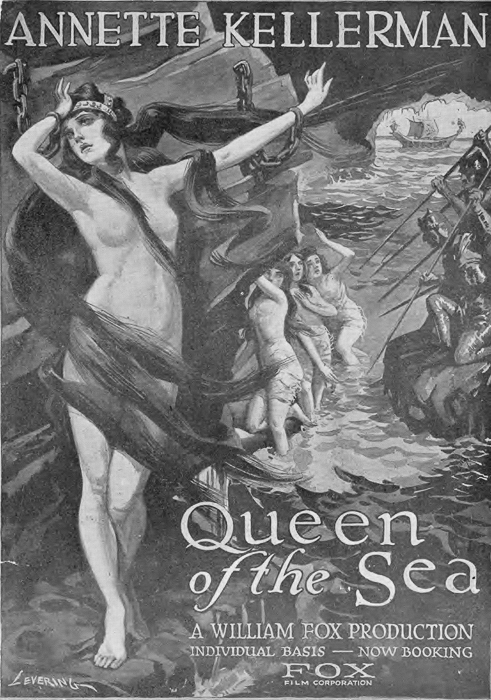
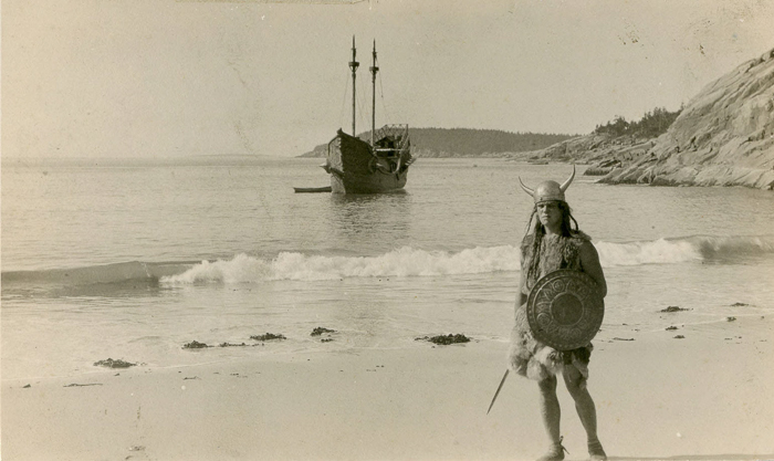
So many interesting discoveries this past week, I’m not even sure where to begin. Life cycle of barnacles, photos of the old estate, hiking adventures, a movie filmed here in 1917, a wrecked schooner, sudden change in the geology: birds, banter, and Beatrix Farrand … I had to break Sand Beach out into its own post!

April 28: 1:15-3:30pm, drizzling, grey, overcast, 51ºF. It started to rain about an hour into the hike. 2 Black-backed Gulls, 12 Common Eiders (6 male, 6 female), flock of 7 Black Scoters flew by, 1 loon, 1 Thick-billed Murre (Rich saw it, I didn’t.)
Walker: Rich MacDonald, ornithologist and naturalist; Natural History Center, Bar Harbor

Rich and I started out from the Great Head parking lot around 1:15 on a cool, overcast day. It started to drizzle when we reached the beach. The rain never got heavy enough to discourage us, although I did have to wipe my glasses off a lot. Climbing down to the beach, we found an old refuse pile beginning to poke out of the bank, and wondered if it were from the old estate:
As we started hiking we found some great tidepools, and Rich took a moment to try to help me identify the seaweeds in them. He pointed out the gametphores or conceptacles on shoots of young Rockweed. I find the young seaweeds hard to figure out, they look so different from their older forms.
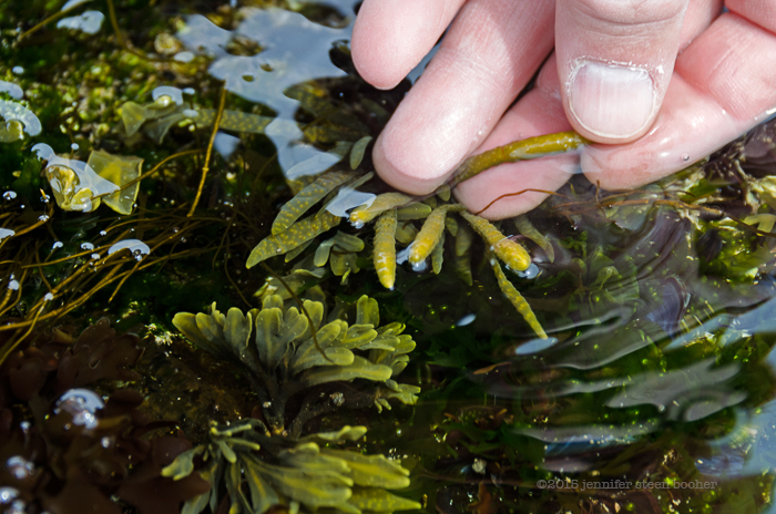
J: Is that a Fucus?
R: Yeah, this is Fucus vesiculosus. And this is a different kind of Rockweed. People call this and this Rockweed, but there are five “Rockweeds” on the coast of Maine.
J: [Ascophyllum] I can usually recognize, but seaweeds tend to bewilder me.
R: When I was in college I went to the State University of New York in Plattsburgh, New York, and I got this notion that I wanted to be the next Jacques Cousteau, but you can’t really do that in Plattsburgh, so I went for a year to Long Island University in Southampton, New York. It was a great school, … but I was so gung-ho … taking ichthyology (study of fish) and phycology (study of algae) and going into the lab classes out into the field, and my classmates were like, eeew. There were a lot of city people who didn’t want to get dirty, and I [said], ‘I’ll get right in there,’ wading out chest-deep into pools to get stuff, and it was great. I found out what science really was there, and I found out that I liked it even more.
J: Messy, dirty science?
R: I always thought Jacques Cousteau was a scientist, but he was a Hollywood scientist…

J: I feel like I’m becoming a scientist backwards. I always thought that if you wanted to be a scientist, you picked a field and studied it, but I’m finding an interesting creature and studying that, and it’s leading me into different fields. Backwards.
R: I think that I would have been a really good naturalist back in the 1700s
J: Wouldn’t that have been fun?
R: I know! You didn’t specialize in anything, you knew something about everything. I like that kind of generalist knowledge.
J: You wrote papers and drank brandy and all your friends applauded you.
R: That’s right. And the only real downside to that it was almost exclusively men.
J: Well yeah.
R: That’s one thing about it that I didn’t like.
J: What, being a man?
R: No, no, being a gentleman scientist among only gentlemen.
J: Yeah. There were a few women.
R: There were, but you know,
J: They didn’t get any credit.

R: So where are you from originally?
J: Massachusetts. I was born in Brooklyn, New York, and I grew up in Southbridge, Massachusetts. How about you?
Rich: Born in Niagara Falls, New York, and grew up in Lewiston, New York, which is the next town north, … and then vacationed in a lot of different places but including the Adirondacks, and so I wanted to go live in the Adirondacks. Swore I would never leave New York state. And then I met Natalie [his wife].
J: I thought I was going to be a city girl. I grew up in a tiny, broke, mill town, where all the mills had closed, and I was like, ‘I am so out of here.’ And then my husband and I were living in San Francisco, loving it, but I wanted to go back to school for landscape architecture, and we struck a deal that he would leave the computer geek’s dream job at ZiffDavis Labs, if we moved to Maine afterwards. And I was kind of like, Maine? Are you sure you don’t mean New York City? But we never regretted it.
R: I wish I had brought my aquascope. You put it in the water and you can look under the water … It’s like snorkeling except you don’t have to get down into the water, you can just sit here, and I just love the fact that we don’t see any bare rock here. Every inch is covered by something.

J: Now are these baby barnacles all over? Baby something.
R: All the little specks down there? … Probably barnacle spat.
J: Can’t really see them all that well. A lot of things become clearer when I look at the photos on my big screen when I get home. Look at the way the coralline is wrapped around the, what is that, a barnacle? Kind of funky.
R: There are a couple of really good, simple, little field guides we sell. One, the authors include Susan White, who’s a former Maine SeaGrant program colleague of Natalie’s. It’s something like Life in the Intertidal Zone. And it’s a fairly small book,… and then there’s Life on the Intertidal Rocks. The Finder’s Guide series, it’s a little index-card-sized, fits in your back pocket nicely… The Life on the Intertidal Rocks is great for identifying stuff, sitting here and looking, and the Susan White one goes into a little more detail, a little more narrative. Not a lot.
J: One of the best ones I’ve found is kind of odd, I found it online, it’s a teachers’ guide to the Gulf of Maine. I can’t remember who put it out, one of the state agencies. [Ed.note: it’s the Department of Marine Resources.] It’s just line drawings, but it’s awesome. Like yesterday, I got a tweet. I don’t really Twitter, I’m on there because it’s my Dad’s social media of choice, but somebody tweeted me with a photograph of this thing. It looked like a [bright pink] sea cucumber with a tail attached. I think it was a rat-tailed sea cucumber, and the only place I could find references to that was in this teacher’s guide. [I haven’t been able to find that tweet again, if I do, I’ll link it here.]

Top to bottom: Common Loon, Common Eiders (male and female), Black-backed Gulls
J: [pointing to two birds on a rock] Black-backs?
R: Yes, Great Black-backed gulls. Both of their backs looking a little less black at this angle so I wanted to check the legs. If the legs were yellow, they would’ve been Lesser Black-backed gulls. [writing in his notebook] So what I’m doing, …I have these four-letter codes that are standard codes that are used [by birders], … American Crow, Great Black-backed gull, two, and a black-capped chickadee I heard earlier, there are some ducks out there – probably eider. No, they’re red-necked grebes. They breed in the pretty far north, up in Canada, they come here for the winter. … The great black backed gull is the largest gull in the world.

J: Really? It’s hard to get a sense of the scale when they’re that far away.
R: They’re a big bird, they’ve got a four-and-a-half foot wingspan.
J: I think I saw one of them harassing an eagle last Saturday.
R: That would make sense. … There’s a common loon out there.
J: It’s funny, I’ve seen loons on almost every single walk. Or, one loon on every single walk. I started to wonder, is it following me? Is it the same loon every time?
R: It’s interesting about the loons because people come up here (there’s another loon down there, over by the gulls) people come up to Maine in the summer and they expect to see loons in the lakes, which they do, and they’ll see loons on the ocean and they’ll say, “Rich, I saw a loon on the ocean! But they don’t go to the ocean, do they?” Well, as a matter of fact, we think of them from the lakes I think because they’re so vocal when they’re on their territory, and they make beautiful and ethereal sounds … but loons…, the ones that are born this summer, when they fledge they’ll leave the pond by late September and they’ll go to the ocean and they’ll stay in the ocean for four years.
J: Seriously?
R: Yep. They won’t leave the ocean for four years, until they’re old enough to breed. It takes them four years to reach maturity. [Then] they will fly and look for ponds where there’s room for them, because loons are very territorial on their ponds. There’s a certain size; Eagle Lake and Long Pond are big enough for maybe two pairs of loons in each of those, but Lower Hadlock Pond, Upper Hadlock Pond, one pair each, because they’re voracious fish eaters so they’ve got to have enough food. I see loons every single day I go to the ocean.

R: So have you found anything really interesting, unusual, exciting so far?
J: There’s a cave down by High Seas, I couldn’t get to it, I have to go back this summer because I think you need to wade to get into it, but I’m dying to get in there.
R: Well that’ll be neat.
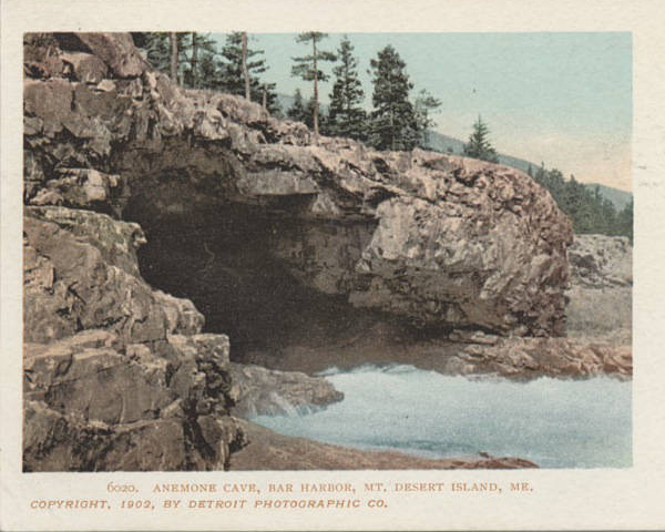
J: And of course Anemone Cave. I hadn’t been there in something like 20 years, and it’s still amazing.
R: There was a time that Anemone Cave had cliff swallows nesting there, but it got well-known and a popular place people would go and look for critters. They scared away all the swallows.
J: I actually found a guide from 1880-something, and Anemone Cave was already threatened back then. The people who owned Schooner Head were already imposing rules on it, trying to stop people from taking the anemones, so it’s kind of amazing that there’s anything left there.
R: It looks like it goes in cycles, … the literature and the guidebooks say, ‘Check this out,’ and everybody does and then it gets threatened and they take it out of the next generation of books, and then it goes in the next generation after that.
J: Well it’s all over the internet. I wasn’t sure I should even put it in the blog, but seriously, if you do a search for Anemone Cave, there are directions and GPS coordinates, and it kind of doesn’t matter whether the park puts it on their maps or not.
R: Yeah, the internet really changes the way people access information.

We found part of a lobster shell in a tidepool. I find lobster shells all the time, but usually they’ve been cooked. Look at all the blue around the edges of the plates – beautiful colors. We tried to figure out what might have killed it, but our CSI-Acadia episode was pretty short. As Rich pointed out, it would have been a big one, certainly market-sized. The edges of the shell had been nibbled, possibly by crabs after the lobster was dead. I put it in a plastic grocery bag and took it home for a still life, but forgot that I had it, and my bag smelled horrible when I opened it up again for the next walk. Pee-yew! That one won’t be in any still life.
 We found large clumps of what we think was deer hair floating in several tide pools in one area, but no sign of an injured animal nearby.

R: A pool like that one we just walked by is high enough up that it’s going to be fresh water, although there might be some salt in it from the spray, and I was looking to see if I could find any spotted salamander eggs there. I didn’t see any. It might be just salty enough to make them not go to it. But over in the Otter Cliffs area there are some pools where they do lay eggs.
J: Wow, it never occurred to me to look for them out here. I walked right past that pool thinking it [was] just rainwater. That’ll teach me! Got to look at everything.
R: Yeah, absolutely, you just never know. It’s like when I’m doing birding programs, I always tell them to look at every bird, every gull, every duck, because sometimes it’ll be that unusual one,
J: the one you weren’t expecting.

J: I didn’t see any urchins or sea stars in Anemone Cave
R: Well this time of year that makes sense. Between the snow and ice and the cold water they’re probably deeper right now
J: That’s a relief. Last time I was there, years ago, it was just crawling with them.

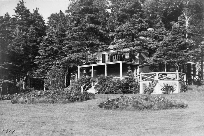
The tea house in its prime. Photo courtesy of Acadia National Park Archives.
R: I love going to the … tea house, the ruins up there at the point. For me it’s special because I was doing research on the birds of MDI from a historical standpoint [Rich has written or contributed to several resources on the birds of MDI] and I found some old bird research journals from the 20s and 30s and they were doing bird banding out there.
J: At the tea house?
R: It was bunch of well-to-do, probably 50, 60 year old women, and I can just imagine them sitting around drinking tea and saying, “Minerva, darling, I think there’s a bird in the net.”
J: The whole amateur naturalist thing again. It’s what I would do if I were rich.
R: I’m Rich, but I still have to work for a living.
J: Oh I get it. Sorry, I’m slow. You’re Rich, I’m Slow.
R: Nice to meet you, Slow.
More about the tea house:

“The Stone Tower on Great Head”, Gladys O’Neil, from The Rusticator’s Journal
Note: We’ll talk more about the Satterlee estate in the Sand Beach post, because the rest of the estate was down there. Only the tea house was on Great Head itself, as you can just barely see in this photo:

Photo courtesy of Acadia National Park Archives
J: OK, I can no longer see through my glasses [because of the rain.]

The cave in the center distance is where Nicole and I saw the wounded deer last week.
J: Cormorant. Flying down below.
R: Is it a Great or a Double Crested? [Looking through binoculars] Double Crested. More orange at the base of the bill. If it was a Great it would show white there.
J: I just see silhouettes [no binoculars.] There’s something else out there, in a straight line from the black and white buoy.
R: There’s one next to that orange buoy. I see one I believe is a murre, which is a cousin to a puffin. By that black and white buoy over there is a common loon.

An inconvenient cleft drove us up to the top of the cliff here, and by the time we reached the top I was pretty darn tired and decided it was more sensible to continue on the path than to scramble down the rocks on the other side, especially since it was raining.
J: This is the point when I start to realize how out of shape I am. Or maybe it’s just how close to 50 I am.
R: It’s ok, I’ve crested 50 and it doesn’t look so bad.
J: And you’re still doing this, so that’s good.
R: When I was a kid, I was asthmatic and I was in the hospital a lot, on average about two and a half months a year. And then I got to be a teenager and got tired of all the medicines I was on, and I discovered girls. They didn’t discover me, but I discovered them! I said, ‘ok, I’ve got to do something about this.’ And it was just intuitive to me that the more physically fit I was the less problems I should have with my asthma. But physical exercise triggers my asthma. So there’s a really difficult balance, and I didn’t get very good at that balance until I was well into my 20s. But I started to lose a little bit of weight and started to get a little bit into shape and I did outgrow it a little bit. I still have to take medicine twice a day, but I just said, ‘you know, I have a life that I want to live, and I’m not going to let my asthma be a handicap.’ Sometimes I still mess up and I’ll have asthma problems but generally I just go live my life. I love hiking, skiing, biking, kayaking, and canoeing, and I’ve run the MDI Marathon three times.
J: Seriously? Holy cow.
R: The last time I ran the marathon was in 2010, I think. I’ve got some heroes/role models, people I’ve known over the years. Jim Goodwin, passed away a few years ago at a hundred and two, and he was still splitting his own firewood and Clarence Petty, these are all Adirondack guys I’ve known over the years, Clarence Petty died at a hundred and four. At 92 he said, ‘You know, I’m starting to get old,’ and stopped being a flight instructor. There’s a few of these guys out there who are just amazing people, and I don’t know if I’m going to be amazing like that, but I want to at least stack the odds in my favor to live the life I want.

[We saw several eider ducks.]
J: Now are those the males?
R: The white ones are males and the brown ones are females.
J: Look at them all! I was surprised by how few eiders I saw this winter.
R: The eider population is going down pretty considerably. There’s a lot of factors but one of the big ones is our bald eagles have been so successful returning, and they’re preying on the eiders.

J: I’m just admiring the rocks. And the color of the ocean. It’s not blue, it’s not green, it’s not grey. [It never comes across in photos.]
R: This year’s cruise with Garrison [Keillor] [ed.note Rich and Natalie were naturalists aboard the Prairie Home Companion cruise] was in March in the Caribbean, and it’s kind of fun to be down there and the water’s really beautiful in a lot of ways, but I’ll take this water every day. I just love it up here.
J: Like I said, I’ve never regretted moving up here. Little career-challenging, though.
R: Yes. That’s why I started my business, the Natural History Center. I was a field biologist for the Nature Conservancy and before that had worked as a researcher for other institutions. I thought with my resume, no problem getting a job here. But when a job comes up, a job I actually want, there’s a lot of people with similar resumes or better that want the same job. The last two jobs I applied for there were over 300 applicants for each. I was in the final running, but didn’t get it, so I said, ‘Ok, if I’m going to be happy professionally, I’ve got to make my own job. So I started my nature store and do nature tours, I do some contract research. … I think it’s all worked out well in the end. We’re still a startup. … It’s really satisfying to take a family out and have the kids jut get so excited about whatever the critters are that we’re looking at. And it’s even more satisfying when the next year they come back and say, ‘We want to go on another tour with you!” And the kids are all excited to tell me what they’ve learned in the intervening year.
J: That does sound awesome! High job satisfaction.
R: I get these family groups and I can see I’m really hitting home on a few things with [the kids]. I’m a firm believer that we need even more protected lands than we have. We’ve got a good start here on MDI with Acadia, but in the state of Maine, in my opinion, we’re woefully behind, and nationally and internationally, we’re … behind. For the health of the natural world, we need a lot more.
R: This hike, the Great Head trail, is my daughter’s favorite hike. She says it is the best hike in the universe.
J: What does she love about it?
R: I think she likes the length of it. It’s just the right length for her, for her short legs. She likes the diversity of habitat. She likes the fact that a lot of the trees are short, so when we’re looking at birds they’re not eighty feet up in the trees, they’re only 20 feet up. She likes some of the rock scrambling that’s involved, she likes stopping at the … tea house. We always, without exception, stop there and have a chocolate break. She likes the scrubby, pitch pine forest … I love this stuff and she notices that I like it and that also gets her excited. Usually when we do this hike we’re doing it with friends who have kids her age, so she has a lot of very fun memories tied to this. I think it’s a little bit of everything tied up together.
J: We used to use M&Ms. To get our kids up the mountain. We did this one a lot, too, although we usually, when they were little, we’d go up to the tea house and go back down that way. They liked the way the roots formed steps on the path. Tabitha used to called them “Tabby-sized steps.”
R: How old are your kids now?
J: My son is 16, he’ll be 17 next month, and Tabby’s 14. Now I can’t get them out on hikes. At all. Christopher is always sailing. He is a cutthroat competitive sailor. Tabby loves biking, but she doesn’t like hiking anymore.
R: So are your kids going to join you on your walk?
J: My son says when I get down toward the marina he’ll meet me out there. Tabby says there are too many bugs. I might try and do something … in parallel where she’s biking somewhere and we meet up. Natalie and I talked about doing that with kayaks. I just want to include people, I’m not overly dogmatic about how they participate.
R: Right here, this is another reason why my daughter loves this trail more than anything else. [Sits and slides right down a steep, smooth rock.]

R: The scotch pine, the ones with round clusters, like balls of needles, it’s a neat tree. This one’s been chewed by a porcupine!
J: Now how do you know a porcupine [did that]?
R: Take a closer look. You can imagine the teeth peeling this off. If it was fresh without any sap on it we’d actually see some teeth marks. This is very typical porcupine behavior. They’ll chew right down to the inner layer of wood and they’re eating between the bark and the inner layer; they’re eating the cambium. They’ve got to be pretty desperate to be eating scotch pine! The scotch pines, they develop these cones [that have pitch in them] and [naturalists thought they] needed fire, to melt the pitch to release the seed. Back in the 70s some researchers at a site in northern New York realized it just needs extreme heat, but extreme heat is relative. It just needs to be somewhere around 150, 160 degrees Fahrenheit. That’s enough heat to melt the pitch. So where do you get that? When’s the last time we had a fire here? 1947. When’s the next fire? Who knows, but not frequent enough in the history here to have pitch pine growing at the ages we have. So they found that … there’s two ways. One, the cones fall on a rock, and on an extremely hot summer day, with the sun beating down [on] a flat, exposed rock, it can get to about 160 degrees Fahrenheit. Just that millimeter of surface above. But you put your hand an inch above, it’s hot, but it’s 120 degrees. And two inches above, it’s 99 degrees. It quickly cools down. So that’s one of the ways. But in a place like [MDI] we don’t have enough flat rock surfaces to soak up that sun and really get hot. So squirrels eat the cones…, and the resins have natural sugars in them so they eat the resin, and they release the seeds, coming through the gut.

J: So internally it get hot? Inside of a squirrel is 160 degrees?
R: No, but their stomach acid digests the resin.
J: Oh! That is so cool. The complexity of the interactions.

‘Sand Beach Mountain, Mount Desert Island,’ by Thomas Cole, 1844. From “The Artist’s Mount Desert” by John Wilmerding
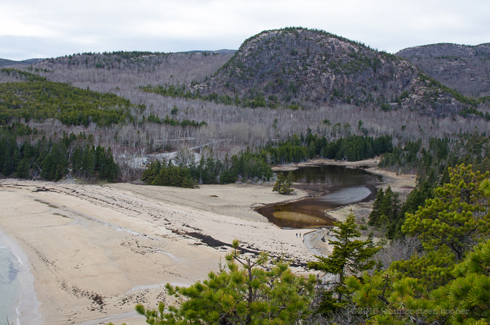
R: This wetland over here to our left is a really good wetland for MDI. [Ed.Note: The body of water just right of center in the photo above.] I find a lot of birds in there during certain periods of the year.
J: That used to be one of the few places my daughter would swim, the stream where it comes out, because it’s warm. It’s the only warm outdoor water here! But she’s moved on now, she and her friends like playing in the waves. Does your daughter like swimming around here?
R: She does. She’ll swim in the stream, she’ll swim in the ocean, if there’s water she’ll swim in it.
J: Mine were like that until they discovered leeches.
And just like that we were back at the parking lot. Thanks for a fascinating walk, Rich; I can’t think of many people who’d be as happy as you about a long scramble over the rocks in the rain!

April 30, 2015: I forgot to note the temperature, but it was cool with a little wind, mostly overcast with occasional bursts of sunshine.
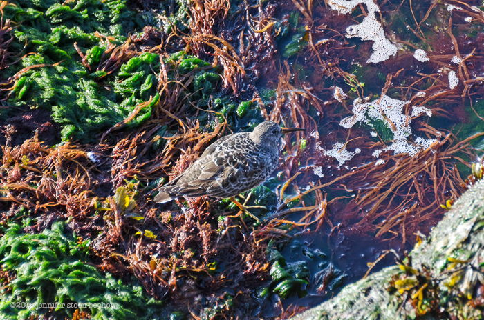
I felt that I had missed too much of Great Head’s shoreline, so I went back a couple of days later, this time starting at Sand Beach and working my way east along the rocks. I’m glad I did! For starters, there were even more birds out today, and they were closer to the shore:

Clockwise from top left: male Red-breasted Merganser (Mergus serrator), Black Scoters (Melanitta americana), Common Loon (Gavia immer), male Common Eider (Somateria mollissima)

Juvenile Black-backed Gull (Larus marinus) with two mature Herring Gulls (Larus argentatus)
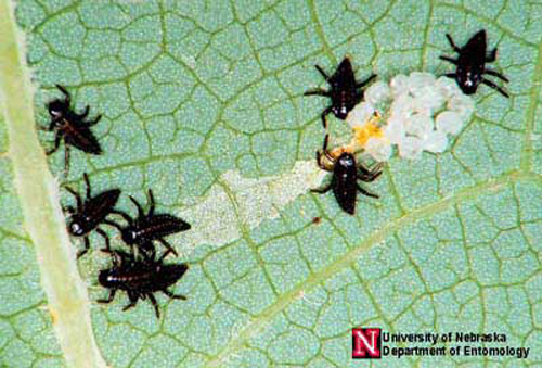
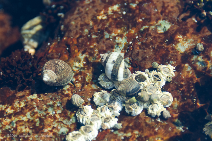
And the tide pools were full of interesting things. You might remember earlier Rich and I were wondering if what we saw in the pools was barnacle spat. The photos I took that day weren’t close enough to tell, but there were some shallower pools today, and yes, clearly the barnacles are settling down:

So let’s talk about barnacles. They are relatives of crabs and lobsters, and they have several life stages. They begin as an egg, and then hatch into a tiny larva called a nauplius, which has one eye, goes through five moults, and is free-swimming. After those five moults, it becomes a cyprid. See all those tiny things that look like yellowish grains of rice? Those are cyprids. The cyprids’ job is to find a place to settle. They have two little antennules at one end which are not visible to my eyes, anyway, which they use to crawl around and examine hard surfaces. When it finds a suitable spot, a cyprid will glue its forehead to the rock or shell, and begin to form a shell around itself. The little brown ovals scattered over everything in the photo above, and over the mussel in the photo below are cyprids that have glued themselves down and become metamorphs. A metamorph is the stage in-between, maybe 3-4 days after settling, but before the white shell has really gotten going. It’s also called barnacle spat, and it gets all over everything. Worse than cat hair.

Eventually, the barnacle will extend its feathery legs (called cirri) and begin feeding, sweeping its legs back and forth to filter plankton out of the water, then sort of sucking off its ‘fingers.’ Or toes, really. Like this:
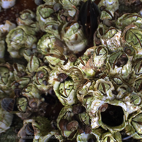
Sea cucumbers feed this way, too. Go watch Diver Ed mimic a sea cucumber feeding, it’s priceless. Back in the photo of the cyprids, did you notice all the itty-bitty baby periwinkles hiding in the empty barnacle shells?

One of the coolest things I came across was almost too tiny to photograph. Top right photo below shows a Red Chiton (Ischnochiton ruber) half-hidden under some barnacles. It was only about a centimeter long, but it’s the first chiton I’ve ever seen in Maine, and I couldn’t believe the hot pink color. A chiton is a mollusk, like the other creatures in this collage, but where whelks and limpets have a single, solid shell, the chiton has eight articulated plates that can flex like the elbows of a suit of armor. Or maybe more like an armadillo shell. The flexibility is important – it lets the chiton move over rough terrain. They’re herbivorous, scraping algae off the rocks with radulae (tooth-like things, sea urchins have them, too.) I think they’re cool because they look like alien fossils. The chiton family is 400 million years old, so they sort of are.
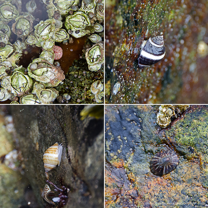
Clockwise from top left: Red Chiton (Ischochiton ruber), Dog Whelk (Nucella lapillus), Tortoise-shell Limpet (Testudinalia testudinalis), another Dog Whelk (also called Dogwinkle)
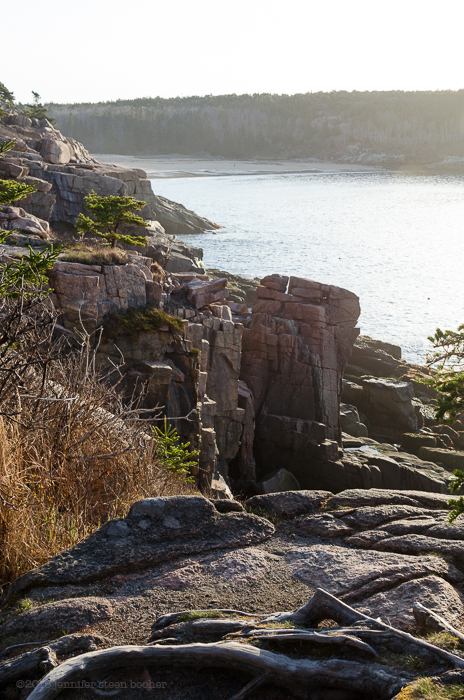
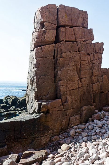
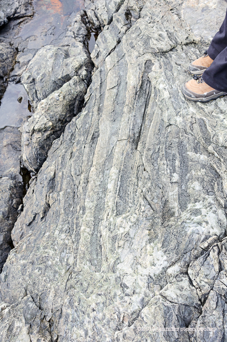
I’m going to call your attention briefly to the rocks – this is a great example of shatter zone, with bits of the old country rock suspended in the newer stone.  Take note, because we’re about to leave the shatter zone for some amazing granite formations on the other side of Sand Beach:


Just wanted to show you a horse mussel and a blue mussel living side by side. I don’t know what smashed the blue mussel, but it seemed to still be alive.

This is as far as I was able to go at the tide line,

so I headed up the cliff:


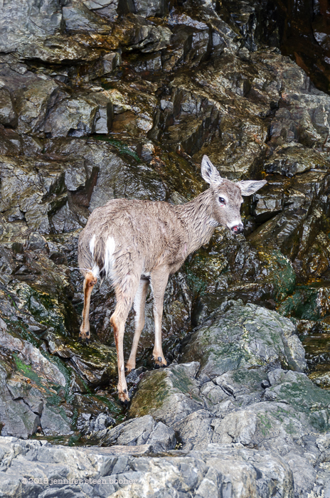
At the top of the cliff I found myself following a deer trail yet again. How can I tell its a deer trail not a human one? Poop everywhere, clearly deer and not human.


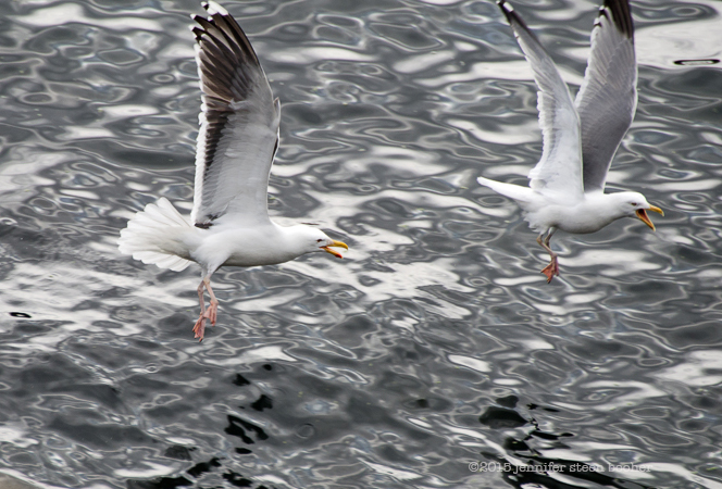
Black-backed Gull chasing a Herring Gull.
I want to leave you with a question I’ve been mulling over. Great Head was private property, and yet it was clearly a popular tourist destination. There are passages like this in many early guidebooks: “Our next ramble is to Great Head … It lies a short mile beyond Schooner Head and is reached by the same road. Approaching the Head, we have a fine view of Newport’s southern end descending to plunge into the sea. [ed.note: Newport Mountain is now called Champlain] High up on the ledges are the nibbling sheep, foraging among the closely cropped grass. Reaching the farmhouse, most persons here leave their carriages; though the road extends some distance farther into the woods. … The left-hand track leads by a gradual ascent directly to the Head. … Arriving at its highest point, a view is had far and wide of the grand old ocean, while landward rise the mountains.
This whole peninsula recently became the property of a Philadelphia family that has a taste for landed trifles. Among their effects, it is said, is an islet in Lake Superior, and a snow-peak in the Swiss Alps. But Great Head need not feel ashamed of itself in any company. …
Visitors are fond of coming to Great Head again and again to spend the whole day in sauntering from point to point, catching each new expression of the cliffs; or book in hand, bestowing themselves under some convenient rock, to keep one eye on the stereotyped page and the other on the changeful deep.” [from Rambles in Mount Desert: With Sketches of Travel on the New-England Coast from Isles of Shoals to Grand Manan, B.F. DeCosta, 1871. (as reprinted in Discovering Old Bar Harbor and Acadia National Park, Ruth Ann Hill, 1993.)]

detail of “Path Map of the Eastern Part of Mount Desert Island,” by Bates, Rand, and Jaques, 1911. Photo courtesy of the Library of Congress.
I found references like this to Schooner Head as well. They’re both included on trail maps like the one above, from 1911. The map includes a note about private property:

legend on “Path Map of the Eastern Part of Mount Desert Island,” 1911. Courtesy of the Library of Congress.
How did that work, do you suppose? Did the Hales and the Satterlees and other landowners not mind having dozens of strangers wandering around their estates? Was it just an accepted custom? When did it change? Why?

One last observation that may be of interest to hikers. The pools of rain- and melt-water in the rocks along the hiking trails were teeming with mosquito larvae:

Better stock up on bug spray this year.


 Another gorgeous spring day for the Coast Walk! This one was much calmer, with a light breeze rather than the strong winds we ran into last time. My husband, Brian, came with me again. At first the tide pools seemed to have the same creatures we’d been seeing all along – blue mussels, barnacles, periwinkles, and the colorful crustose corallines:


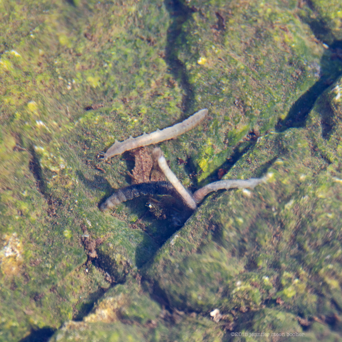
 Somebody fastened something here not too long ago, but I haven’t been able to find out who or what. Anybody know?


![Library of Congress, Prints & Photographs Division, [reproduction number, e.g., LC-J7-1234]](http://jenniferbooher.com/wp-walking/wp-content/uploads/2015/04/SatterleeGarden.jpg)


