

October 20, 2016: 6:30am-12pm. Started just about sunrise, 46ºF (8ºC), slight breeze from shore, a few clouds. Warmed up a bit as the sun rose and turned into a gorgeous autumn day. Black Backed Gull, 4 Loon, 5 Great Cormorants (they might have been Double-Crested Cormorants) 2 crows, and an unidentified dead fish.

Please note that the whole Point is private property. And many, many thanks to Sue Ferrante-Collier and to Steve Pinkham for their assistance in contacting people for permission to cross these properties!

Walker: Kenn Chandler, builder. I met Kenn through the MDI Photo Club, where he is the outings coordinator. He was one of the first people outside of my family to discover the Coast Walk, and when you’ve just started an insanely complex and time-consuming project, having a stranger come up to you and say, “Are you the one doing the Coast Walk? I love it!” makes you feel like a rock star. Kenn has a very special place in my heart!

We met at the Seal Harbor beach just as the sun was rising, and headed out toward the western point. The tiny island in the center of the photo above is called Little Thrumbcap, and I’ve wanted to explore it ever since I first saw it. (‘What’s a Thrumcap?‘)
 Kenn moved to the island in 1971: “My Grandma, Winifred Dole Mann, had a summer place in Southwest Harbor. My family always came up for visits in the summer and loved it. Her driving skills had deteriorated pretty badly and she was pleaded with to stop driving. When she was 90 she threw her drivers license in the fire on Christmas of 1971 and whined that she was giving up her freedom. She wanted someone to help her in her retirement to Maine. Both my sister Janet and I volunteered and it wasn’t long before my love affair with Maine and the island were established.”

“When we came to Southwest Harbor to visit my Grandma, we were on vacation for the most part. We used to fish a lot in Norwood Cove from the old wooden punt, sometimes to eat and sometimes for fun. A couple times my sister and I were instructed to catch enough flounder for the family for dinner. It was easy fishing. We would pick a few mussels and put them on hooks with sinkers, let them down to the bottom (4-6 ft deep) and reel them in as fast as we could. Everyone was quite pleased. That is, until I read your Coast Walk 3 about the overboard discharge. It makes sense though, bottom feeders, but who wants to look a gift horse (or fish) in the mouth?”

Kenn and I had a conflict of opinion on the Point’s name – I had always called it Dodge Point (because of Dodge Point Road) but he knows it as Crowninshield Point. I poked around and found that the Dodges had a house there in the 1860s, and Commander Crowninshield built a house out at the very tip in 1885.

George N. Colby, 1887
Maps show both names, but as you can see on the map at the beginning of this post, Google calls it Crowninshield, so I guess Kenn won that round.

Edward L. Rand, 1893

Waldron Bates, 1917
We couldn’t see it from the shore, but I knew we were passing pretty close to St Jude’s Episcopal church. Built in 1887, it was the first church in Seal Harbor. It’s part of the Parish of St. Mary and St. Jude, which is based in Northeast Harbor, and still holds services in July and August.

St. Jude’s. Photo from Vandenbergh and Shettleworth, Revisiting Seal Harbor.
Another landmark that’s just out of sight from the shore is the congregational church, which was built in 1902.

photo from Bechtel, A Church for Seal Harbor
Putting together what I’ve read in the history of both churches (see Works Cited), it sounds like up to that point, Seal Harbor was geographically isolated from the other towns on MDI and more closely related to the Cranberry Islands (it’s a straight shot across the water to Islesford.) While Northeast Harbor residents could row across the Sound to Southwest for Sunday services, Seal Harbor people don’t seem to have gone to church regularly. In 1887, when St. Jude’s was built, 100 out of 118 residents were unbaptized. (Hansen, p.24) The increasing summer population seems to have reached a tipping point in the 1880s, and a church became a necessary amenity.

(Undated photo of Crowninshield Point.) Photo courtesy of the Seal Harbor Library


Our progress was very slow at first, not just because of the thick seaweed but because we are both photographers and walking into the rising sun made for some glorious back light:


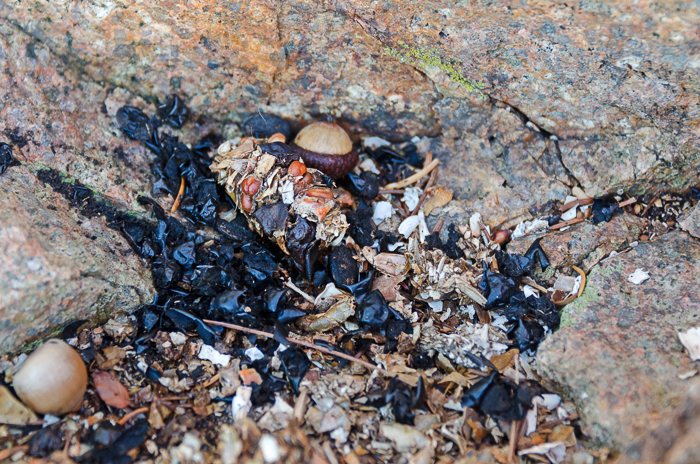
We ran across a stash of the scat that’s been puzzling me – I think it’s either otter or raccoon – this time with lots of berries in it as well as crab shells. (I have other photos with more crab shells but this post is already wicked long!)
We watched a Great Blue Heron catch a crab:

and tear it apart:

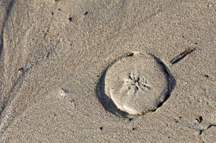
We also spotted several sand dollars trying to dig themselves into the sand:
In spite of all the distractions, we eventually reached the tip of the point, and Thrumbcap Island:


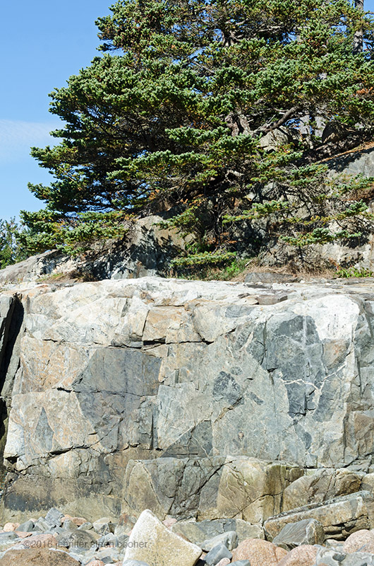
The geology out on the point was remarkable – we were clearly back in the Shatter Zone:


As we worked our way around the outer edge of the point, we crossed a beautiful little cobble beach:


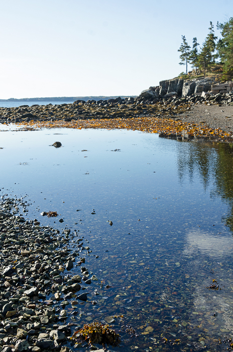
And then we finally rounded the point and looked into Bracy Cove:
There’s enough history here that Bracy Cove is going to get its own post – there’s no trace of it now, but this was a town before Seal Harbor was! Tune in next time for that post…
Meanwhile, more cool geology:

Halfway along the point, we reached the Harbor Club:

The Harbor Club. Photo courtesy of the Seal Harbor Library
The main building was designed by Duncan Candler, who also did Skylands and the boathouse on Little Long Pond.

The Harbor Club in 1927. Photo from Vandenbergh and Shettleworth, Revisiting Seal Harbor.
The club opened in 1926 with a swimming pool (which soon became a heated pool) and tennis courts. Rental cottages were added in 1956 (tenants had to be approved by the club board).

Image from Heckscher, The Harbor Club, 1995.
There’s a surprisingly awesome book about the club at the Seal Harbor Library – much more readable and entertaining than the church histories! I kind of wanted to quote long passages from it here but I’ll have to give you just a small taste:

Image from Heckscher, The Harbor Club, 1995.

Image from Heckscher, The Harbor Club, 1995.

Image from Heckscher, The Harbor Club, 1995.
Lately I seem to be digressing more than usual in my research, or maybe I’m just sharing more of those digressions with you. Here’s a classic: while writing the bibliography for this post I accidentally googled the name of the Harbor Club history’s author, August Heckscher, and discovered that he was a journalist, arts administrator, sailor, and remarkably, a master printmaker whose atelier, The Printing Office at High Loft (run from his summer home in Seal Harbor) produced enough artist books to have its own archive at the New York Public Library. You can read more about him in this Chebacco article.

from Carl Little, “August Hecksher, A Man About the World – and Mount Desert Island,”


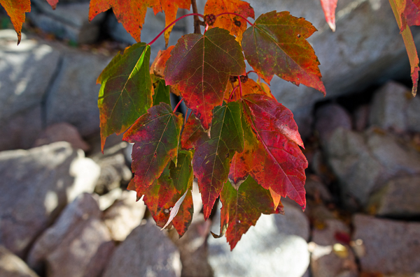
A vivid patch of red maple, sumac, and wild roses gave us a last flurry of fall color photos:


And six hours after we started, we were shuffling wearily up the stones of Bracy Cove to our car.

Kenn: “I distinctly remember pulling on to the seawall at Bracy Cove and parking to watch the waves and listen to the popples roll around in storms. I first did this with my Grandma in her 1968 Ford Custom so that would have been in the early to mid 70’s. I also remember cruising by in my GMC pickup and seeing over the top of the seawall all the way along. We had a huge winter storm sometime around 1980 that covered the road in stones and left a seawall maybe 8 feet high all across the beach. The state came out with snowplows to push the rocks off the road. There was no parking anywhere on the water side of the road there for many years after that.”
_____________________________________________________
WORKS CITED
Bechtle, Isabel K., A Church for Seal Harbor, Northeast Reprographics, Bangor, ME, 2002.
Colby & Stuart, hand-drawn “Map of Mount Desert Island,” 1887. Original in the Northeast Harbor Library Archives.
Heckscher, August, The Harbor Club, A History, Augusta, ME, J.S.McCarthy Co., 1995.
Little, Carl, “August Heckscher, A Man About the World – and Mount Desert Island,” Chebacco: The Magazine of the Mount Desert Island Historical Society,
Vol. VIII, 2006-2007. (pdf available for download at link)
Stebbins, George, “Random notes on the early history and development as a summer resort of Mount Desert Island and particularly Seal Harbor,”(typescript of a speech), August 1938. [MSS in Northeast Harbor Library Archives.]
Vandenbergh, Lydia and Shettleworth, Jr., Earle, Revisiting Seal Harbor and Acadia National Park, Arcadia Publishing, Charleston, SC, 1997.

Aw shucks Jenn, you ARE a rock star!
What a lovely visual presentation of the trail with splendid composition to boot! I enjoyed this area during visits in Northeast Harbor. It merits appreciation, respect and continuing diligence in defense of its preservation.
Thanks, Jenn, for your genuine commitment to this very special place. And to this fine fellow, Kenn, too!
Ed
Hi Ed,
Thanks so much, I’m glad you enjoyed the post! (Just to clarify, though, the route we traveled isn’t a public trail.) Kenn was a great companion!
Jenn
I love all of the information you have provided. I am actually a desendent of the Dodge family.
I’m trying to trace back on Capt Edwin Dodge which was my GGrandfather on my paternal side. I have been told that the Dodges owned almost all of Seal Harbor at one time. I am currently doing a research paper for my College Composition class and have been trying to find out how the Dodges decided to come up to Maine.
I have found other Dodges, along with about 45 other men founded Iselesboro and have found that that family branched off to Cranberry and Seal Harbor. Any information you have, would be much appreciated!! Thank you!
P.S. my son Jonathan (Dodge) Hawthorne, is a wonderful speaker and photographer. Would love to have him get involved in the MDI Photographer group. He’s a little bit reluctant, so I’m trying to get ahead with him about that. Thank you again!
Michelle Dodge Hawthorne
Hi Michelle, What a cool project! Have you already contacted the MDI Historical Society? They have a lot of documents digitized and searchable on their website, and may be able to help with other research. And we would love to see your son at the MDI Photo Club meetings! People in the club have a wide range of interests and skill levels, and it is not a competition-focused group but more centered on helping each other grow.
My GGGGrandfather was granted the land at Dodge’s Pt. About 2,400 plus Acres. He sold the point to Rockefeller Sr. for $1.00 Back then they were selling land for .10 cents an Acre. The Dodges came from a long line of excellent fishermen and 3 mast fishing vessels. I don’t appreciate your article at all!
You need to do some research before trying to sell your lame artwork.
Heir of the Dodges of Seal Harbor, Maine.
Thank you for the additional information, I’m always interested in hearing more about the island’s history.
Jenn,
I’m not sure how I happened on this post, but I am glad I did. Thank you so much for researching and bringing rich history forward for us to know. As a descendant of Edwin Dodge, and the generations of Seal Harbor descendants since, I treasure your work and thank you. Recorded history always comes thru the eyes of the recorder. My great grandmother, Gladys Dodge, wife of Albert, always told us our ancestors lost the land around Little Long Pond by gambling it away. I always wondered how the Dodges came to own it in the first place. Surely the indigenous folks never needed deeded property rights until the colonizers arrived.
I appreciate the links to your resources as I look forward to reading them as I age and life slows down. Thank you!
Hi Christy,
I’d love to hear more about your research!
Regarding European property ownership on MDI: Louis XIV granted ownership of MDI to Antoine de la Mothe Cadillac, an officer of his army, in 1688. In 1787, the newly-formed USA confirmed the grant to his granddaughter, Marie Therese de la Mothe Cadillac de Gregoire. That grant mostly applies to the east side of the island. The west side got divided up via a land grant to Governor Bernard of Massachusetts in 1860. There’s a copy of a survey of the DeGregoire land here: https://nehl.digitalarchive.us/items/show/2816 The Park Service also has some information about colonization: https://www.nps.gov/acad/learn/historyculture/colonization-and-settlement.htm
Christy I have never met you but we must be related. The Dodges didn’t lose the land thru gambling!!! I have a copy of the deed from Hancock County. Gideon sold it for $1.00. along with all the timber. You can stop spreading rumors now. I’m very proud of my Dodge heritage. They we’re hard working and excellent fishermen. Tristrum Dodge is one of the original settlers. He was sought after because of his fishing skills. My Grandfather Robert Rhodes Dodge was a very good man
He worked hard all his life lobstering and as a caretaker for Brooke Astor in NEH. The Dodges owned almost all of Seal Harbor according to my Fathers Uncle Edward Dodge. The Dodges owned a lot of land in Bass Harbor and donated it to the state for a preserve. It is another Dodge Point over there and the original home Extra Dodge built is still there. Just like the one Gideon built in Seal Harbor. The Peter Dodge were granted a coat of Arms by the King George 1 in Chester England. The Dodges have an honorable history. My documentary is coming out soon.
I look forward to seeing your documentary. If you leave your name, I’ll keep an eye out for it. Please keep comments polite – it is possible to correct people without insulting them.